Friday, August 25, 2023

Cobb Peak

Date: Friday, August 25, 2023. 

Partners: Roy.

Objective: Cobb Peak.

Stats: 11 miles and 4,500ft of gain in 10hrs.

Links: Lists of John.  Strava.  Photos.


Photos


Roy and I had our sights set on the Tetons.  Unfortunately, this was a rough summer season and there  were reoccurring storms that were forming rime ice up on the peaks.  We had eyed Forbidden Peak as a late back up option but due to the long drive and rain forecast for what would have been our only summit day, we decided that maybe we'd just stick close to home.

I figured Cobb Peak would give us a nice long and challenging day and give us a chance to simply get out and camp for a couple of days.  We stayed at Sawmill Gulch Campground and were the only people there the first night.  The bathroom looked and smelled (in a good way) like it had just been cleaned.  The camp sites themselves were a little funky.  Once we decided on our site, we leaned that there were about a million Daddy-Long-Leg spiders running about.  Oh well, its their home, not ours!  Everything was still a little damp and dank from the recent thunderstorm that was pretty significant.  We got set up and got some dinner in us, then turned in after a couple hours of chill time.

We were up just before sunrise and hit the trail with cool temps and clear skies.  The first few miles are flat so we wanted to grind those out and get to the stream crossing.  We walked past some pretty big mushrooms along the way.

It took as a bit to find a suitable crossing.  We ended up going just a bit higher than the summit post beta suggested.  Once across the steam, the real fun and route finding started.  Looking to gain the ridge looked pretty tricky, but once we started up, the route revealed itself.  

Eventually we were above the treeline and looking at the Southwest Face of Cobb.  We had some discussion about trying the West Ridge proper, or sticking to the Face.  Taking into consideration that there was a good chance of thunderstorms, we stuck to the face.  There were a few pauses to scope the most efficient line, but we found our way into the Gully as described.  

This is what we came for.  Fun Class 3 with the option to add some extra spice if desired.  It felt like we were moving well, but that darn gully went on forever.  It didn't feel steep, until we looked down.  The sky was getting cloudy and we had a few sprinkles, but reached the summit and had very warm temps.  The views are always incredible in The Pio's!  Unfortunately, the weather Gods told us we didn't have very long to enjoy it.  After digging through the summit box and taking pictures in every possible direction, we headed back down the gully.  While we were headed across the Southwest Face, we encountered the sandy dirt that was described in the beta.  We did drop a little lower on the way down, so somehow we must have missed it on the way up.  

By the time we were back to the treeline and emptying our shoes of all their newly acquired contents, the thunder started.  There wasn't much concern at this point now that we were not completely exposed.  The predicted showers hit and soon we were basically soaked.  Ah, to rain jacket, or not to rain jacket... It was too warm for a shell, but too wet to not, so we tried both.  The worst of it didn't last long and eventually we were too close to the trailhead to really care.

It's funny how the pace quickens when you can smell the beer!  It was a good long day with a good buddy and we were feeling the stoke.  The next morning we basically passed on breakfast and went straight to The Wrangler which is simply fantastic.  While we were munching away and looking over our pictures, we had to look up how much 10,000 Dong is in USD.  Uh, are we going back up there... we joked.

Saturday, August 19, 2023

Altair Peak and Standhope Peak

Date: August 17-18, 2023.

Objectives: Altair Peak and Standhope Peak.

Stats: Approx 20 miles and 6,800ft gain round trip.

Links: Altair PeakStandhope Peak.  Photos.


I had planned this as an acclimatization trip prior to heading to higher elevation terrain.  The goals were to sleep up high and scramble up some peaks.  

Photos


Day 1 

Started from the Broad Canyon Campground and headed up to Baptie Lake.  Pretty straight forward and pretty warm in the east facing canyon.  A few stream crossings but nothing we could't get over.  Plenty of options for camp sites and it appeared that there wasn't anyone else there yet.  We quickly got the tent up and headed out for Altair Peak.


Altair Peak

This peak actually sits above Betty Lake so we had to decide on going up past Goat Lake and dropping down to Betty, or going back the way we came and taking the trail up to Betty Lake.  We decided to take the second option since it seemed to be more efficient; less distance and less vert.  It was already blazing hot so I did not want to force the pace.  After all, the goal of this trip was to acclimatize and not to set any PR's.  Uneventful hike until we lost the trail leading up to the saddle.  We wandered straight up until we saw that the trail was off to our left and then moved onto the ridge.  The ridge was a fun and solid class 3 scramble with a bit route finding but nothing that gave us much pause.  We dropped our packs and hiked the last 500ft or so the summit.  We descended the ridge to the trail and had no difficulty staying on it unit we got back to where we thought we had lost it.  It was in fact maybe four feet from where we were.  I blame the huge snow drift.  Oh well.  It was very hot hiking back to camp and I had neglected to fill my water bottle.  Thus, I had inadvertently depleted myself.  Dumb move on my part.  We got a nice flyby of some kind of fire fighting aircraft.   


Standhope Peak

After a pretty warm night and a short rain shower, we woke up to clear skies.  We hiked past Goat Lake to the saddle where we took a short break.  I'd call 75% of the East Ridge class 2.  I'd call the last 25% easy class 3 and a bit loose if anything.  The highlight here was an F-15 flying by just to the north of Altair.  The summit was a bit breezy and I could see the predicted thunderstorms already starting to build.  I wanted to give The Fin a try but decided that it was better to bail now when and where we could easily get down and minimize exposure, as opposed to being 2-3 hours into climbing The Fin, which would be tedious and time consuming, then find ourselves on an exposed ridge with a thunderstorm on our heads.  There was a group heading up Standhope that we chatted with.  They gave me a weird look when I told them that I hoped the weather would hold out for them.  We arrived back at the tent right about 12:00 and had planned on a bit of a rest before heading down.  Less than 30 minutes later the sky was dark and the thunder and rain started.  We decided to jam on out instead of waiting for who knows how long for the storm to pass.  I don't know what the people that were heading for the summit of Standhope experienced, or the people fishing at Goat Lake, but I was glad to be down low.  Maybe two hours later the sun was back out and it was crazy hot.  It was nice to be camping there that night and not facing a 6hr drive home.  

Friday, August 4, 2023

Neahkahnie Mountain

Date: Friday, August 4th, 2023.

Objective: Neahkahnie Mountain, Oregon.

Stats: 3 miles and 900ft gain round trip in 2.5hrs.

Links: StravaLists of John.


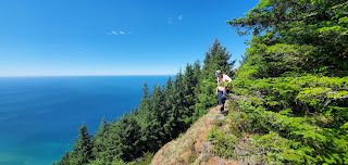
Our annual trip to the Oregon coast which turned out to be our honeymoon with the obligatory peak to hike.  Not much to this bad boy to start.  Just and easy hike on a mostly shaded and good trail and never real steep.  Not much for views to start out with, but the view from the true summit is wonderful.

It seemed like Normies, aka most people go to the rocky view point just west of the true summit.  In my humble opinion, the view isn't as good there as it is blocked by trees and there is no shade.  We went to the true summit as indicated on Lists of John.  From the trail, it is just a short and easy bushwhack up a use trail with a tiny bit of exposure to one side and maybe one borderline very easy class 3 move.  We found it short and fun and we had the summit all to ourselves.  I ran up to the other viewpoint just to check it out and found it underwhelming compared to the true summit.