Saturday, June 22, 2024

Born Lakes and Lonesome Peak

Date: June 20-22, 2024.

Objective: Lonesome Peak 11,302ft.  Idaho: A Climbing Guide.  Lists of John.  

Route: West Ridge, class 3.  Loose blocks near the summit!

Strava links and stats below.

Day 1: Hike to Born Lakes.  4.3 miles, 1,400ft gain in 3hrs.

It had been a while since I'd done a proper backpacking trip, so with a couple of days set aside for some mountain fun I headed into the White Clouds.  Having plenty of time would afford me a relaxed pace, an attempt on a summit and enought time to lose a fly or three.

Blackman Peak from Fourth of July Trailhead.


It looked like the area was mostly clear of snow, but there were a few large drifts left on the trail into Ants Basin.  The ridge heading to Blackman had snow but I was able to get to the other side without much difficulty.  The east side of the ridge had a few decent size snowfields that were already pretty soft from being in the sun.

Patterson Peak from the small untamed tarn on the trail.

Fourth of July Peak.

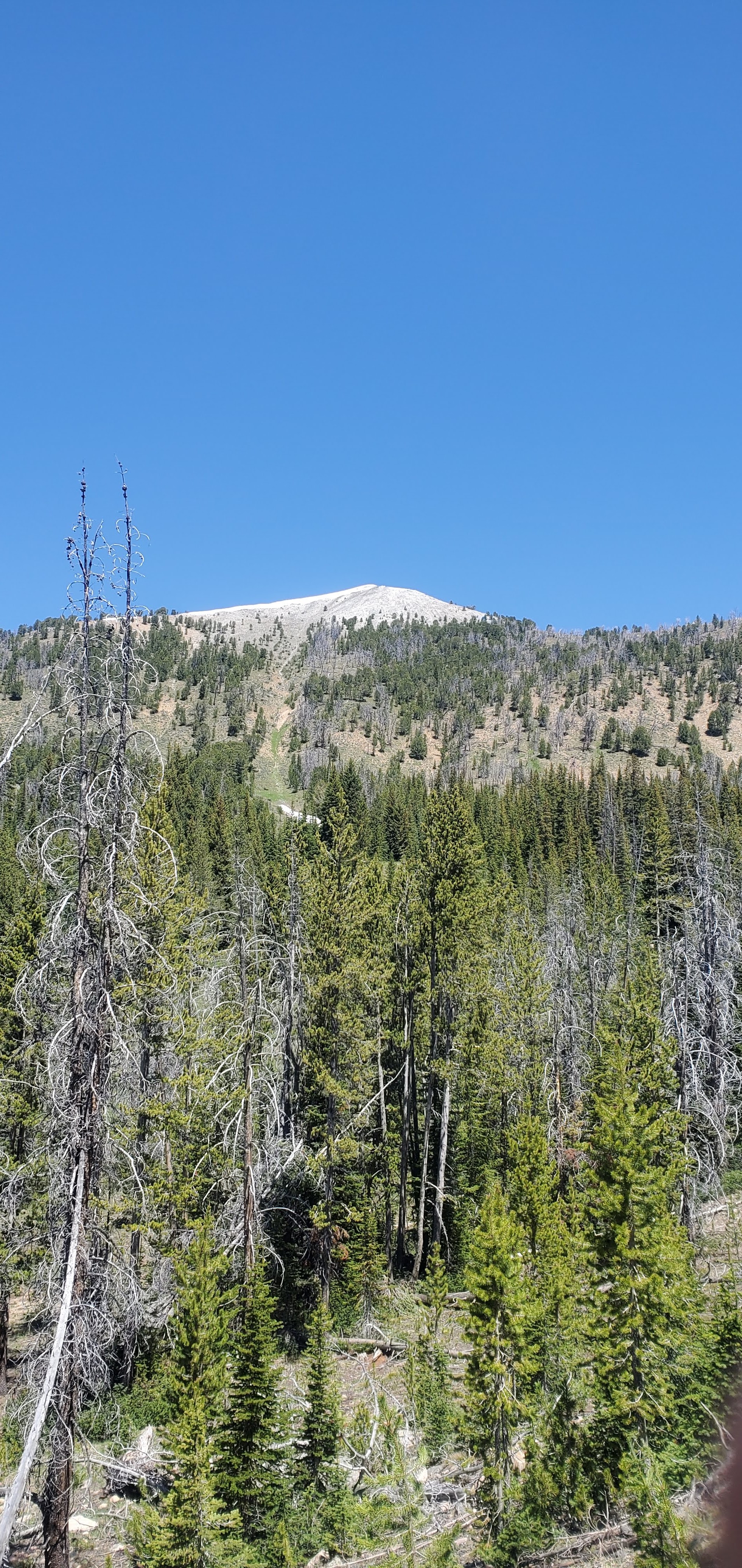
Lomesome Peak.

I knew there was a recent storm that had dropped maybe a couple inches of snow, but the first view of the West Ridge of Lonesome Peak did not get my hopes up.  

Ridge to Blackman Peak.

Ants Basin.

Born Lakes area.

There were a few large snowfields heading toward Born Lakes.  There was also the wet, marshy ground that comes with the snow melt.  I did my best to not go stomping though this fragile environment.  Traveling across the snow was basically unavoidable and I had a few real nice knee to thigh deep post holes.

Perhaps this is Strawberry Basin Point.

A good view of the South Ridge of D.O. Lee Peak.

Closing in on Born Lakes.

The trail system through here is very braided and not represented well on most maps.  I just headed for Lake 9,555.

View from the lower lake.

It had taken a bit longer than I anticipated to reach the lakes.  I had plenty of time to wander but I found a nice camp site at the lower lake that was too good to pass up.  I also wanted to get my shoes and socks off to dry them while it was still warm and sunny.

Camp site.

A lovely view from camp.

With plenty of day light remaining, I hit the lake to toss around some fly's.  There was zero action going on, but the scenery was amazing!  I studied the pictures I took of the nearby peaks on the way in and decided to try Lonesome Peak the next day.  The snow on the ridge looked like it might hinder access to the summit, but all you can do is try.


Day 2: Lonesome Peak.  Looks like the GPS went wonky, but approx 5 miles with 1,900ft gain in 5.5hrs round trip


Signage.

I forgot to set an alarm and somehow I way overslept, so it was after 09:30 by the time I set off.  I wanted to get a head start on the heat of the day, but oh well.  

West Ridge on the left.

It was a pretty easy and shaded walk to reach the base of the West Ridge, so that was nice.  

Looking up.

I stuck to lookers right near the edge of the trees and headed for point 10,690.  It was a steep but manageable grind.

Looking toward Blackman Peak.


Looking down.

Looking south with Castle Peak just coming into view.


Looking up.

Very near point 10,690.

Mount Andrus.

Ridge to the summit.

Once I got up to point 10,690 I had a good view of the route.  It looked mostly okay, but the snow made me moderately leery.  

Philosophy time: Don't just turn around.  Keep going and let something turn you around.

About half way up the ridge.

The West ridge proper was an easy walk.  It wasn't until it pitches up to the summit that it got interesting.  

Summit.

Snow on the ridge.

There actually ended up only being one small snowfield that I was forced to cross to reach the summit.  After that, it was a moderately angled scramble on loose blocks to the top.

Summit block.

Playing Jenga on a mountain is nerve wracking.  With some careful route finding and ninja like relexes I was able to reach the summit.  Wow, what a view!


Looking north at D.O. Lee, ect.

Castle Peak,

Summit register.

looking down the West Ridge.

After doing some quick summit things, I started down.  Slow and steady across all those loose blocks.  I was relieved to get out of that mostly unscathed.  Walking down the ridge was pleasant and I was thinking I might explore a little.  I had heard of people coming up the South West Face gullies and figured I'd shoot down one.  Investigating from the top, some looked like they defeinetly cliffed out.  I kept moving down the ridge and eventually found an area that looked good.  It was pretty sandy and loose scree.

Looking down.

What I ended up in was a scree funnle of not fun-ness.  Long story short, I regret that decision and if I had to do it again, I'd just go back down the ridge.

Looking back at the gullies of not fun-ness.

The day was fairly warm now and I was glad to get back into the trees and enjoyed the shaded walk back to camp.  After from rest, I headed lakeside for some fishing.  After an hour or so of nothing, I started to notice some fish coming around.  There was a jump or two in the vacinity, but they were not interested in anything I was going.  Zero bites and zero fish, but it wasn't for the lack of trying!

Day 3: Hike out.  4.3 miles with 700ft gain 2.5 hours.

I made sure to set an alarm and got an early start for the hike out.  I told myself that if the fish are jumping, I'm going to fish for a bit.  By the time I was packed up and ready to start walking, the lake was as smooth as glass.  It was definitely warmer overnight and the snow didn't set up real well, so I had more than a few knee deep post holes.  I went ahead and kicked a few extra steps where it was necessary to help out any incoming hikers.

Looking across Ants Basin towards Blackman Peak.

All things considered, I feel like I hit this just about right.  Warm days, cool nights, very few bugs and only a few people.  In a month the snow will be gone and the bugs will be out, but the fishing will probably be way better!
Friday, May 31, 2024

Bull Trout Point

Date: May 31, 2024.

Objective: Bull Trout Point.  Idaho: A Climbing Guide.  

Strava.

Stats: 6 miles and 1,300ft gain round trip in 6hrs 30min.  Class 2.


Post ultra is always a fun time.  I was stoked to get out but didn't want to over extend myself.  Bull Trout Point is super chill and has great views.  From where I parked, I followed the trail to a point where gaining Mains Ridge was obvious.  


Following the ridge is easy enough.  I had brought snow shoes and ended up carrying them 99.2% of the time.


I stuck to the south side of the ridge.  The views were magnificent for such a relatively small peak.


There was one very small rock tower to get over en route to the summit.


I was pretty sure I could see the Lost River Range; possibly Borah Peak.  Castle Peak was unmistakeable. The Sawtooth Range was just across the valley and very impressive.


I reversed my route up without incident.


Saturday, May 11, 2024

Tiger Claw

Date: May 11, 2024.

Objective: 50k and 8,700ft gain in 10hrs.

Run Tiger Claw!

Strava link.

This 50k has a whole heck of a lot of vert!  The course is fairly unique in that it has three different ascents that link to one common descent.  It's up to the runner to decide which order you want to do the different loops in.  My initial plan was to do the Yellow ascent first, the White ascent next and save Pink for last (see the website if you want the details).  It turned out to be a pretty warm day and while I was chatting with other runners waiting to start I decided to do Pink second since it is longer than White.  


The Yellow ascent is a nice sustained climb that takes you to the top of West Tiger Mountain.  An awesome view of The Mountain, aka Tahoma, aka Mount Rainer greeted us at the top.  

After a ripping fast descent, it was time to tackle Pink.  It is longer of all three and was fairly shaded with a little extra up-and-down for good measure.  It was a tough climb up to the aid station in the blazing sun above the trees. 

My legs were talking to me on the next descent.  Hu, maybe I better back off the pace a tad...

I thought saving White for last was a good move.  I figured I'd get the two longest climbs out of the way first and do the shortest but steepest climb last.  Thinking about it after the fact, it might have been better to get it out of the way with relativly fresh legs.  I saw the Fam at the lower aid station but I did not have any time to spare.  

It was pretty warm by now.  My legs really started to cramp and I was moving slow.  There were about 4 other runners with me on this section.  I wont speak for them, but I was hammered.  I made it up to the aid station and I officially felt like death.  I knew I was going to have to dig deep to finish this bad boy, so fueled up, got a good soaking from the aid station crew and headed down the last descent.  

I had two choices, try to move "fast" and risk cramping, tripping and eating it.  Or, understand that I probably had enough time that I could slow up a bit and still finish.  The descent is pretty dang steep so I played it safe.  After pushing through the lower aid station, there was about a mile of no shade and there was no point in prolonging the suffering.  My normal strategy is to save some gas for the push to the finish, but I was feeling crushed.  I kept my stoke high and my pace up as much as I could but those last few miles seemed to drag.  I finally hit the last stretch of pavement to the finish shuffled my way over the finish line.  Just my luck that this would end up being the warmest day of the year so far, but that's literally why salt pills exist.      


Friday, August 25, 2023

Cobb Peak

Date: Friday, August 25, 2023. 

Partners: Roy.

Objective: Cobb Peak.

Stats: 11 miles and 4,500ft of gain in 10hrs.

Links: Lists of John.  Strava.  Photos.


Photos


Roy and I had our sights set on the Tetons.  Unfortunately, this was a rough summer season and there  were reoccurring storms that were forming rime ice up on the peaks.  We had eyed Forbidden Peak as a late back up option but due to the long drive and rain forecast for what would have been our only summit day, we decided that maybe we'd just stick close to home.

I figured Cobb Peak would give us a nice long and challenging day and give us a chance to simply get out and camp for a couple of days.  We stayed at Sawmill Gulch Campground and were the only people there the first night.  The bathroom looked and smelled (in a good way) like it had just been cleaned.  The camp sites themselves were a little funky.  Once we decided on our site, we leaned that there were about a million Daddy-Long-Leg spiders running about.  Oh well, its their home, not ours!  Everything was still a little damp and dank from the recent thunderstorm that was pretty significant.  We got set up and got some dinner in us, then turned in after a couple hours of chill time.

We were up just before sunrise and hit the trail with cool temps and clear skies.  The first few miles are flat so we wanted to grind those out and get to the stream crossing.  We walked past some pretty big mushrooms along the way.

It took as a bit to find a suitable crossing.  We ended up going just a bit higher than the summit post beta suggested.  Once across the steam, the real fun and route finding started.  Looking to gain the ridge looked pretty tricky, but once we started up, the route revealed itself.  

Eventually we were above the treeline and looking at the Southwest Face of Cobb.  We had some discussion about trying the West Ridge proper, or sticking to the Face.  Taking into consideration that there was a good chance of thunderstorms, we stuck to the face.  There were a few pauses to scope the most efficient line, but we found our way into the Gully as described.  

This is what we came for.  Fun Class 3 with the option to add some extra spice if desired.  It felt like we were moving well, but that darn gully went on forever.  It didn't feel steep, until we looked down.  The sky was getting cloudy and we had a few sprinkles, but reached the summit and had very warm temps.  The views are always incredible in The Pio's!  Unfortunately, the weather Gods told us we didn't have very long to enjoy it.  After digging through the summit box and taking pictures in every possible direction, we headed back down the gully.  While we were headed across the Southwest Face, we encountered the sandy dirt that was described in the beta.  We did drop a little lower on the way down, so somehow we must have missed it on the way up.  

By the time we were back to the treeline and emptying our shoes of all their newly acquired contents, the thunder started.  There wasn't much concern at this point now that we were not completely exposed.  The predicted showers hit and soon we were basically soaked.  Ah, to rain jacket, or not to rain jacket... It was too warm for a shell, but too wet to not, so we tried both.  The worst of it didn't last long and eventually we were too close to the trailhead to really care.

It's funny how the pace quickens when you can smell the beer!  It was a good long day with a good buddy and we were feeling the stoke.  The next morning we basically passed on breakfast and went straight to The Wrangler which is simply fantastic.  While we were munching away and looking over our pictures, we had to look up how much 10,000 Dong is in USD.  Uh, are we going back up there... we joked.

Saturday, August 19, 2023

Altair Peak and Standhope Peak

Date: August 17-18, 2023.

Objectives: Altair Peak and Standhope Peak.

Stats: Approx 20 miles and 6,800ft gain round trip.

Links: Altair Peak.  Standhope Peak.  Photos.


I had planned this as an acclimatization trip prior to heading to higher elevation terrain.  The goals were to sleep up high and scramble up some peaks.  

Photos


Day 1 

Started from the Broad Canyon Campground and headed up to Baptie Lake.  Pretty straight forward and pretty warm in the east facing canyon.  A few stream crossings but nothing we could't get over.  Plenty of options for camp sites and it appeared that there wasn't anyone else there yet.  We quickly got the tent up and headed out for Altair Peak.


Altair Peak

This peak actually sits above Betty Lake so we had to decide on going up past Goat Lake and dropping down to Betty, or going back the way we came and taking the trail up to Betty Lake.  We decided to take the second option since it seemed to be more efficient; less distance and less vert.  It was already blazing hot so I did not want to force the pace.  After all, the goal of this trip was to acclimatize and not to set any PR's.  Uneventful hike until we lost the trail leading up to the saddle.  We wandered straight up until we saw that the trail was off to our left and then moved onto the ridge.  The ridge was a fun and solid class 3 scramble with a bit route finding but nothing that gave us much pause.  We dropped our packs and hiked the last 500ft or so the summit.  We descended the ridge to the trail and had no difficulty staying on it unit we got back to where we thought we had lost it.  It was in fact maybe four feet from where we were.  I blame the huge snow drift.  Oh well.  It was very hot hiking back to camp and I had neglected to fill my water bottle.  Thus, I had inadvertently depleted myself.  Dumb move on my part.  We got a nice flyby of some kind of fire fighting aircraft.   


Standhope Peak

After a pretty warm night and a short rain shower, we woke up to clear skies.  We hiked past Goat Lake to the saddle where we took a short break.  I'd call 75% of the East Ridge class 2.  I'd call the last 25% easy class 3 and a bit loose if anything.  The highlight here was an F-15 flying by just to the north of Altair.  The summit was a bit breezy and I could see the predicted thunderstorms already starting to build.  I wanted to give The Fin a try but decided that it was better to bail now when and where we could easily get down and minimize exposure, as opposed to being 2-3 hours into climbing The Fin, which would be tedious and time consuming, then find ourselves on an exposed ridge with a thunderstorm on our heads.  There was a group heading up Standhope that we chatted with.  They gave me a weird look when I told them that I hoped the weather would hold out for them.  We arrived back at the tent right about 12:00 and had planned on a bit of a rest before heading down.  Less than 30 minutes later the sky was dark and the thunder and rain started.  We decided to jam on out instead of waiting for who knows how long for the storm to pass.  I don't know what the people that were heading for the summit of Standhope experienced, or the people fishing at Goat Lake, but I was glad to be down low.  Maybe two hours later the sun was back out and it was crazy hot.  It was nice to be camping there that night and not facing a 6hr drive home.  

Friday, August 4, 2023

Neahkahnie Mountain

Date: Friday, August 4th, 2023.

Objective: Neahkahnie Mountain, Oregon.

Stats: 3 miles and 900ft gain round trip in 2.5hrs.

Links: Strava.  Lists of John.


Our annual trip to the Oregon coast which turned out to be our honeymoon with the obligatory peak to hike.  Not much to this bad boy to start.  Just and easy hike on a mostly shaded and good trail and never real steep.  Not much for views to start out with, but the view from the true summit is wonderful.

It seemed like Normies, aka most people go to the rocky view point just west of the true summit.  In my humble opinion, the view isn't as good there as it is blocked by trees and there is no shade.  We went to the true summit as indicated on Lists of John.  From the trail, it is just a short and easy bushwhack up a use trail with a tiny bit of exposure to one side and maybe one borderline very easy class 3 move.  We found it short and fun and we had the summit all to ourselves.  I ran up to the other viewpoint just to check it out and found it underwhelming compared to the true summit.  


Friday, June 16, 2023

Mt. Zumwalt

Date: June 16, 2023.

Objective: Mt. Zumwalt 8,816ft.

Stats: 6.5 miles with 3,700ft gain round trip.

Links: Lists of John.  Idaho: A Climbing Guide.  Summit Post.  Strava.


I'd been keeping en eye on the weather and waiting for some kind of opportunity to open up.  I had a loose idea of snowshoeing this peak earlier in the year, but it just hadn't line up yet.  I wasn't super thrilled about doing this later in the year but the weather was good and I needed to check the box.  My kiddo who is now full grown adult had been saying he wanted to do a peak with me soon and misery loves company.

We started straight up the south slopes from the Grandjean road.  It's pretty steep and soon we found some brush to deal with.  There are no trees to provide shade and it was pretty dang hot.  The most enticing thing about this peak is that it doesn't take much elevation gain to get awesome views of the Sawtooth Range.

The view after about 10 minutes of hiking up hill.

Looking south.

Once past the brush, the SSW Ridge is a very pleasant hike that is shaded by trees and affords those awesome views.  We were able to follow some good game trails to around 8,000ft where we started to hit snow.  We didn't bother to bring snowshoes and the last 400ft was the worst.  Just soft snow, a few postholes but really nothing awful. 

Looking toward the summit.

Snow with about 400ft to go to the top.

Views.

Views.


Views.


Views.


Summit shot with Ian.

Views.


Views.


Views.

Fortunately the summit was flat and dry and we were able to hang out and enjoy the view while we had a snack.  I'm always blown away by views of the Sawtooths.  We had seen a few ticks so we made sure to stop and do a tick check every so often.  Going down though the brush wasn't as bad as going up, but it was still pretty steep with tough footing and slow going.  We were back at the car with no tick bites so two thumbs up there.