
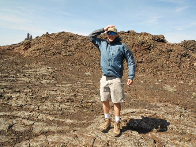
Deez checking out the A'a lava flow near camp.

Since I was still technically doing a school project we headed to the visitors center so I would have a complete report. We also picked up a map and guide book, as well as other geeky science souvenirs.

If you notice in the picture above, the wind is blowing west at almost 20mph at the visitors center.
There are some neat displays there, but we were ready for the first hand experience.


So we set out at about 3:30pm with plenty of day light left, warm temps and moderate wind.

Stop one of the day was the Devil's Orchard.


It's amazing that plants and trees take root with a soil profile that is mostly non-existent.

Lava river near the loop drive road.

Stop two was the Broken Top loop. The trail hikes across the great rift, a large crack in the earths crust and the source of many of the lava flows here.

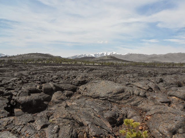
Big Southern Butte is one large unit of rhyolite that extruded above the basaltic flows and sits about 25 miles away to the ESE.

My guess would be that this rock was mostly cooled on the outside and still molten on the inside when it was impacted by another object. Very impressive!

A beautiful display of the ropy texture of a Pahoehoe lava flow.

After the long drive and a couple short hikes we finally head back to camp to relax. Dinner was Chicken Pesto Penne. Its too bad we didn't plan for garlic bread!

The wind died down and we enjoyed the evening with some tunes and a few rounds of Go Fish as we swig away on some Bota Box Cabernet.

We started day two with a Borah Baggie omelette, a recipe from In The Wild Chef. We jazzed it up with pepper, bacon bits and sharp cheddar on a tortilla and it came out great.


We began day two's adventure on a shortcut walk to the North Carter Trail directly from camp. We had it to ourselves, which was surprising on such a nice day.

Looking over the north crater flow.


Then it was on to the North Crater Trail. It was here that we noticed the wind really picking up.

Lava cave along the trail.

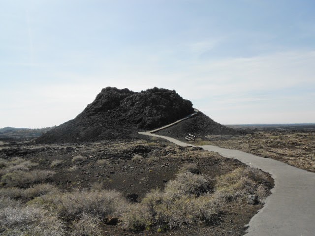
If you notice the hill has an asymmetrical shape, that's because the wind was blowing from the west when these cinders were ejected and deposited. The steeper slope on the left is the windward side, and the more gentle slope on the right is the leeward side. There are several examples of this all throughout CMNM.
It had became extremely windy as we hiked along the big craters rim. Now we could hardly talk, even when standing right next to each other.


Never the less, the views were impressive. I really don't feel these pictures do it justice.

As we arrived at the spatter cones, I was still amazed that we had yet to see a soul along the trail.

While looking into the snow cone, we finally figured out how it got its name. Ah-ha!
We had the spatter cones all to ourselves. I had expected lots of other people on such a nice day, even with the wind.
By this point, it was probably blowing 40mph sustained with crazy strong gusts.

Deez looking into the spatter cone. We wished we had brought the pack up here for a lunch break out of the wind. Oh well... On to the Inferno Cone!

It was here that we found the other people, lots of them.


View from the top of Inferno Cone.

It was also here that the wind was blowing crazy hard! Westerly 40mph sustained and probably gusts up to 60. Denise got some shots of me leaning into it on one foot, maybe I'll add some later (hint-hint). We seriously couldn't hear each other yelling and Deez had a bit of a hard time standing up. I was contemplating having her carry the pack so she wouldn't blow away. Ether that or I'd short rope her and she could fly like a kite...

View from the top of Inferno Cone toward the Lost Rivers and Lemhi's. I wondered how the Idaho Summits group was doing on the spring outing.
We dropped off Inferno Cone and walked the loop road back to camp to stay low and out of the wind. At camp we had a quick lunch while we struggled to take the tent down without loosing it. Then we jammed over to the visitors center to pick up a cave permit, then we set off hiking over the Blue Dragon lava flow.


After a generous push from the tail wind, we arrived at the caves where we found even more people than at Inferno Cone.


We happily headed down to explore the cave welcoming the chance to get out of the howling wind.


My camera battery had been running critically low since Inferno Cone , so my photos were abruptly cut short about here.


We headed back out of the Indian cave and over to the smaller caves further down the trail. While walking upwind back to the car , the topic of people kites came up again... Maybe time to invest in a wing suit?
It was really great to finally get a chance to explore this amazing place. The geologic structures here are excellent examples and tell an amazing story of a landscape formed by wind and fire. Hey, whaddaya know, homework can be fun!
FYI, the great rift is estimated to erupt again within the next 1,000 years, so get it while its hot! Err... cool!
- Granola out.
Nice TR Tom
ReplyDelete