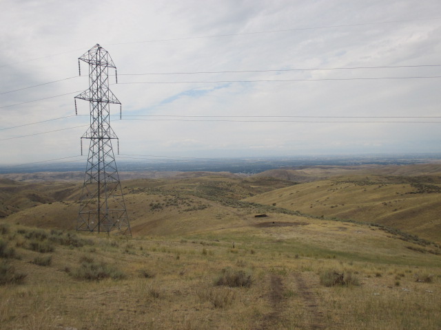
Tuesday, September 29, 2015

Hutton Peak 9-27-2015

Partners: Dog.

Stats: Class 2. 6.4 miles round trip. Total time 4:30. Elevation gain approx 1,700ft to summit elevation 5,331.

Gear notes: N/A.

Links: Hutton Peak on Lists of John. Dan Robbins' TR on Idahosummits.com Hutton Peak Page on Idaho: A Climbing Guide. Idaho Alpine Zone TR.

Hutton Peak on the left, Fiddler on the right.

With some fine fall weather on tap, I figured it was about time to head back into the Danskin Range to hike Hutton Peak and Fiddler Bench Mark. I've been trying to not over research the local peaks to heighten the adventure a little. On bigger peaks, knowing the landmarks is critical. For local peaks, I just make sure to stay off of private property. I should have done a little more research on getting to the top of Hutton in order to facilitate my planned 2 peak day.

Willow Creek.
I arrived at Willow Creak Trailhead about 10:00am and set off up the trail with cool temps and light wind. A fine fall day for peak bagging, in deed. I knew I needed to gain the ridge to the north; I had no idea where to get on it. I ho-hummed about not having a map or really planning a route. After about 20 minutes of contemplation, I wasn't sure if I'd even make it to Hutton Peak. All I knew for sure is I wasn't going home yet, and certainly not without getting to the top of something.

Granite outcrops above the creek.
I finally started up the slope I just happened to be standing at the base of. I wanted to get up higher to at least survey the area.

Looking east, up Willow Creek.

It was a steep hike up the hillside that quickly lead to my view of the area opening up, which was a good thing. Getting pelted by grasshoppers as I hiked added to the fun.

Steep slopes and false summits.

I found a trail that I had no idea would be there. With the usual instinct of hiking to the highest point around, I headed to the highest point I could see. I figured that had to be Hutton Peak, or at least close to it.

No, that is not the peak; it sits a ways behind the highpoint. If it looks far away, that's because it was. If it looks steep, that's because it was. At this point my tenacious personality got the best of me. I was going to find Hutton Peak at the least, or kick my butt trying.

Looking towards Three Point Mountain and Blacks Creek Road.

I followed the trail to the final steep slope that lead up to the general direction that I wanted to go and hiked straight up. Not the most fun thing, but apparently I'm a glutton for suffering. After dang near 1,000 vertical feet I could enjoy a fine view over the Danskin Range.

Fiddler and Danskin Peak on the right in the background.

I was finally able to scope out the ridge that lead to Fiddler. It's always farther, higher and harder than it looks and Fiddler looked to be along ways away.

Hutton Peak.

At this point, I was fairly certain that I was headed to Hutton by way of the several false summits and pointless ups and downs. 

Closing in on Hutton.

I had burned up some time trying to figure out where I was headed earlier in the day but at least I was getting closer to Hutton Peak.

Looking west from the peak.

The day had heated up significantly and there was no shade to be had. The slight cool breeze was more than welcomed as I took in the view from atop the peak.

Looking east, towards Fiddler.

Fiddler was still a long hike away. I had burned up some time scratching my head earlier in the day and it was now too close to my set turn around time of 2:00pm to make a reasonable effort to push on. I could still have made it to Fiddler and back to my car well before dark, but I should have started earlier. I decided that in heat of the day and the extra effort that I had already put in just to get up Hutton, Fiddler, sadly would have to wait for another day.

Fiddler.

So close, yet so far away.

Since I wasn't going to push any further along the ridge, I enjoyed a nice break on the top of Hutton.


Oh yeah, almost forgot to take that selfie. 


Looking down into the South Fork Boise River and Prairie.

The view down towards Prairie was pretty cool. Now I have to figure out if I can get up to that mesa or not.


Looking down the lower route.

What goes up must come down. Getting up, over and down all those false summits was not the funnest thing ever. The above picture was taken well away and below the top of Hutton. My route followed the obvious ridge in the center to the grove of trees at the center-right where the trailhead is. Long, hot and laborious...

Fall colors in Willow Creek.

It was easy to appreciate the cool shade down in the creek. The undergrowth was beginning to show off its fall colors. I wish I had brought a map and planned a more specific route to complete my planed 2 peak day, but I try to live in the now so I won't say I regret anything. Next time I can return with a better understanding of the area.  

At least I didn't come away with sore legs and nothing to show for it.

Happy trails!

Granola, out.

Wednesday, September 9, 2015

Bald Mountain. September 7, 2015.

Partners: Deez and Ketchum.

Stats: Class 2. 7.62 miles round trip. Total time 4:50. Elevation gain approx 2,000ft to summit 5,122.

Gear notes: Probably should have packed heat and worn some kevlar.

Links: Idaho: A Climbing Guide Bald Mountain Page. Idaho Alpine Zone TR. Splattski TR. Bald Mountain on Lists of John.

Bald Mountain from point 4220.

Bald Mountain is just off the Banks to lowman highway and provides a very enjoyable hike only 45 minutes from our part of town. With the weather finally cooling off, we decided to set out and attempt to slay this local peak. We parked at the Ranger Station just east of Garden Valley and hiked up the Station Creek trail. This trail is not marked on the map, but it is there and easy to follow.

Station Creek Trail.

Its a popular hike so we weren't surprised to see a few others on the trail. It's a moderate climb out of the valley, but we enjoyed the cool morning and the hiking was pleasant.

Station Creek has a dendritic drainage pattern and that drainage divide is hiked around while following the trail. Its a round-about way to the peak but the ridge does have a fantastic view of the valley.

Deez heading up the trail.

For the most part, the trail is shaded, so that's always a plus when the day starts heating up. After about 2.5 miles, we got our initial view of Bald Mountain through the trees. It looks close, but the ridge does go around the drainage and there is some backtracking involved.

The first glimpse of the peak from the trail.

We could hear the distant sound of rounds popping off at the shooting range near by as we continued on our way towards the peak.

En route to point 4220.

We made good time up to point 4220 where we got a real nice view of Garden Valley and Crouch.

Garden Valley.

There is also the first legit view of Bald Mountain.

Bald Mountain. 

There is some up and down involved on the trail and we did contemplate an off-trail shortcut, but we figured that it was just more up and down, and not beneficial enough to attempt. There is no quality control needed here; this is a fine trail.

No need to hurry, just enjoy the hike!

A quarter mile and 300 feet to go.

We were curious if the trail actually went all the way to the summit. As we got closer, it appeared that if it didn't, it was very close. The path goes through the trees and up the right hand ridge. I would recommend to meander up through the trees to save a short distance and stay in the shade.

Wildflowers.

There were still a few wildflowers out, which is always a plus.

Deez hiking up the last few feet to the false summit.

Once past the trees, the trail does die out, but the route is obvious; just go up.

Looking at the true summit.

From the false summit, it is only a short walk to the true summit. Gotta hit the high point!

Ketchum on the summit of Bald Mountain.

Ketchum usually likes to top out first and we don't mind. We figure he's just leading the pack.


I took a short video as we topped out on this island in the sky.


USGS Poorman marker.

The USGS Poorman marker ensured that were on the correct summit, although there was no elevation indicated on it.

Summit smiles.

After our glory shot, it was time to have lunch and soak in the panoramic view.


Looking west.

An interesting rock cairn on the summit.

Looking east.

Walking the trail on the return.
After a nice break on top, we reversed the obvious and vacant trail.

Granite slabs.

These granite slabs are a cool feature to enjoy on the ridge between point 4220 and Bald Mountain.

Heading down, just past point 4220.

We walked past point 4220 and discussed what sounded good for dinner.

Well, cheeseburgers are pretty much a mandatory post hike meal, so...

Not long after that, we didn't really know what was happening, but we were scared.

Here's the short version:

We heard gunshots, very loud and very close. I yelled HIKERS! several times as loud as I could. Apparently, the correct response from Elmer Fudd was to crack off a shot every time I yelled.

We basically walked into some crazy people with guns who had set up their own shooting range.
I was pissed. I still am. Who, in their right mind, would ever think that was a safe place for target practice. They were bustin' caps in a shallow ravine where the trail makes a U turn from one side to the other. Basically shooting at a log about 50 feet below the trail on the other side. Yes; I know its National Forest and people can carry guns, but seriously, W-T-F. We finally received a "we see you, you're clear" so we walked past the group of about 20. These people gave off a very weird vibe. I'm going with crazy anti-government survivalist cult. We hadn't even made it past them before they started peeling caps again. Dog was on the leash, but pretty freaked out to say the least. We were freaked too. Who wouldn't be?

We were beside ourselves after this incident. I really wished the ranger station had been open to report this but, alas, it was a federal holiday and there were no rangers on staff. At the end of the day we were just glad we didn't have any kids with us and that no one got hurt. I feel that this group was not exercising caution and that our situation was highly unsafe.

I don't mind people carrying guns. It's not guns that I have a problem with; its people who have no concept of other people that I have a problem with. I've dealt with bad weather, lightning, sketchy snow conditions, rock fall and this is not even the first time I've encountered crazy people with guns. This was probably the scariest moment I've had while hiking. I sure don't want to think that this is normal behavior or beginning to lead to a loss of peoples desire to get out here. This is a recreational trail, not a shooting range. I'd like to wave a big middle finger to those crazy's. They're nuttier than squirrel turds.

I'm not about to become some tragic accident!

Moving on!

This local peak earns an A+ in my book. Its easy to get to, the trail is good with the option to go off trail if desired and the peak itself is very, very cool. Don't let the Fudds discourage you from attempting this peak. I would recommend a very bright orange shirt though.

The only other thing we learned on this trip, is that when gunshots are so close they make you jump and duck, they're too close.

Happy trails!

Granola, out.
  

Friday, September 4, 2015

Peak 5179 "Cartwright Peak". September 3, 2015.

Partners: N/A

Stats: 11.74 miles. (A few wrong turns, backtracking, etc.) Total time 3:05. Elevation gain approx 2,000ft.

Gear Notes: Packed light for what I hoped would be a fast trip.

Links: Mark Jones' List of Peaks Within 1hr Drive of BoisePeak 5179.

Peak 5179 "Cartwright Peak".

This peak has no significance to the normal people. I wanted to hit it because the weather is finally cooling off and it's close to home and I had yet to stand on the peak. With a cold weather pattern and a partial open day in my schedule, I figured I'd take a shot at it. I started from the main Avimor trailhead. From there, I made my way to Sheep rock and followed the road near the peak, to the USGS triangulation marker. Since I did not have partners and would normally do a long run on this day in my week anyway, I chose to run up it. By run, I mean run when and where I could. By When and where I could, I mean I ran most of it. By running most of it, I mean, I did run, but this was a long and in places, steep route, so I just did my best.

These don't mean much here.

After I left the trailhead, there were a few interesting twists and turns in the trials. Overall, if you know the area, you wouldn't understand, but I had never been here before. Depending on which map you chose to use, some trails are listed on one, but not the other. Some numbered and named, some not. There were a few unsigned intersections which did trip me up, but hey, I was out for a long run.

I would say I took the scenic route, but there wasn't much to see.


Looking southwest over Avimor.

After the initial confusion of which trail I was on that would get me to Sheep Rock, the route was obvious.

Turn left, turn right. Just stay pointed towards Sheep Rock.

I figured if I could get up to Sheep Rock, I would at least get a good run in. From there, I could survey Peak 5179.

The Junk Yard.

Just before the Powerline Trail, I got to an area that I called the Junk Yard. It features old metal structures, broken pieces of wood and lots of cow pies. The Junk Yard was my approximate half-way point. There are several steep sections of trail to get over en route to Sheep Rock, but also enough sections of easy graded trail to make for good running, hiking, or mountain biking, if you so choose.

Foothills.

I always enjoy the views of this area.

 The twin summits of Currant Peak.

Shaffer Butte and Deer Point.

About the time I passed most of the steep sections, I could finally see Sheep Rock and Peak 5179.

Peak 5179 and Sheep Rock.

Sheep Rock is kind of cool. I would have liked to take a little more time to explore it, but I was on kind of a tight schedule with having to cover so many miles. From there, you can follow the unnamed road shown on the map up the west side of the peak, then turn right and walk across the flat summit area. Per the map, this peak is on unposted private property. There is a fence and a gate at sheep rock, but it is easily past, and by the looks of it, past often.

Sheep Rock.

Sheep Rock.

Looking north toward Peak 4602.

I was able to locate the USGS marker. I felt that Cartwright Peak would be an appropriate name.

Possibly misspelled USGS marker.
I think Cartright was supposed to be Cartwright. Like the road, canyon and USGS quadrangle.

Um, think they spelled it "rong".


Looking northeast.

The cold and still 30mph wind was not very inviting, so instead of deploying my jacket and hanging out, I bailed after snapping a few obligatory photos.

Peak 5035.

Peak 5035 sits across Cartwright Canyon.

Currant Peak.

I can literally see my house from here. Okay, probably not, but its down there.

View over the valley.

So, um, yeah, it's a really long way back to the car. 


Summit selfie with our beloved Squaw butte in the background.

Other than the USGS marker and some miscellaneous debris, I didn't see anything else to mark the summit and I did not find a register.

Unnamed road near Sheep Rock.

Running the road past Sheep Rock was fast and easy going.

Cool tree in the rock.

Getting back down to the Junk Yard was steep and fast. The air was noticeably warmer, but still breezy.

Above the Junk Yard and Powerline trail. A little more than half the descent still remained. 

After leaving the traihead, I didn't see anyone else for the remainder of the trip. I suspect I was lucky. These are very popular trails. It was a long grind back to the car, but a good run. 

It's nice having so many trails and peaks so close to home. They make for fun and fast trips when the weather is cool. Many of them are on private property, so I'm leery when attempting them. 

I got lucky on this one.   

Happy trails!

Granola, out.