Stats: 11.74 miles. (A few wrong turns, backtracking, etc.) Total time 3:05. Elevation gain approx 2,000ft.
Gear Notes: Packed light for what I hoped would be a fast trip.
Links: Mark Jones' List of Peaks Within 1hr Drive of Boise. Peak 5179.
 |
| Peak 5179 "Cartwright Peak". |
This peak has no significance to the normal people. I wanted to hit it because the weather is finally cooling off and it's close to home and I had yet to stand on the peak. With a cold weather pattern and a partial open day in my schedule, I figured I'd take a shot at it. I started from the main Avimor trailhead. From there, I made my way to Sheep rock and followed the road near the peak, to the USGS triangulation marker. Since I did not have partners and would normally do a long run on this day in my week anyway, I chose to run up it. By run, I mean run when and where I could. By When and where I could, I mean I ran most of it. By running most of it, I mean, I did run, but this was a long and in places, steep route, so I just did my best.
 |
| These don't mean much here. |
After I left the trailhead, there were a few interesting twists and turns in the trials. Overall, if you know the area, you wouldn't understand, but I had never been here before. Depending on which map you chose to use, some trails are listed on one, but not the other. Some numbered and named, some not. There were a few unsigned intersections which did trip me up, but hey, I was out for a long run.
I would say I took the scenic route, but there wasn't much to see.
 |
| Looking southwest over Avimor. |
After the initial confusion of which trail I was on that would get me to Sheep Rock, the route was obvious.
Turn left, turn right. Just stay pointed towards Sheep Rock.
I figured if I could get up to Sheep Rock, I would at least get a good run in. From there, I could survey Peak 5179.
 |
| The Junk Yard. |
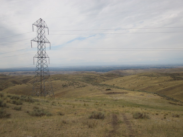
Just before the Powerline Trail, I got to an area that I called the Junk Yard. It features old metal structures, broken pieces of wood and lots of cow pies. The Junk Yard was my approximate half-way point. There are several steep sections of trail to get over en route to Sheep Rock, but also enough sections of easy graded trail to make for good running, hiking, or mountain biking, if you so choose.
 |
| Foothills. |
I always enjoy the views of this area.
 |
| The twin summits of Currant Peak. |
 |
| Shaffer Butte and Deer Point. |
About the time I passed most of the steep sections, I could finally see Sheep Rock and Peak 5179.
 |
| Peak 5179 and Sheep Rock. |
Sheep Rock is kind of cool. I would have liked to take a little more time to explore it, but I was on kind of a tight schedule with having to cover so many miles. From there, you can follow the unnamed road shown on the map up the west side of the peak, then turn right and walk across the flat summit area. Per the map, this peak is on unposted private property. There is a fence and a gate at sheep rock, but it is easily past, and by the looks of it, past often.
 |
| Sheep Rock. |
 |
| Sheep Rock. |
 |
| Looking north toward Peak 4602. |
I was able to locate the USGS marker. I felt that Cartwright Peak would be an appropriate name.
 |
| Possibly misspelled USGS marker. |
Um, think they spelled it "rong".
 |
| Looking northeast. |
The cold and still 30mph wind was not very inviting, so instead of deploying my jacket and hanging out, I bailed after snapping a few obligatory photos.
 |
| Peak 5035. |
Peak 5035 sits across Cartwright Canyon.
 |
| Currant Peak. |
I can literally see my house from here. Okay, probably not, but its down there.
 |
| View over the valley. |
So, um, yeah, it's a really long way back to the car.
 |
| Summit selfie with our beloved Squaw butte in the background. |
Other than the USGS marker and some miscellaneous debris, I didn't see anything else to mark the summit and I did not find a register.
 |
| Unnamed road near Sheep Rock. |
Running the road past Sheep Rock was fast and easy going.
 |
| Cool tree in the rock. |
Getting back down to the Junk Yard was steep and fast. The air was noticeably warmer, but still breezy.
 |
| Above the Junk Yard and Powerline trail. A little more than half the descent still remained. |
After leaving the traihead, I didn't see anyone else for the remainder of the trip. I suspect I was lucky. These are very popular trails. It was a long grind back to the car, but a good run.
It's nice having so many trails and peaks so close to home. They make for fun and fast trips when the weather is cool. Many of them are on private property, so I'm leery when attempting them.
I got lucky on this one.
Happy trails!
Granola, out.
No comments:
Post a Comment