Partners: Mark, Tory and dogs.
Stats: 3.8 miles with exploring and approx 900ft gain so summit elevation 3,494 in 3hrs round trip. Class 1-2.
Gear notes: Pack weight approx 20lbs for training.
Links: Little Butte on Lists of John.
 |
| En route to Little Butte. |
Mark, Tory and I met up for a hike of Little Butte near Emmett on a fine Saturday morning. We were also doing recon and possibly hiking Peak 3,500 as well. We rendezvoused at about 9:30 and were hiking about 15 minutes after that.
 |
| Looking south, along the east side. |
We weren't planning on a long day whether we went for peak 3,500 or not. We hit the top of Little Butte in about an hour.
 |
| Peak 3,500. |
 |
| Looking north, along the east side. |
We explored the top and looked for any sign of the arch.
 |
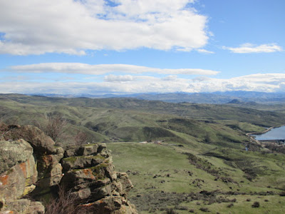
| Black Canyon Reservoir. |
We found a way to the south end of the butte, then over to the west side.
 |
| Looking west from the top. |
There is an appreciable drop off from the top of the butte to the terrain below. The Jones' dog, Vuyo was mindful of it. Ketchum aka Honey Badger; not so much. That's why I don't like taking him on anything more than class 2. His dare devil side is out of control and I really don't want him to get hurt or worse.
 |
| Squaw Butte. |
There were fun sections of scrambling that would have been more enjoyable if I wasn't constantly having to keep an eye on Dog.
 |
| Talus field on the west side. |
In stead of finding the arch, we found a talus field that both dogs were having a bit of difficulty dealing with.
 |
| Negotiating the talus. |
We abandoned our plan of circumnavigating the butte and finding the arch and settled for lunch with a fine western view of the Payette River on the valley floor.
 |
| High point selfie. |
We headed back to the top and Mark said we were at the high point. Picture time!
 |
| Heading down. |
The Jones' were due back in town shortly so we headed back to the vehicles.
 |
| Black Canyon Dam. |
 |
| Google Earth view of the hike. |
We could hear the distant rumble of water flowing over Black Canyon Dam as we walked. It's been a fine spring so far; now time to plan for the bigger peaks.
Game on!
Happy trails. Granola, out.
No comments:
Post a Comment