Date: October 11, 2014.
Objective:
Sinker Butte.
Idaho: A Climbing Guide.
Partners: Deez and Ketchum.
Stats: Not too hard. We did 5.22 miles in about 3 hours.
We were short on time, big on energy and really itching to get out. I've had Sinker Butte saved for just such an occasion, so off we went. While not big or really significant in any way, if you're looking for a short hike close to town, you can do a lot worse. Fall is a great time to visit this area because even when the temperature is not too hot, it still feels really warm. This day was 70* and partly cloudy with a light cool breeze. However, there is no shade to be had other than on the the south canyon wall.
 |
| Sinker Butte from the road. |
 |
| Swan Falls Dam. |
Guffey Butte and Sinker Butte are both what is known as a
Maar.
The hike begins at Swan Falls Dam, that has dam restrooms, open to the dam public.
 |
| Swan Falls Dam. |
The only map we had showed land use so we could tell Sinker Butte was on BLM land, although the Butte itself was not indicated on the map despite it also showing the roads in the area.
 |
| Snake River. |
After a quick walk on the dam to cross the Snake River, we were walking up the open slopes and then on the road that leads to the south canyon rim. There are some really neat pyroclastic and tuff formations here.
 |
| Boulder. Deez for scale. |
 |
| Welded tuff. |
Looking northwest on the gravel road that will lead you to the canyon rim.
 |
| Road. |
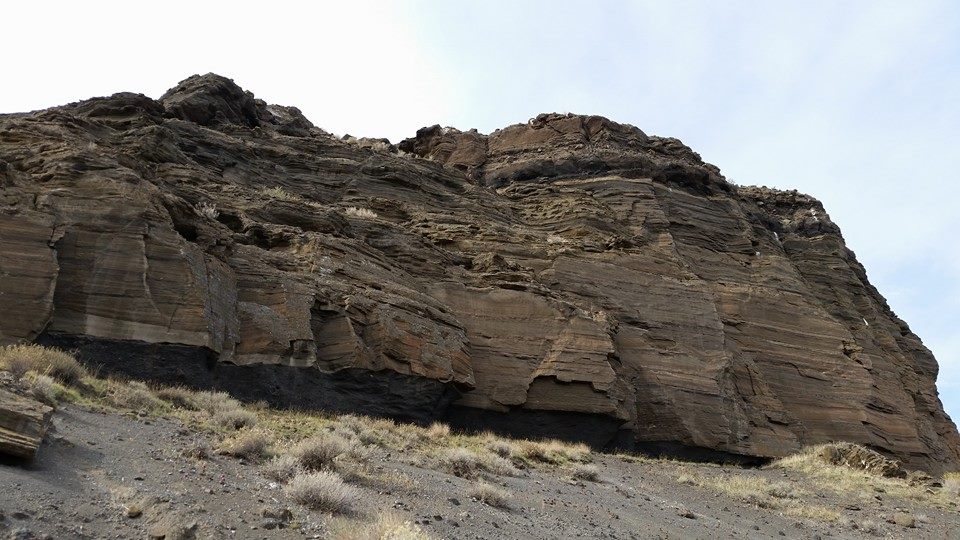
There are some cool tephra horizons in the canyon wall.
 |
| Cliffs. |
Looking west across the canyon as the road turns south. It was about here that we left the road and took a short cut to the top which left my legs scratched up from the brush. Deez was the smart one and wore pants.
 |
| Cliffs. |
On the final push. It's about here that the views open up.
 |
| Looking northwest. |
 |
| Deez heading up. |
 |
| Deez heading up. |
 |
| Clouds. |
You can see the Owyhee Mountains to the south. The high point is the pile of rocks that has a summit register and a very tattered flag.
 |
| Looking south. |
While this was nothing more than a fun short hike, standard procedure still applies; Sign the register, eat a sandwich, take in the views and snap lots of pictures.
 |
| Dog on top. |
 |
| On top. |
BSU had the day off so I was sporting the Gator's!
 |
| Register. |
 |
| Deez at the highpoint. |
 |
| Leaving the highpoint. |
 |
| Snake River Canyon. |
We dropped off and regained the road to avoid the brush. This takes you through the rest of the canyon which is actually quite impressive and worth the extra mileage.
 |
| Canyon. |
 |
| Looking west. |
 |
| Taking in the view of the canyon. |
 |
| Looking back on what we descended. |
 |
| In the canyon. |
 |
| In the canyon. |
From here we stayed on the road for most of the hike back above the dam to keep in the shade.
 |
| North canyon wall. |
Checked another item off the ever expanding to-do list.
Not a bad way to spend a Saturday afternoon!
 |
| Swan Falls Dam. |
 |
| Another Dam view. |
 |
| Google Earth view. |
Adventure is where you find it!
Happy trails!
-Granola, out.


No comments:
Post a Comment