Date: July 19, 2020.
Objective:
Mount Idaho - 12,065'.
Partners: Mark and Tory.
Stats: 10 miles and 5,500' gain. Class 3.
Strava.
Notes: Strava stats a little inflated due to backtracking. Forgot to bring some work gloves for scrambling on the sharp rocks.
Having a day off between peaks was nice so the 04:00 wake up call didn't feel too bad. We did
Breitenbach a couple days before and I felt fairly ready for another big day. We hit the start button at about 05:30; a nice early and cool start. Seriously, tons of mosquitoes though. I realized I forgot my sunglasses in my duffle bag so I had to double back to the rig, then met up the Jones's farther up the canyon. I won't speak for Mark and Tory, but I was getting stoked to tag their final 12er.
 |
| The shadow to the Lost River Range on the valley floor. |
 |
| Hiking the shoulder of point 11,060. |
 |
| Mark on the shoulder. |
The Elkhorn Creek approach is pretty chill, but it is steep until you get up into the trees. From there we were able to follow cairns and our noses to the end of the creek. I remembered/thought we were heading further up the canyon, closer to the base of the west face of the peak but we ended up on the shoulder of the prominent point on the west ridge. This area was pretty steep with some rock outcrops and big trees to move around. Once on top of the shoulder and heading toward the west ridge, we had a clear view of the peak. Mount Idaho appears to be a jumbled mess because it is just that. The west face is a maze of scree chutes and rock ledges. But for now we still had a bit of easy ground to cover. The view of Borah from the saddle was as awesome as I remember from my last trip here, almost 8 years ago to the day.
 |
| Traversing to the saddle. |
 |
| West ridge and west face of Mount Idaho. |
 |
| Mount Borah and Sacagawea. |
The "Towers" section was fun and there was more of a braided trail than I remembered and provided a nice warm up scramble before starting up the face. From the Towers, it's about a half mile to the base of the face. We stopped there for a good break and put our brain buckets on for the rest of the climb. The scrambling was straight forward and fun, but I forgot to bring a pair of gloves. The quartzite rock is pretty sharp.
 |
| Towers. |
 |
| Towers. |
 |
| Base of the west face. |
The maze kind of goes like this: Climb up the initial rocks at the base of the face and that takes you to a prominent bench. At this bench, veer climbers right and follow the ramp that traverses out onto the face. You will find yourself about 600 vertical feet from the top, but don't get antsy, this is the most difficult section. We climbed across a series of gullies and up a few ledges, still moving out to the right a bit. We had to cross one very steep gully that still held snow. Once above the last of the chutes and ledges there is a wide open scree slope. We stuck to the left side and hugged the stable rocks until we topped out on the summit ridge, just to the right of the true summit. The traverse along the right to climbers left was pretty cool; a little airy and probably the best part of the climb for me.
 |
| West face. |
 |
| Low on the face. |
 |
| Gaining the ramp. |
 |
| Traversing out onto the face. |
 |
| Scree gully to the summit ridge. |
 |
| Climbing a rib on the west face. |
 |
| Final stretch to the summit ridge. |
 |
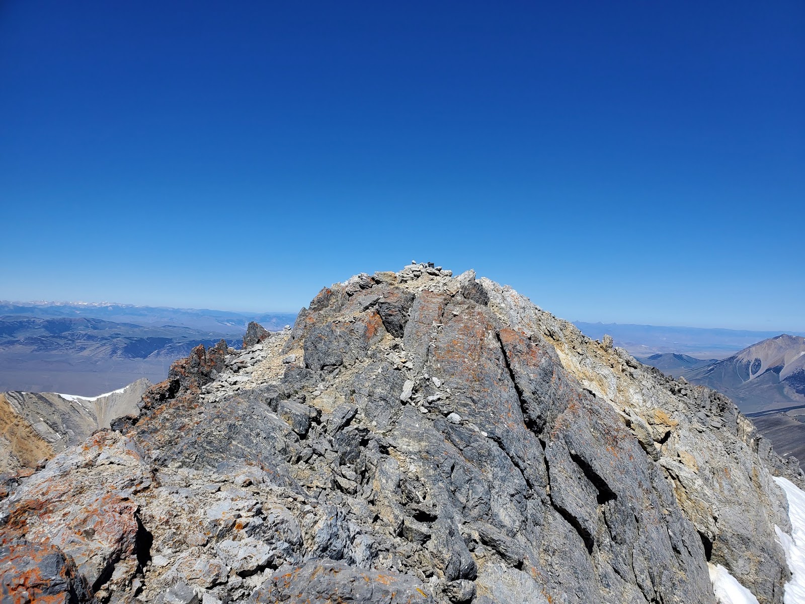
| The true summit. |
 |
| Merrian Lake. |
 |
| Mt. Idaho, aka Elkhorn Peak. |
 |
| Mark and Tory approaching the summit. |
 |
| Mount Borah. |
 |
| Looking south over the crest of the LRR. |
 |
| 9 of 9 on the 12ers! |
It was pretty rad getting to be with Mark and Tory as they reached the top of their final 12er. They agreed that they saved the best for last. We were pretty sure we could see climbers on Borah. The summit of Mount Idaho is a fantastic perch, but there was still work to be done.
We got a little cattywampus while descending the face, but there is no defined route. It's simply a matter of getting down and not getting swept off the face by the scree. We kept moving down and to the right and ended up back at the snow gully where the steps we had kicked earlier should have provided a nice boot path, but the snow was super soft and slushy.
Oh well, just get on and off it as quick as you can!
Once past that, we regained the ramp that leads back to the ridge and back to the base of the face. We picked our way back to the saddle where we discussed going down the wide open slope that leads straight down into the canyon, but we decided to retrace our steps to the shoulder of point 11.060. From there we dropped off to the right a bit and made some good time zipping down the scree, and eventually ended up right at the top of the creek.
The shade of the trees was quite welcome and we could feel the heat of the day really taking hold. We dug in a gutted out the descent with a stop or two to cool off in the creek.
12ers are better with friends, no doubt about that.
Ah, I remember when I finished the 12ers! I expected enlightenment and all I got were sore feet. The elation lasted about 2 days.
I hope their revelry lasts a little longer.


This comment has been removed by a blog administrator.
ReplyDelete