Partners: N/A.
Stats: From Federal Gulch CG; approx 6 miles, 3,500ft to summit elevation 11,027ft and 6hr round trip. Route; south slope/south ridge. 50 degree snow climb.
Gear notes: Ice ax and crampons.
Links:
Summitpost.
Idahosummits trip report.
Idaho Alpine Zone trip report.
Idaho: A Climbing Guide.
 |
| A cold, clear morning. |
I was looking for a spring snow climb with some elevation and I found Jacqueline Peak. This can also be done without snow and is rated class 3. The route can be shortened by driving farther up the East Fork Road with a high clearance vehicle, or riding a mountain bike from Federal Gulch campground. I spent the night at the campground and got an alpine start to get the best snow conditions.
 |
| Jacqueline Peak south slopes. |
It was totally dark when I left on foot and my timing worked out well. I reached the base of the peak just as the sun was coming up.
 |
| Alpenglow. |
I had to stop for a while to get some pictures of this beautiful alpenglow. It did take some time to get the best pictures, but it was worth totally it.
 |
| Grays Peak. |
The route is very straight forward and it gains elevation quickly.
 |
| Looking down the south slopes. |
This would be a great ski descent.
 |
| Looking west. |
There are many peaks in this area that can be reached from the East Fork Road.
 |
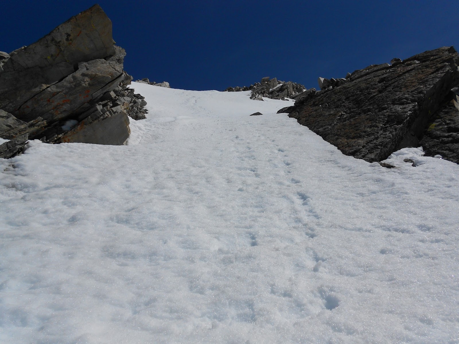
| Looking up the south slope. |
Climbing on snow was cruiser. Instead of dealing with the talus, it was an easy uphill hike.
 |
| Looking down. |
The upper part of the route I did was a mix of large talus, firm snow and a couple chutes that made for really fun climbing, both up and down.
 |
| Summit ridge. |
I kept to the upper edge of the talus to avoid any cornices. Looking back on the ridge I could see that it was in fact corniced. I proceeded with caution below the snow.
 |
| Looking down the ridge. |
 |
| Near the summit. |
I would totally go back and do it as a class 3 climb. I bet the view would be better too since you could follow the spine of the ridge instead of being ten feet below it.
 |
| Johnstone Peak. |
I got a great aerial view of Johnstone Peak.
 |
| Near the summit. |
The ridge to the summit was funky with the cornices. I removed my crampons and stuck to the rock.
 |
| Cornice. |
Whoa mama! Now that's a cornice!
 |
| Grays Peak from the summit. |
There was enough of a snow cap/cornice on the top that I stopped at the edge of the rocks. GPS indicated my altitude was consistent with the summit elevation. I didn't find any markers or a register among the rock. I didn't dig or venture out onto the cornice.
 |
| McIntyre Peak. |
 |
| Looking SE at a sea of peaks. |
The summit was sunny and windless, but cold. I soaked in the views for a while before starting down.
 |
| A few feet below the summit selfie. |
A few feet below the summit, I had to stop and take that all important summit shot that I forgot on top.
 |
| Looking down. |
The south slopes are wide open and many lines are possible.
 |
| Looking back up one of the chutes. |
The snow was now noticeably softer, so that meant I had to get moving.
 |
| Long glissade. |
For my descent, I went over to the more open slopes, east of the ridge. Down lower where the slopes were steep and had a clear run-out made for excellent seat glissading. Near the snowline was miserable post-hole hell into the brush.
 |
Red = ascent. Yellow = descent.
|
There are many options for climbing this peak, including an approach from the north from Big Basin. A really neat option would be to traverse the ridge that connects to McIntyre Peak. That would get you two 11ers in one climb.
 |
| Walking back to the car. |
The day had heated up and I wished I had packed some sorts for the hike back to the car.