Steve and I set out for the first leg of our trip, Baker Lake at about 3:30pm. Warm and sunny skies with a full parking lot meant the competition for a camp site might be stiff.


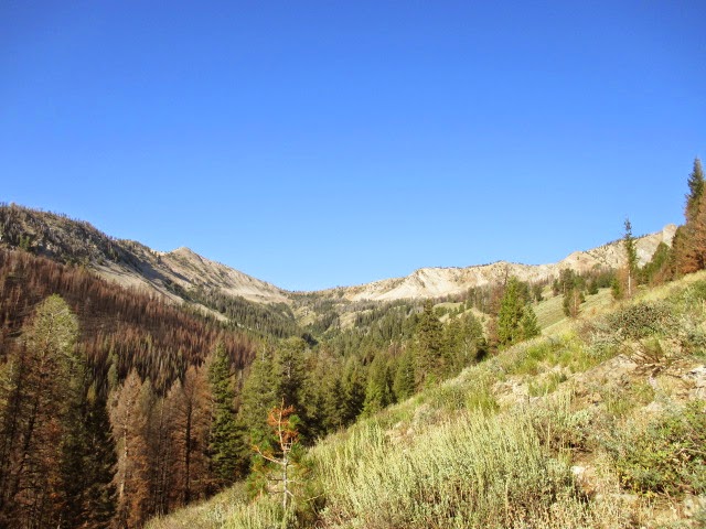
As we began the hike we discussed the massive fire that burned here just under a year ago. We expected to see some burn scars, but Steve's research of the area indicated it wasn't too bad.


This section was about the worst. The hill side on the left has been eroding away.

We had loose plans of jamming up Backdrop Peak, seen above, and possibly Baker Peak as well.

We arrived at Baker Lake having passed no more than some day hikers and fishermen. The camp sites were ours for the choosing. It was getting a little late in the day for climbing peaks and I wasn't feeling quite 100% so we opted to pass on Baker and Backdrop Peaks and save our energy for the next day.

Steve set up one of his new gadgets he picked up from the Outdoor Retailer's convention; A handy-dandy in-camp water filter.

Going backpacking with Steve means you had best remember to pack your appetite. After all, he is a Wild Chef!
Big Dan's Spicy Hummus on fried pita bread? Why, yes please.

Curried Salmon Pilaf for dinner was not a bad way to go.


We had anticipated the objective for tomorrow, as we were completely in the dark as to any finer details.

Sunrise on day 2.

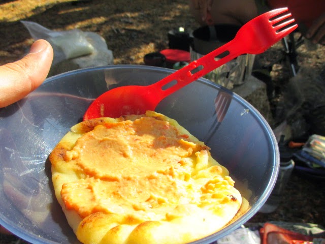
Brie Flappers for breakfast.

Washout along the trail on the way out.
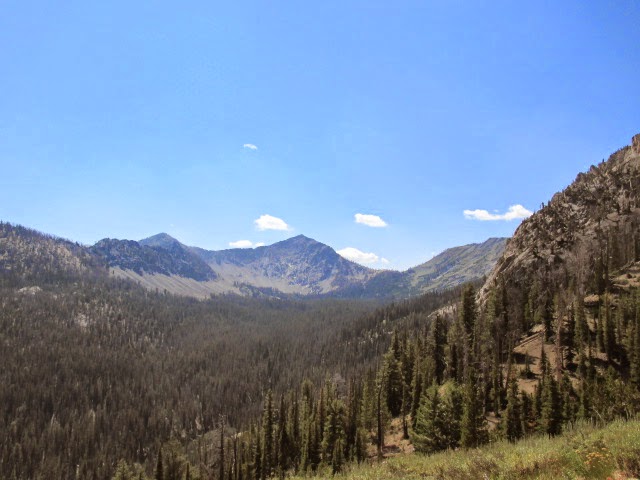
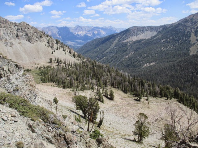
Baker Peak is on the left.

We met Dan, Tom, Tamara John and Shadow at the trail head for our secret ascent.

We had an easy trail approach. Other than that, the route was until now, uncharted.
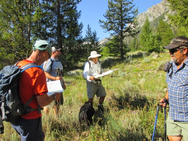
John, Dan, Tom, Steve and I contemplate the route.


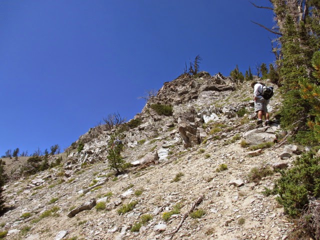
We left the trail at 8,060 feet and began a steep bushwhack to reach an upper basin.

We really were not sure exactly where we were headed, but we knew where we were, so we kept heading up.

We aimed for the base of that rib where we found a neat little meadow at 9,000 feet.


Dan and Tom had eyed the ridge line from the right.

The climbing was steep and exposed class 3. The occasional loose rocks kept us vigilant as we ascended.
Looking towards the Boulder Mountains.

Looks fun, don't it!

Yeah, if you could go ahead and NOT fall, that'ed be great...

Naming peaks with Dan and Tom was a pleasure. After all, these are two guys that inspired me to start mountain climbing.
As we neared the top of the rib, we each chose slightly different routes.
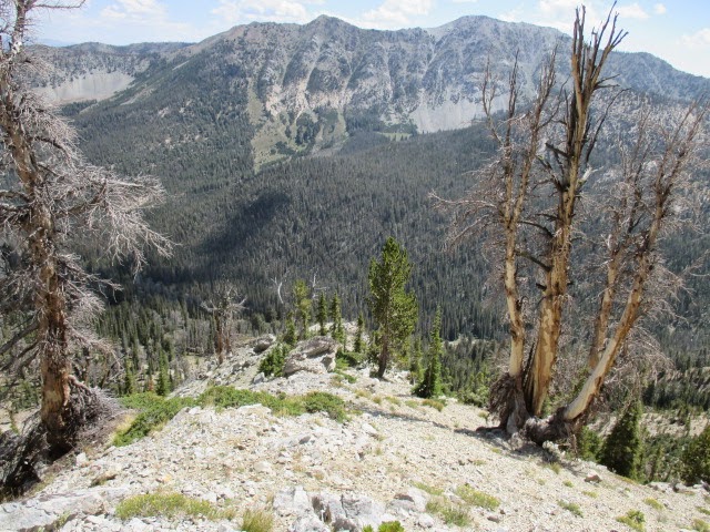
Norton Peak sat behind us as we explored this new terrain.

Dan working his way up the rib.

Tom surveys the route.

I found some really neat rocks that looked more like they belong at Craters of the Moon.

Look at that folding!

Looking down the rib.

After we reached the saddle, we found easier class 2 terrain. We traversed right to the high point.

Dan on the summit ridge.

Seriously, look at that folding!


Beautiful views along the summit ridge.

At 2pm, everyone stopped and sat down on what we thought to be the high point. Usually when climbing, you're concerned with what you see. It was what we didn't see that was important to us. No cairn, no register, no beer cans, no trash. There were absolutely no signs of previous human occupation.

Summit view.


Looking back on the ridge we climbed.

Norton Peak as seen from the summit.

Dan and Tom lead the descent. We made sure to hit all high points along the ridge.

The gang down climbing one of the tricky gullies.

Tom in the lead on descent.

From here, we could see goats high on the peak in front of us. We descend a different route, also unclimbed, hoping to find easier ground. What we found was a very tricky, loose and exposed head wall that we had to down climb. We were kicking big rocks loose, so we had to be extra careful. We made it down without any major incidents.

After our trip though sketchvill, we hit this snow patch for a short break.

Looking up at the head wall. We descended a gully to the left.

After we descended the talus field, we hoped to find a lake, but the lake was gone. Dried up, not there.

Now, all we had to do was bushwhack back to the trail. We all chose our own poison and just went for it. Tom straight up smoked everyone back to the parking lot, where Steve was waiting for us with fresh cold creek water. Dan and I arrived next, then Shadow, John and Tamara. GPS data indicated 10.4 miles round trip. My altimeter logged 3320ft of elevation gain.
It was pretty cool do something like this in the company that I was in. What had started as a total walk into the unknown turned out to be a tough, yet very enjoyable day.
Thanks for letting me tag along!
Idaho: A Climbing Guide web page of the ascent.
- Granola, out.