Monday, July 18, 2022

Trappers Peak

Date: July 18, 2022.

Objective.  Trappers Peak 5,996'.

Stats: 11 miles with 3500ft of gain in 7hrs round trip.  Class 2/3.

Partners: Roy.


Roy and I were coming off a pretty long day on Mount Shuksan two days ago.  We wanted to start up Mount Baker on Sunday (July 17) but we decided to call it off with some heavy fatigue and a changing weather forecast calling for some pretty cold temps.  It just didn't make sense to start another two day climb.  We changed the play and took an extra day off to rest and set our sites on "low hanging fruit", per the Beckey guide book. 

Trappers Peak trailhead sits inside the North Cascades National Park, so I figured that we would need a parking permit like everywhere else, but apparently not.  The forecast said clear skies but that was not the case at the trailhead.  No biggie, we just wanted to bag another peak and hopefully get a good view of the Picket Range.


The weather was cloudy and humid and not really cold.  The trail was still pretty muddy from all of the late season precip.  It was a straight forward hike on the trail to Thornton Lakes.  The route up the South Ridge up Trappers Peak leaves the trail just before the trail drops down to the lakes.

Hiking.

Looking towards the lakes.

Along the ridge.

Class 2/3.

Looking down the ridge.


There were a few sections of class 2/3 that were very fun.  There were a few snowfields that we had to cross that required thorough evaluation due to the limited visibility and steep ridge.  The whiteout was a bit concerning but we were able to find our way without much trouble.  There were a couple other peaks close by that could be linked, but that wasn't going to happen today.  We just couldn't see a gosh darn thing.  

After retracing our route back down to the trail, it was autopilot back to the car.  The Friggin' mosquitoes were so bad that we couldn't get in the car fast enough.


Steep section.

Whiteout.

Summit.

Roy on the summit.

Roy on the summit.

Steep drop off to the right.

Friday, July 15, 2022

Mount Shuksan

Date: July 14-15, 2022.

Objective:  Mount Shuksan 9,131'.

Stats: Approx 18 miles and 8,000ft gain round trip.  13hr summit day.  Strava.

Partners: Roy.

Roy and I set out for the Cascades yet again, this time with our sites set on the North Cascades National Park.  We chose Mount Shuksan simply based on aesthetic value.  Shuksan just "looked awesome".  After hammering out the logistical side of things on the drive over, all we needed to do was decide on the route.  We knew we would be approaching via the Sulphide Glacier which would put us on either the SE Rib 5th class rock route, or climbing the SE Gully which could be a mix of snow and ice and possible class 4 rock.

Interestingly enough, after a very dry winter, the mountains were now buried in late spring snowfall.  We knew there had been a few recent ascents but still had some concerns about the ridge being snow free enough to climb and bringing enough of the right gear for it.

We started the hike to bivy at darn near 1100 and found ourselves sweltering in the low elevation sun on snow covered and exposed slopes.  We took our time taking breaks in the precious little shade and enjoyed the views of Mount Baker.  After getting settled in camp we realized that the sunset was going to spectacular.  The only problem with that was we wouldn't be up to see it.  We hit the sack pretty early for an 0100 wake up.  We wanted to get across the low elevation glacier before the heat of the day.  We also wanted to get ahead of any potential traffic jams on the route.  
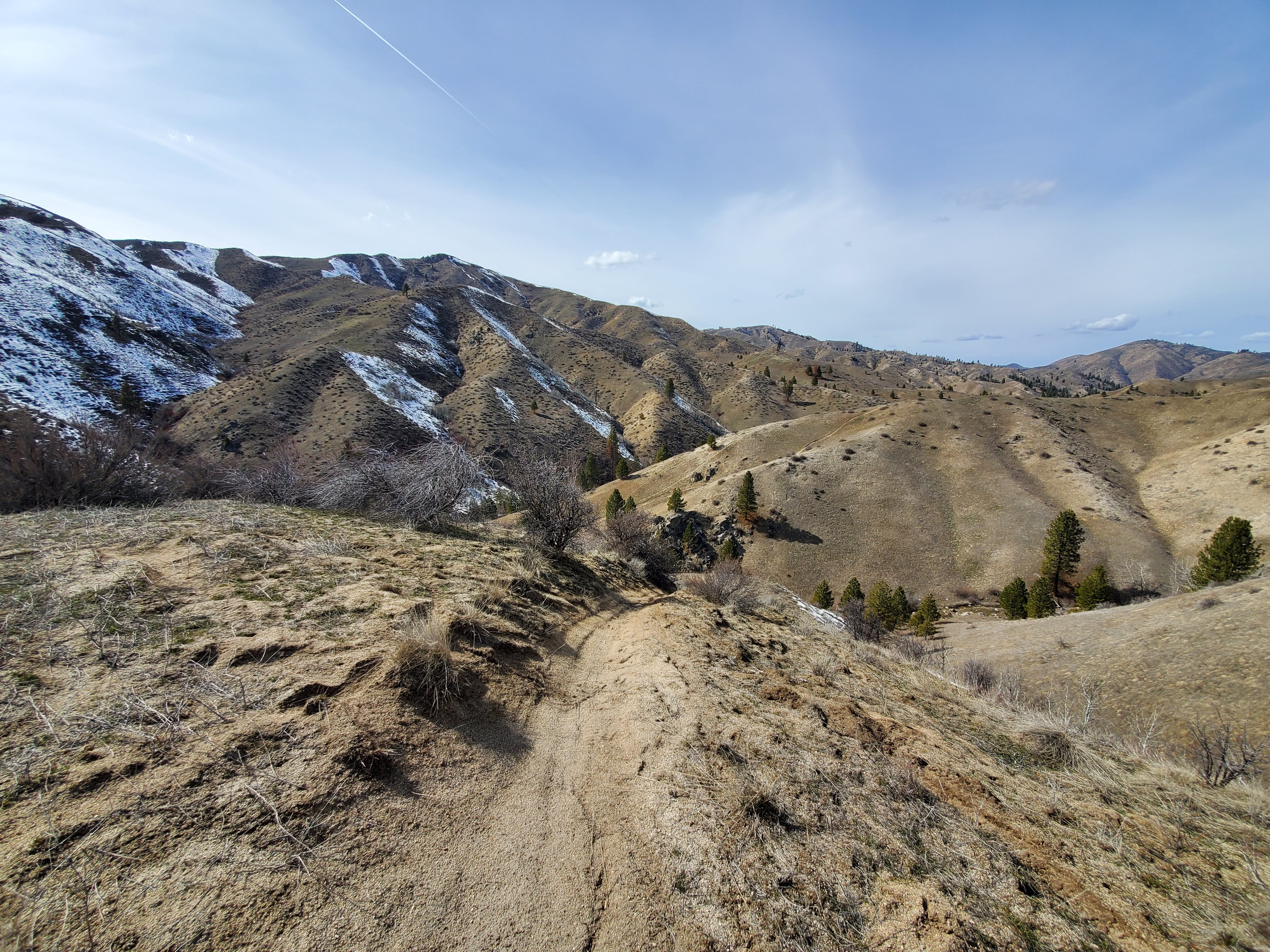
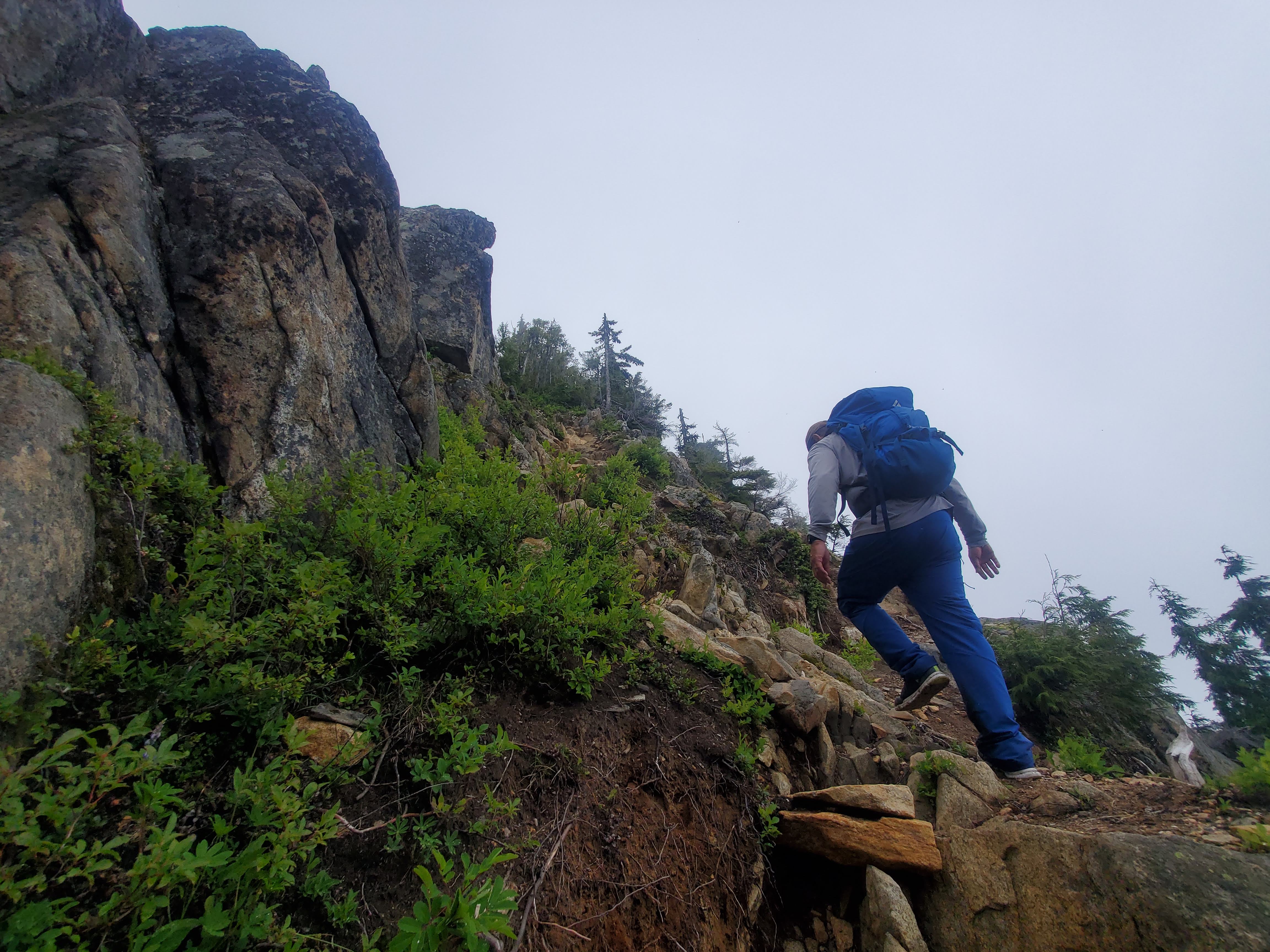

Trailhead.

Trailhead.

Mount Baker aka Komo Kulshan.

View from camp.


The temps were fairly warm when we set out from the tent at 0200.  We knew the snow depth was sufficient to bridge most crevasses but still chose to rope up before where we thought the actual glacier began.  We hit the jackpot with an amazing sunrise.

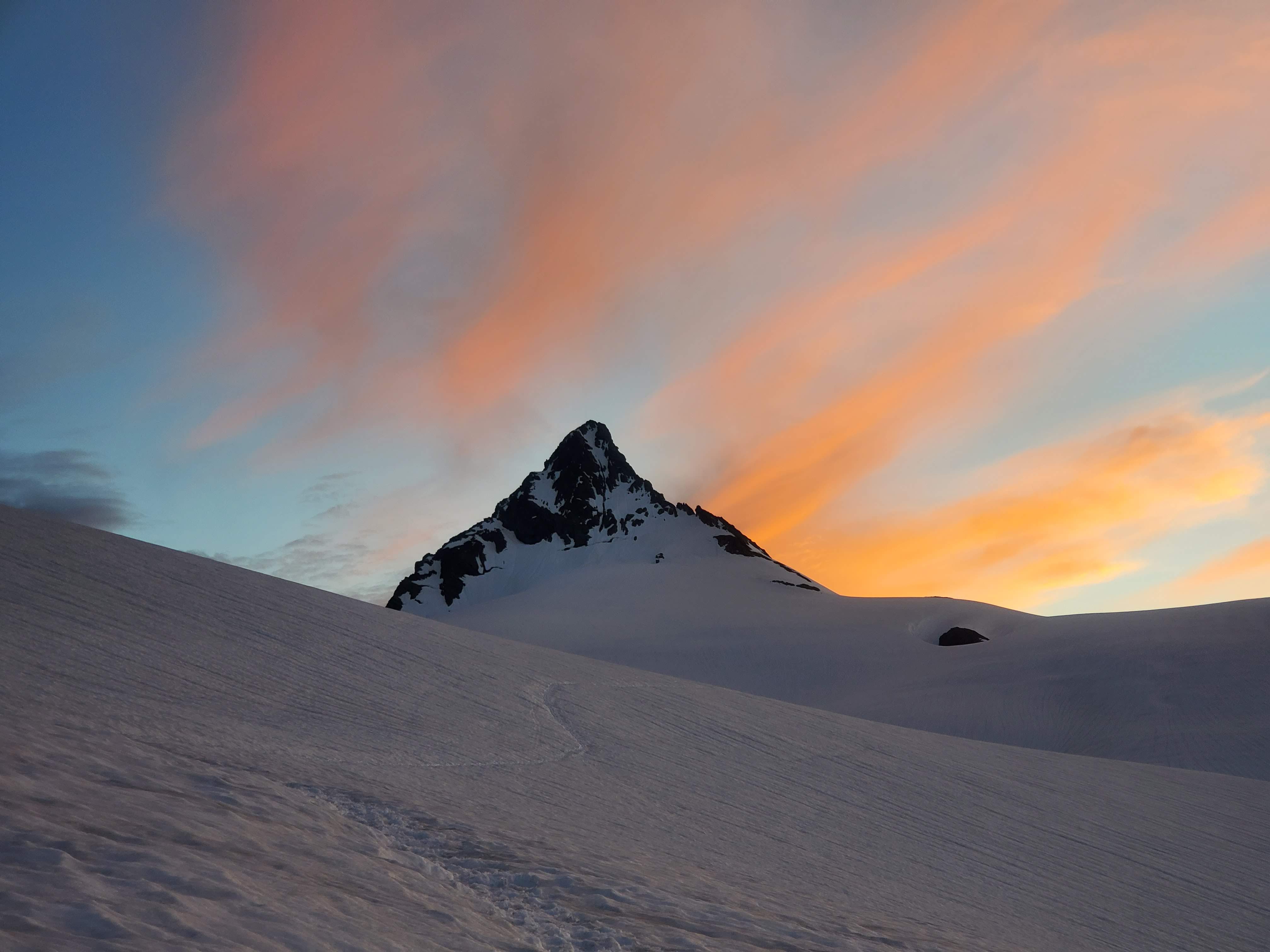
Sunrise on the Sulphide Glacier.

Shuksan summit pyramid at sunrise.

Sunrise.

Roy at a break.

Nearing the summit pyramid.


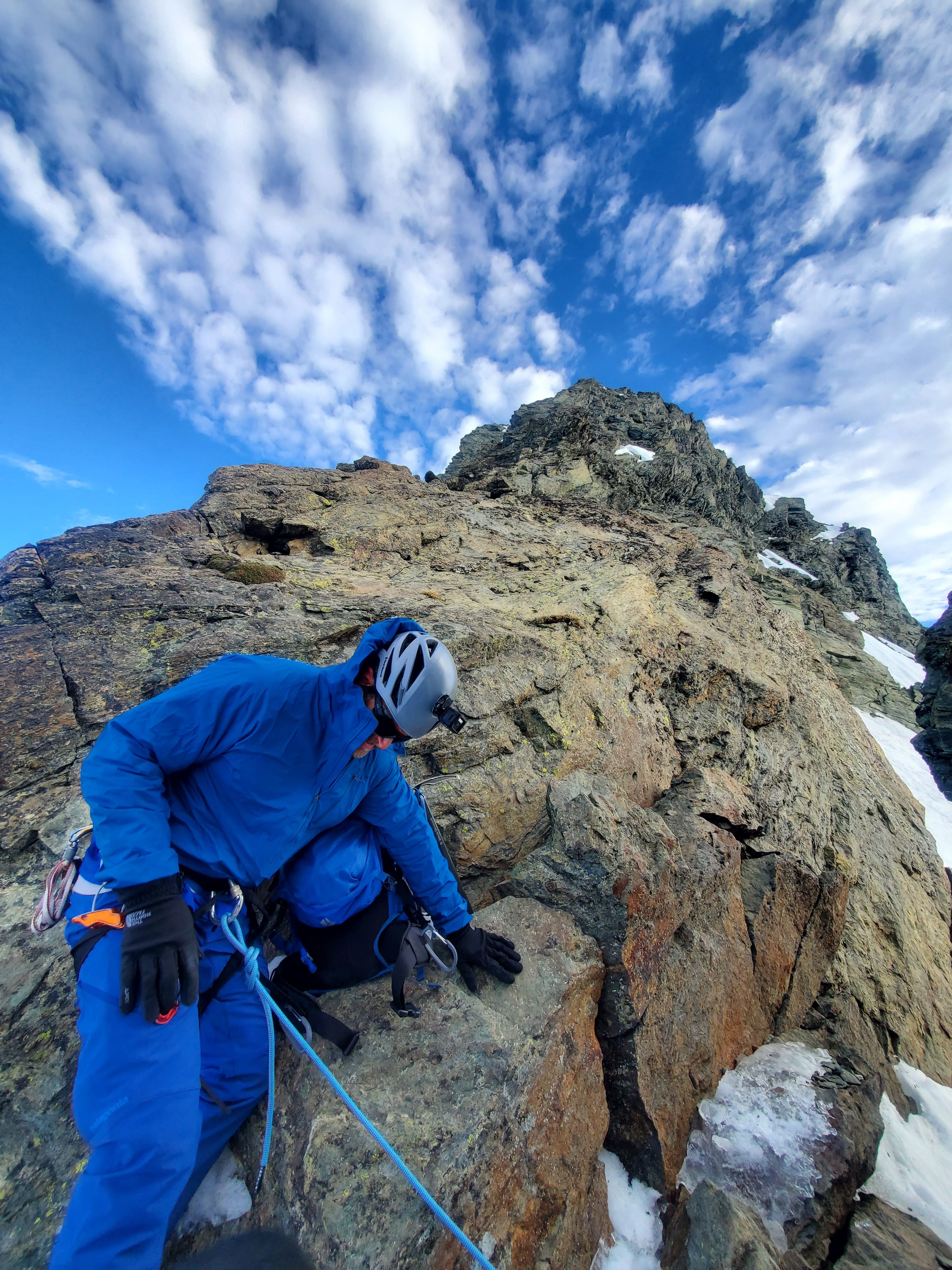
It was pretty cruiser up to the base of the SE Rib and the route looked clear.  I had a dicey moment on a steep and icy slope because I hadn't put my ice ax in self belay soon enough.  Time to wake up!!!  After gaining the notch, we had to reconfigure the rope from two person glacier travel to technical rock, take the crampons off and stow ice axes for several pitches of rock.

The SE Rib started out a bit "slabby" but the rock was bomber solid.  Roy led and cruised up pitch after pitch.  I think we did 3 and half 60m rope lengths to gain the summit.  Super fun, super sunny and a super solid partner made it almost go by too quick.  We gained the summit and Roy dug out the register and signed us in.  We only spent about 5 minutes on top because we had at least two parties behind us and the most difficult and dangerous part yet to come.  

Our route was up the right hand ridge and down through the gully in the center.

Roy leaving the first belay.

At a belay.

Looking down the SE Rib.

Roy flaking the rope.

Last pitch to the summit.

Summit.

Baker in the distance.

First rappel.

Rappelling.


We down climbed on belay to the first rappel station.  From there, Roy led the rappels thought the Gully.  There was some zig-zagging from one side to the other and we really took our time to triple check everything.  Eventually we got to a spot very low in the gully that did not have a rap station and Roy ended up making a couple, leaving some slings and rap rings behind.  I'm sure the party behind us appreciated that.

Once we were to a spot that we could hop back on the glacier, we reconfigured the rope back to two person glacier travel and cruised.  The way back to the tent seemed a heck of a lot longer than the way up.  Packing up was brutal in the heat, but the only way out is though and we still had some appreciable ground to cover.

The mosquitoes were out of control back down in the trees.  We had been watching some low clouds come in from the west all day and by now there was a light rain.  It kept the blood suckers at bay for the time being.  

We climb for the experience.  We climb for the views.  Getting a summit is awesome, but getting back to the car is what it's all about.  Ripping the boots off and busting out the flip flops, potato chips and beer; not necessarily in that order though.

Almost back to camp.

Heading back to the car.


Friday, March 18, 2022

Danskin Mountains

Date:  Friday, March 18, 2022.

Objective:  Explore the Danskin's.  Tagged Hutton and Fiddler BM.

Stats: 17.5 miles and 5500ft of elevation gain in 7:30 round trip.  Lots of rugged trail and off trail travel, plus the creek rally and bushwhack at the end.  Strava.


Due to the very dry winter here, I figured I would head out and see what the Danskins were like.  I've been in the area a few times and love how remote they feel even though they are very close to Boise.  I wanted to try the connecting ridge from Hutton Peak to Little Fiddler, and had loose plans of trying a bigger loop if conditions and time allowed. 

The trails are ATV/ OHV/ dirt bike trails and are very rutted, but at least they are well defined.  The snow got to be a hindrance the closer I got to Little Fiddler.  Pedestrian travel is rough out here, but I never saw another person and the weather was dang near perfect.  From where I decided to turn around, about 2-3 miles round trip short of Little Fiddler, I knew there would be a bunch of vert to regain, and at least 8-9 miles back to the car from here if I turned around now.  There was another trail that I was considering that stayed above Willow Creek that would get me back to the trailhead.  Instead of going back up and over Fiddler BM, I cut down toward it and started following my escape route.  After about 5 miles of following this route, I decided that maybe I should just go ahead and take a dip in Willow Creek.  The temps were warm, the day was getting late, and this option would surely save several miles and at least it would be flat.

It wasn't the worst life decision I've ever made, but it wasn't without its challenges.  The creek was waist deep in places and crossing it was unavoidable.  There were a few areas where the best option was to basically class 3 bushwhack- combo- log cross with my fingers crossed.  I probably ended up crossing the creek 8-10 times.  The last two of which were actually not needed, but I was on a roll and the cold water was quite invigorating.  It was a long and tough day but the adventure and route finding were top notch.  

Pictures   

Trail just above Willow Creek and heading towards Hutton Peak,

Looking towards the trailhead.

Early morning rays.

Looking east.

Looking south over north facing slopes.

Hutton Peak.

Summit of Hutton.

Flat BM and Bender Peak.


North side of the ridge that I followed.

Looking north.

Hutton Peak from Fiddler BM.

Fiddler BM.

Little Fiddler is a long ways away.

Heading towards Little Fiddler.

False summits on the way to Little Fiddler.

Rocks.

Zoomed in on the summit of Little Fiddler.

Green grassy fields above Willow Creek.

ATV track leading into the creek bottom.

Wild turkeys.

The last stretch of dry trail before the creek rally began.