Tuesday, November 8, 2016

Rock Roll Peak

I managed to sneak up Rock Roll Peak before Winter sets in.

Date: 11/6/2016.

Objective: Rock Roll Peak 10,458ft.

Partners: N/A.

Stats: 10 miles, 4,153ft round trip. Class 2. Strava Track.

Gear Notes: N/A.

Links: Summit Post Page.

South Ridge of Rock Roll Peak.

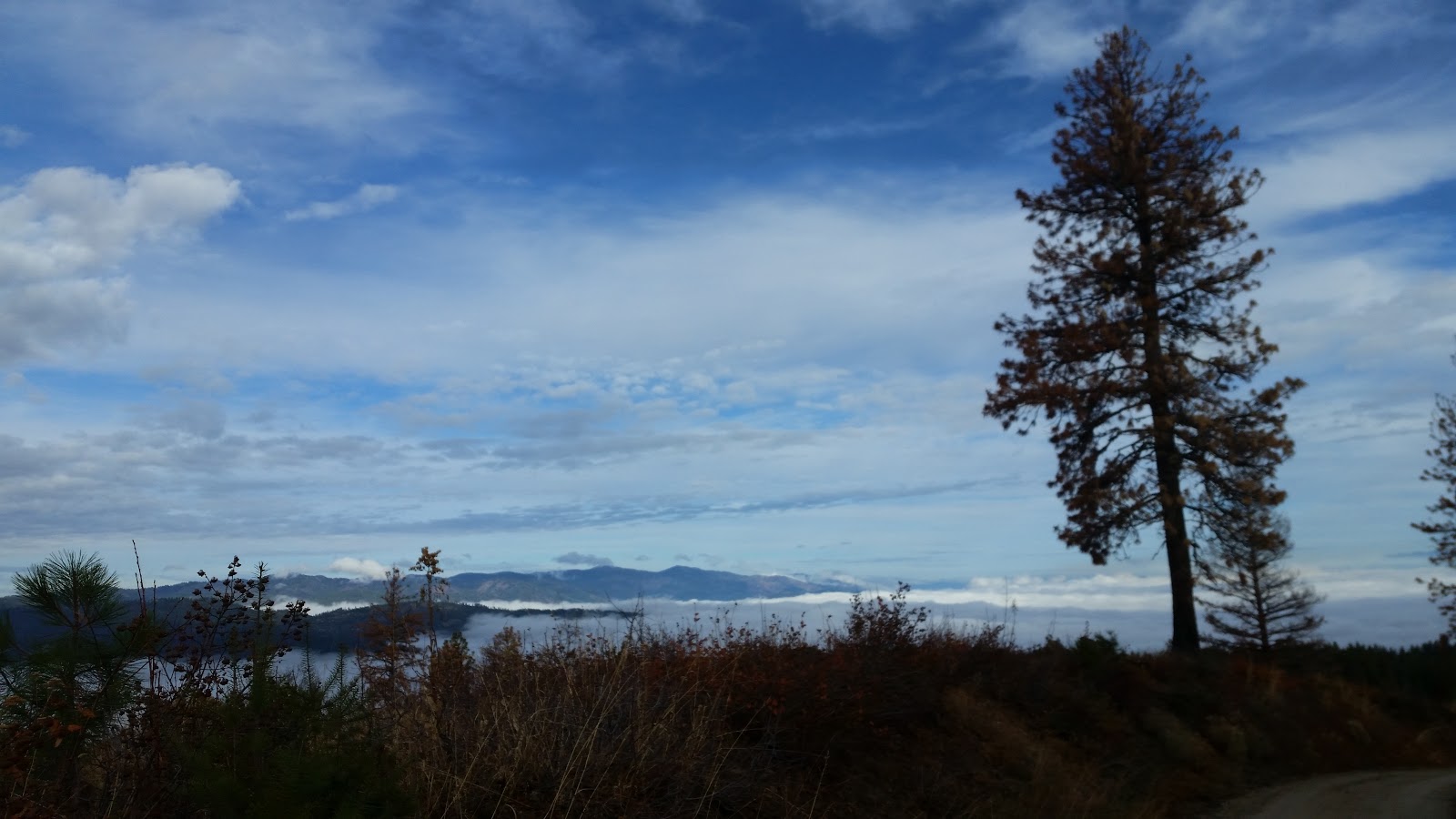
I had been wanting to try Rock Roll Peak for a few years, but some how kept passing on it. I was looking for a quick ascent above 10,000ft before the winter closes in and with the recent high pressure, I figured conditions were about as good as they could get. While driving into the trail head, I couldn't remember how far the road was passable by car. As I came to realize, you can actually drive the whole length if it. I parked way too soon and ended up walking an extra 1.4 miles to the actual trail.

Near the end of the road.

The head of the canyon is a fantastic place with several good camp sites. I missed the actual trail on the way up but was able to find it after a short cross-country hike up a dry creek bed.

As I like to say; the adventure starts when you don't know what will happen next.

Nearing the ridge.

The plan was to hike the trail to around 8,200ft then head for the saddle on the south ridge of the peak. It is important to note that there several lines that will take you to the south ridge from the trail. They all vary in difficulty based on length and elevation gain. There was an obvious Col that would require the least gain, but more time on the trail hiking away from the peak, then back tracking along the ridge. I picked a good looking line and headed up the west slopes.

Looking down the ridge from the false summit.

Reaching the ridge meant getting the awesome views, but it also exposed me to the biting cold wind.

DBE.

DBE looked quite gnarly.

And, I uh... want to climb that... hu...

Pioneer Mountains.
A bit of snow was present on the route, but not enough to necessitate snowshoes or crampons. That was fine with me because I wasn't packing either.

Upper ridge.

Higher on the ridge, there was just enough snow to make things interesting. Again, not enough to make it a high risk operation or present a mission critical problem.

Rolling along the rocky ridge.

Near the summit.

After the false summit, some careful probing and step kicking, the true summit was near.

Summit cairn.

Peak 10,334.

The ridge heading north to peak 10,334 looked passable but I wouldn't have time to head over there.

More Pio's.

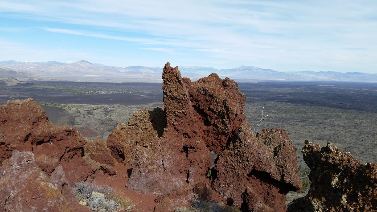
Quite possibly the best thing about Rock Roll Peak is the expansive view that includes the Pioneer Mountains to the south, the Hemingway-Boulders to the north and into the White Cloud Mountains beyond that. To the west and northwest the Smoky Mountains are visible and off in the distance to the east, the Lost River Range can be seen.

Goat Mountain.


Summit pic.

Lost River Range.
I didn't linger long at the summit cairn. I got the mandatory pictures and retreated to a spot out of the wind to get my grub on.

Descending.

There were options-O-plenty to descend the ridge and regain the trail. I blindly chose a different route down the west face and almost ended up in a quandary of crumbling rock in a steep gully. After some side-hilling and careful stepping, I was back down on the trail, out of the wind and day dreaming of the options for future adventures here.

Baldy in the background.


The Magic Gully.

For future reference I would consider this, the magic gully, to gain or descent the ridge between Rock Roll and Peak 10,334.

Rock Roll Peak from the road.

It was a fine day to be out exploring a new (to me) area and I almost forgot to gripe about the added pedestrian mileage on the way back to the car.

Happy trails!

Thursday, November 3, 2016

Warm Springs Point

Checked yet another peak off of Marks list. You can basically drive to the top of Warm Springs Point. You can also run on the road. We chose to do the latter.

Date: 10/29/2016.

Objective: Warm Springs Point.  Elev 6,054ft.

Kid/family friendly? Yes, just shorten the mileage.

Partners: Mark J.

Stats: 12.2 miles 1,380ft in 2.5hrs round trip. Class 1.

Gear notes: Standard long trail run kit.

We took the Centerville Rd out of Idaho city and parked at 3.8 miles, at the junction with FSR 311. Follow 311 south past a couple of junctions and spur roads to the peak. A map/GPS will be handy. The road could be driven to within a very short distance of the peak, but whats the fun in that? You could also park further away from the peak and increase the suffering, err... I mean mileage, as desired. The road was in great condition and made for smooth running. We enjoyed the crisp autumn morning air and ran to our objective for the day. Saw several hunters, but that the norm for this time of year. Pictures below. Happy trails!

We're above the clouds that are above Idaho City. Looking toward Mores Creek Summit.

Mark on the summit.

Summit View.

Fire pit on top.

Summit selfie. 

Looking east.

Looking southeast.

Looking north. 


Sunday, October 30, 2016

Big Cinder Butte

We jammed over to Craters of the Moon at the last minute with one thing on the agenda; get the high point.

Date: 10-23-2016.

Objective: Big Cinder Butte 6,515.

Partners: Deez and the Lego Master.

Stats: 5 miles and 5 hours round trip with 645 feet of gain.

Links: Idaho: A Climbing GuideSummit PostNational Park Service.


Big Cinder Butte from the tree molds trail.

Craters of the Moon is pretty dang cool on its own. Its family friendly and has great camping. Whats more is there are ranked peaks inside the National Monument. All it took as a quick check of the weather to solidify our decision. The forecast called for very light wind, which is somewhat of a rarity for Craters. Our last trip here was a little on the windy side.

We drove out on Saturday, got a camp site and set off to show the youngster the lava tubes and caves and take a quick stroll to the top of the Inferno Cone. After a not too early start on Sunday, we drove to the tree molds parking area and set out on the trail.

Crater rim along the trail.

I wasn't too sure of where to leave the trail and start up the northwest ridge so we back tracked a bit until we found a suitable slope to ascend.

Looking north into the Lost River Range.

The high peaks of the Lost River Range could be seen from low on the peak.
The hike is mostly though sage brush. As usual, I opted to wear shorts, and as usual regretted that once into the thick of it.

Upper slopes.

Even when the brush appeared to thin out, it didn't. All we could do was grin and bear it. Soon enough we reached the upper slopes of the peak and hiked across the cinders to the summit ridge.

Nearing the false summit.

False summit.

We crunched our way to the summit of the high point but we forgot the crunchy Pringles to go with our lunch.


Summit.
 Let the selfie-fest begin!


Lost River Range.
Crescent Butte.

Big Cinder Butte has big views and the lack of wind certainly did not disappoint us while we lounged on the summit.
Looking south.

Southern end of the Pioneer Mountains.

One more selfie.

We would have stayed longer but we still had a couple more items on the agenda for the day, including the three hour drive home.

Remnants of the crater wall.

There were still plenty of geologic wonders to examine on the way back to the car.

Gas bubbles in the rock.

  There was a system of game trails that we followed to the base of the peak.

Game trails.

Back on the trail.

We skirted the edge of the pahoehoe lava flow in an effort to regain the trail. The day was warm and our spirits were high as we headed off to show the youngster a little more of the park. We still have plenty more to see and do here. While this trip was the true essence of peak bagging, there are many other wonderful options for exploration and adventure.

Happy trails!

Tuesday, September 27, 2016

The Legend of Bear Pete

First let me clarify, I'm a casual runner. Mark Jones invited me to my first trail race, The Legend of Bear Pete 30k. We had been training and were pretty stoked to get a P2K. The big day came, the weather looked crummy and I was doubting myself, but the show had to go on.

Date: September 18, 2016.

Partners: N/A.

Stats: 30k/18 miles and 3,500ft gain to summit elevation 8,752. Time 4:21.

Gear notes: N/A.

Links: Legend of Bear PeteIdaho: A Climbing GuideSummitpost.

I had been feeling pretty good about the overall idea of this race; run the trail to the top of a peak and back down. I wasn't planning on placing first, nor was I trying to. I was only racing myself. Heck, I've been doing that for years. I wanted to finish in under 5 hours, so that was my first goal. My second goal was to experience and hopefully enjoy the race atmosphere. The third goal I set for this was to simply get up the peak.

Mark and Tory made it to McCall the night before as planned, but Mark was not feeling well and said he was a race day decision. I finally got the official word that morning; he was a no go. I was bummed since this was his idea and a major goal of his. There was potential for heavy showers and high winds for the day of the 30k and the 100 milers had been out in it all night. I was beginning to have my doubts as Denise and I drove toward Burgdorf in a heavy downpour, but I wasn't about to let some rain and a lot of mud stop me.

I got checked in, pinned on my bib, jumped in the pack and we were off at 9am. The initial section was along the road. It was fairly flat and made for a good warm up.

Start of the race. Photo credit: Deez.

Beyond the camp ground, the pack was pretty spread out. I wasn't near the front, but not in the back either.

Meadow at the end of the campground.

Before the steep section up the canyon.

If there was an easy section of the course, that was it. Now there was the 3,000 foot climb up the canyon to the summit ridge and a short cross country section to the peak.

Junction.

I passed a few people and wondered if I was pushing too hard. I kept within a moderate perceived effort which was more of a fast hike than a run.

Trail along the summit ridge.

Once on the trail along the summit ridge, I was mostly alone among the beautiful colors of autumn. The clouds made for dramatic scenery but they didn't break until later in the day, well after I was done.

Summit ridge.

Summit ridge.

No views of any nearby peaks to be had. It was just me and the clouds for the time being.

Summit ridge.

Bear Pete Mountain.

Running the trail along the summit ridge was quick and fun. Soon I could see the peak, for the most part.

Course marker.

I broke off the trail for the cross country push to the summit with a fellow runner from McCall. The route was marked with the pink ribbons so it was just a matter of hopping from string to string.

Summit push.

The brush was still wet from all of the rain; now my shoes were too.

Summit shot.

It was a just a quick stop on top to mark the bib and grab a photo. Then back on down to the trail and on to the manned aid station at mile 14.

Summit view.

In the clouds.

The course went through a big marshy area. Normally I would find a way around it, but this was a race, not a dilly-dally. I plowed straight through it going down ankle deep at times. It didn't really matter, my feet were already wet. I checked in at the aid station at 3:08 into my run. I had a little over 4 miles left to get back to Burgdorf. It was mostly downhill but I was starting to feel the effects of the uphill push. Nothing else to do but suck it up and keep moving.

Cue the leg cramps!

The descent was steep and fast with only a couple of real muddy sections to get through. I got passed as I stopped to stretch out a pesky cramp. Soon I was back on the road and headed for the finish line where Deez had been waiting.

Finish line.
Ahh... I can smell beer!

Results.

I had stopped looking at my watch and was in a state of disbelief when I saw my posted time. I was pleased with that but even more happy to get on to the important stuff; free beer and chili.

Post race beer.

We hung out and chatted with Mark and Tory who made the drive up, and cheered on as more finishers of both the 100 miler and 30k came across the finish line. It was good to see familiar faces make it to the keg after their battle with the mountain.

Deez and I at the finish line.

Panoramic shot. Photo credit: Deez.

I felt intimidated at the start, but overall really enjoyed the race experience. I'd do another one. After a soak in the hot tub, we hit the town in search of food, drinks and music.