Wednesday, September 26, 2018

Hope Peak

The Idaho Summits Fall Outing put us in the Pahsimeroi Mountains for a hike up a seldom climbed 11'er.

Date: September 22, 2018.

Partners: Margo, Steve, JJ, Dan, John, Zack and Brett.

Location: Pahsimeroi Mountains, Idaho.

Objective: Hope Peak 11,020.

Stats: 6 miles and 3,000ft gain in 5:23 round trip.  Class 2/3.  Stava track.

Links: Idaho: A Climbing Guide.

The Fall Outing had been announced on short notice, but sometimes that's all you need when your gear has been lumped in piles on your bedroom floor since May or June.  Or is it February?  Nevermind... I just need to find the... (insert random piece of gear) that I just laid out.  I swear I just put it right there!  Oh, there's the bag of spent Gu packets from last week!  I guess I should just decide on going or not, then I can worry about policing up the proper kit.  Uh, go!

Jamming out to the Lost River Range is no short task and usually starts and/or ends with all things Mackay.  I decided to head over by way of Stanley and Challis which was fairly zippy.  The zippyniss ended when I turned on Double Springs Road and headed into Christian Gulch.  The Forester made it, but I took it pretty slow since my goal was to arrive and depart without blowing a tire.  Getting smacked in the face with a view of Borah's North Face will also slow you down a tad.

Borah Peaks North Face.
After five and half hours of driving, including four stops, I had found Margo, Steve and JJ at the camp site.  The rest of the crew trickled in as the afternoon turned into night and we hung around the camp fire and got our laugh on until about 10:30.

We left camp in two vehicles a bit after 8am and were hiking just before 9.  The initial slopes were steep, but the footing was good and the trees provided ample shade.  We made steady progress and were able to follow the occasional elk trail from time to time.  Navigation was fairly straight forward and we were above treeline in about an hour and a half.  The wind that we were expecting made its appearance as we started up the final 1,500 feet of scree to the summit ridge.

Shortly after leaving the vehicles, hiking on remnants of an old two track.

Down in the trees.

Taking a short standing break.

Bell Mountain and Diamond Peak in the Lemhi Range.

Dan and Steve checking out the views of the nearby peaks.

Zack in front of unclimbed Peak 10.340.

Pushing above treeline.

Starting up the scree to the summit ridge.

Peak 10,340.

John and Dan on the upper slopes.  Hope Peak in the back ground.

Closing in on the summit ridge.


There were a few areas that we opted to make some easy class 3 moves to keep the guide book accurate.  In the end it wasn't much more than a steep scree slog to the slightly exposed summit ridge and highpoint.

Summit ridge.

Looking down the route and over Christian Gulch.

The high point is in the distance.

Gooseberry Peak.

The highpoint of Hope Peak.  11,020ft.

Looking back along the summit ridge.

Brett and Zack on the summit.

Quick selfie waiting for the rest of the gang.

Bell and Diamond again.

Summit hugs and high fives.

Now that we had everyone on top we could hug, high five, congratulate, rest and eat.  Oh yeah, we could take in the views too.  There was some discourse about traversing to Trinity Peak.  The day had been relatively easy up to this point and in the end we chose to keep it that way.

Trinity Peak.

After we had had enough of the biting wind we packed up and headed down the slopes to the east of the way we ascended.  It was sheltered from the wind and that meant glorious warmth.

Heading down.

The scree was still quite firm and in no shape for plunge stepping or boot skiing.  It was steep enough, just not loose.  Not a typical complaint if you know what I mean.

East face of Hope Peak.

Scree slope on descent.
After bypassing the ridge, we mostly reversed our track back to the vehicles.  It was a non-stop and uneventful descent; just they way I like 'em.  It seems like we were back in camp with potato chips and a cold beer before I knew it.  Not that that's a bad thing.  It was a great outing with a fine group.

Wednesday, September 19, 2018

Observation Peak

A quick spin (run/hike) up Observation Peak.  This might be one of the finest views in the Sawtooth Mountains.

Date: September 15, 2018.

Objective: Observation Peak 9,151ft.

Stats: 14.5 miles and 3,800ft gain round trip.  Strava.

Links: Idaho: A Climbing GuideSummit Post Page.

The Wapiti Fire had just burned and closed this area a couple of weeks ago, so I was a little hesitant to head into Grandjean.  I knew it was re-opened and from what I could tell, the fire did not reach the trailhead.  Fortunately this was true and the trail was untouched by the fire.  I was on a slight time crunch so I was quick to hit the trail without a proper warm up.

Stiff legs carried me in the first couple of miles when I decided to stop and stretch out a pesky hamstring ache.  I was excited to close out unfinished business from a year ago so I just kept pushing for the summit, since I'd already seen the lower trail.  I was also excited to see that the trail had seen some work and the down fall noted in my previous run was not there.  On that note, I would like to extend a sincere thank you to those who had participated.  It was smooth sailing, or plodding rather, past the junction with Trail Creek Lake to the trail up Observation Peak.  The trail past that junction was a little faint and interesting to follow in some places.

It was a steep 1.3 miles with more than 800 feet of vert on now tired legs.  I finally hit the top and took in the fantastic view while I sucked down a Stinger Waffle.  There was an ammo can summit register that I almost forgot to sign.  All the hard work of getting there afforded me about 10 minutes on top before I had to head down.  I noted streaks of rain to the southwest.  Now I had realized that the route was going to be about 2 miles longer than I had mapped.  Not a huge deal but a hamstring cramp encouraged me to slow down and take it easy.  Threatening clouds that were in the distance were now overhead and dropping a sprinkle or two; hard shell jacket not required.

The descent was slow but without incident and the bulk of the rain hit while driving back to the highway.  I really need to come back and do more running in this area.

Pictures:

Trailhead.

Smooth trail.

Lower trail before the first creek crossing.

Looking across Trail Creek.

Mt. Regan.

Summit view.

Summit view.

Summit view.

Summit view.

Summit view.  Trail Creek Lake.

Summit view with War Bonnet.

Summit view.  Looking far to the south.

Summit view.

Summit.

Ammo can summit register.

Trail just below the summit.

Trail heading back to the junction with Trail Creek Lake.

Observation Peak from the trail

Monday, September 10, 2018

Plan B Backpacking to Bench Lakes

We set out for the White Cloud Mountains, but Wildfire forced our hand.  This is a story of a Plan B that we hadn't even remotely seen coming.

Date: September 7-8, 2018.

Objective: Plan A - Fourth of July lake and Blackman Peak in the White Clouds.  Plan B - Backpack to Bench Lakes.

Partners: Deez and Landen.

Stats: 8 miles with 1,100ft gain round trip.  Strava track.

Notes: I was unaware of the Bible Back Fire until we turned down Fourth of July Creek Road.  Fourth of July trailhead and the surrounding area, including our planned camp at Fourth of July Lake and summit of Blackman Peak was closed.

Lesson learned: Always check InciWeb before leaving.


I perked up when I saw the sign for Fourth of July Creek Road on Highway 75.  Sa-weet, were almost there!

I was in disbelief when I saw the Fire Information sign on Fourth of July Creek Road that explained the Bible Back Fire and showed the closure area that was centered around our planed location.  Son of a bee sting! 

We had come to try and get Landen up Blackman Peak which is perhaps one of the easiest 10,000 foot peaks I know of.  I wasn't expecting anything other than an easy walk to a nice lake and a fun hike to the summit.  I blamed myself for not doing enough research and finding out that this area had been closed for about two weeks due to wildfire.  Deez and Landed both kept saying it wasn't my fault, but I'd rather take blame for being ill prepared than admitting shear stupidity.  Anyways, we were not about to just head home.  After a short brainstorming session, the best option I could come up with was a hike to Bench Lake.  The problem was it was already mid-afternoon and we needed something that would be a short drive from where we were and relativity easy to get to before dark.

View from Redfish dock.

Boat ride.

On the lake.

Trailhead selfie.

We elected to take the shuttle boat to the transfer dock at the far end of Redfish Lake.  I may also be wrong about this, but I think it's easier to get to Bench Lake from the west end, as opposed to hiking from the normal trailhead near the lodge.  Anyways, at least we got a fun boat ride to make a quasi-loop out of the ordeal.

No body seemed too disappointed, but nobody seemed thrilled about hiking 4 miles with 1,200 feet of gain during the hottest part of the day.  We caught a few glimpses of the White Cloud Peaks, as well as some rising smoke as we worked our way up the trail.

White Cloud Peaks.

Landen setting the pace.

Grand Mougl.

It was a hot grind up to the lake, but we found a nice shady camp site once we were there.  The tent went up, wine was poured, dinner was cooked and the Frisbee took flight and we were all smiles; at least that much of the day went according to plan.

New tent at the lake.

Mount Hayburn over the second Bench Lake.


The evening was warm and pleasant, even if it wasn't where we thought we'd be.  Since we didn't have a real agenda, we slept in a bit and weren't too fast about breaking camp the next morning. 

The day before was clear compared to the smell of smoke and hazy skies we now had.  Fine fall colors had come to the flora.
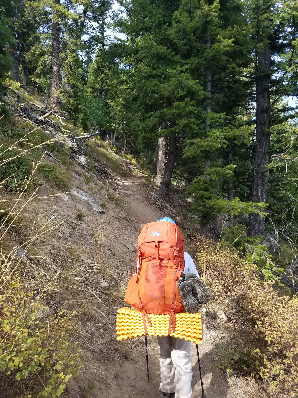
Hiking out.

Sawtooth Peaks barely visible in the haze. 

Hiking out.

East end of Redfish Lake from the trail.

Turning leafs.

There were several hikers and bikers making their way up the trail as we made our way back to the car.  No summits to claim, but still hard to complain.  You could certainly do worse when your unplanned Plan B is an overnight hike near Redfish Lake.

Happy trails!