Partners: Deez, Landen (AKA Lego Master) and Ketchum (AKA Honey Badger).
Stats: Total distance approx 3 miles. Total hiking time 3 hours.
Lists Of John
Gear Notes: N/A.
 |
| Cinder Cone Butte from Simco Road |
When I had set out to complete the list of Ada County peaks with over 300 feet of prominence almost three weeks ago, we were stopped cold by a broken down car. Knowing that
Mercury is in retorograde, we should have foreseen, or at least expected something like that to occur. However, I tend to be optimistic.
Hey, at least the car broke down at the exit for Blacks Creek Road and not in the middle of BFE!
The car is now repaired and with a fine dose of Spring like weather over the weekend, we had little in the way of reconsidering our plans of curing a case of cabin fever, despite the potential for another disaster.
After a smooth departure from town, we were soon heading south on Simco Road, toward the first peak of the day, Cinder Cone Butte. This trip involved driving thought the IANG Maneuver area which is rather interesting in itself. Temperature 55F, winds ESE15 G30, mostly sunny.
Cinder Cone Butte tops out at 3,090 feet with 336 feet of prominence and was just shy of 1 mile round trip from where we parked.
 |
| Trinity Mountains |
The wind was raging but we were just happy to be out in the sunshine. Since this was such a short hike, no packs were required. Hiking with me usually turns into a geology field trip, so I did have to stop a few times for mini-lectures about about cinder cones, lava types and how magma composition changes over time.
 |
| Heading up the east side of Cinder Cone Butte |
A large radio tower sits atop Cinder Cone Butte and the view is quite nice.
 |
| Looking to the north from the top of Cinder Cone Butte |
After the short hike to the top, we snapped the obligatory glory shots. We also found a rather nice chunk of quarts on top.
 |
| Another one of those majestic glory shots |
We then headed down to the car and set course for Big Foot Butte on Range Road. This road is heavily traveled by the IANG and is in decent shape. Although a little rough in places, a passenger car will suffice.
 |
| Whoaaa... |
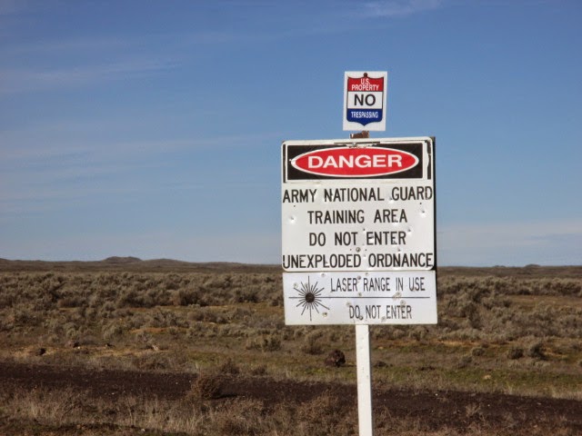
I planned to stop and hit Little Joe Butte which sits just off of Range Road. It only has a little more than 100 feet of prominence, so it was not required to complete the list and would have only been for the LOL's. However, there is a barbwire fence and a sign indicating a heavy sniper shooting range there, hence we did not attempt it.
 |
| Big Foot Butte |
After driving about 22 miles along Range Road, we actually passed Big Foot Butte. We attempted to approach from the north only to be stopped by a barbwire fence and some serious mudding though deep ruts on a side road. The poor Suby had a rough first day back in action.
Big Foot Butte sits at 3,535 feet and has 390 feet of prominence. It was a 2 mile round trip from where we parked.

We parked on the side of Range Road and hiked from the east with our lunch in the pack. Big Foot Butte is probably an old and short lived shield volcano with broken pieces of Pahoehoe lava everywhere.
 |
| Cinder Cone Butte from Big Foot Butte |
We avoided the numerous cow pies and holes in the ground as we walked, while attempting to communicate with the Whistle Pigs.
It didn't take long to hit the top and we were a little bummed that we could't find a USGS marker.
As one could probably imagine, completing an insignificant project such as this is lack luster, but peaks are peaks and it is always a blast to be on them.
Well, now that I have that out of the way!
 |
| Looking south from Big Foot Butte |
We dropped onto the leeward side of the pile of rocks that is the summit and enjoyed our lunch with the sun our shoulders.
Walking back to the car was interesting. Apparently, it was shoot-em-up Sunday and the Whistle Pigs were the targets. We could hear gunshots from a group about a half mile south of our position and really hoped they were shooting in the other direction.
They drove past our car, so they must know that other people are out here...
We got back to the car without incident and continued north on Range Road. I had also planned to hit Christmas Mountain which is also not required for the list, but was on the way. The top looked fortified and there were signs that mentioned something about
off limits and the
Commanding General so we decided against that peak as well.
 |
Christmas Mountain from Range Road
|
We finished up our big horseshoe loop though the desert by driving back into Boise, ending up on the south side of the airport on Gowen Road. There are a few more additional peaks in Ada County that have less than 300 feet of prominence, but I think I'm good with completing the list that involves over 300. I had finished a project that actually began years ago, before I had even known what I had started, and we had gotten the first peaks of 2015 in a fun, short and easy day. Just how easy was it, you ask? It was so easy, that we hadn't even mentioned ice cream to the Lego Master, nor did he even ask about it.
That easy!
Happy Trails!
- Granola, Out.
%2B001.JPG)
%2B002.JPG)
%2B006.JPG)
%2B010.JPG)
%2B011.JPG)
%2B012.JPG)
%2B013.JPG)
%2B018.JPG)
%2B019.JPG)
%2B020.JPG)
%2B025.JPG)
%2B028.JPG)
%2B029.JPG)
%2B032.JPG)
%2B033.JPG)
%2B034.JPG)
%2B035.JPG)
%2B042.JPG)
%2B044.JPG)