Tuesday, August 30, 2016

Tripod Peak and Granite Peak

We ventured into the West Mountains for the first time on a nice out and back hike with the added bonus of Granite Peak.

Date: August 28, 2016.

Partners: Deez, Landen the Lego Master and Ketchum.

Peaks and stats: Tripod Peak 8,082ft. Granite Peak 8,273. 6.5 miles round trip with 800 feet of gain.

Links: Tripod Peak and Granite Peak on Idaho: A Climbing Guide. Tripod Peak on SummitpostTripod Peak Lists of John DataGranite Peak Lists of John Data.

Access and route: Drive north on Hwy 55 towards Smiths Ferry. 9.7 miles past Smiths Ferry and just before Clear Creek Station, turn west (left) on Cabarton Road and cross the river. Turn west (left) on Snowbank Mountain Road and drive 11 miles to the obvious saddle and large parking area on the left side of the road. The trail to Tripod starts at the end of the parking area. Follow the dusty single track trail south from there. Granite Peak is on the opposite side of the road. Snowbank Mountain Road is gravel, washboard and steep but passable by a standard passenger car. Drive time just under 2 hours from Eagle, ID.

Tripod Peak from the trail.
We set out from the trailhead about 10am with a cool breeze blowing across the ridge. Heading south on the trail to Tripod Peak was dusty with a few ups and downs, but not hard. Putting the youngster up front to set the pace with a bit of prodding from the parental units made for slow progress at times, but that's the name of the game with the kiddies.

The trail follows the ridge above Blue Lake that looks quite nice and would make for an even shorter and easier hike with the option to camp.


Looking southeast, across Round Valley.
The temperature rose as expected and the breeze stuck around which kept the bugs at bay.


Pause for smiles on the trail.
 Aside from a few hills the trail is fairly flat, doesn't gain much and is kid friendly.


Trail.
Haze from the fire was pretty thick to the east but the view west to the Wallowas and Seven Devils was clear.


Blue Lake.
 Blue Lake looks like a real nice spot.


Halfway point.
The wild flowers were still hanging on while the yellow sage blossoms were just coming out. A sure sign that fall is just around the corner.


Upper slopes to the lookout.
As we neared the base of the peak, we left the trail and found a route up the southwest slopes up to the lookout.


Looking northwest.
The lookout was staffed and the on duty ranger was very friendly. Deez and Landen got to go inside and check out the digs. The ranger was packing up his stuff and was waiting for the smoke to clear for the helicopter to fly out of Garden Valley to pick him up.


Deez and Landen on the lookout.

Helispot.


Summit view.
Since Tripod Peak is a fire lookout, the view is quite expansive.


Selfie at the lookout.
At 8,082 feet, the youngest member of our merry band of misfits set his PR for his highest summit yet. Pretty good for a kiddo who just spent most of his summer at or below sea level in no man's land, otherwise known as Florida.


Tripod Lookout.

Looking south.
After chatting with the ranger and a fellow hiker, we had a nice lunch at the lookout before setting off.


Helicopter approaching the LZ.
 As we crested the hill about half way back, we saw the helicopter flying in.


Viewpoint near the trailhead.
The are a few rocky outcrops along the ridge that make great viewpoints.


Smoke plume.
 We took note of the substantial smoke plume rising from the Pioneer fire.


Snowbank Mountain.
Back at the car, I automatically took my boots off and then realized I still wanted to get Granite Peak, so I walked the 60 feet up to the summit in flip-flops. There is a good view of Snowbank Mountain, the range highpoint. That summit has an array of FAA radar equipment on top.


View from Granite Peak.
It was a fine day exploring a new area that deserves more of my attention; without a doubt.

Happy trails!

Tuesday, August 16, 2016

Castle Peak with Outdoor Idaho

Dan Robbins extended me a last minute invite to climb Castle Peak for Outdoor Idaho as part of a one hour special titled "Beyond The White Clouds". It was a pleasure to work with this very friendly, talented and dedicated crew.

Date: August 12-13, 2016.

Partners: Cast - Big Dan and Carrie. Crew - Sauni the producer. Tim, CFO, tripod and stills. Jay, camera 1. Zach, camera 2.

Stats: 11 miles and 4,300ft  total gain round trip. Summit elevation 11,815ft, the highest Peak in the White Clouds.

Links: Info on the showPrevious climb of Castle PeakBig Dan's report.

Dan's original partners for this trip had to cancel last minute and I hope all is well with them. He was in need of fresh blood. Last minute trips require last minute packing and planning, as well as last minute permission from your significant other whom you've just told you didn't plan on hiking that weekend (thanks babe!). Dan's instructions to me were simple; pop in and climb Castle while the crew did their thing.

Haze on Hwy 21.

I headed through the haze toward Stanley and was an hour or so behind schedule by the time I got to the trailhead. I knew I'd take the shortcut known as the Splattski cutoff and could make it to the lake in three hours or less. I ran into some acquaintances that was a nice surprise as I dragged my sleep deprived mind and body up the trail.

Washington Lake.

From Washington Lake to the other side of the ridge is a steep and loose effort; short but not easy. If it was easy, it would just be the way.

Looking down the west side of the cutoff.

Its really not a bad way to go if you want to get Chamberlain Basin quick, or if you'd rather not endure the miles of trail that takes all day.

Chamberlain Col.

I was on the east side of the divide in just and hour and forty five minutes later and navigating to the lake was easy enough. Dan and Co. had been at the lake since Thursday and I was late to the party; literally. I told Dan I'd be there about 5-6 and it was closer to 7 by the time I landed at their lake side basecamp. I was greeted by Dan, Carrie and the very friendly crew and soon enough I was enjoying the lavish supplies they had horse packed in the day before. Having wonderful beef and sweet potato tacos and IPA for dinner felt more like car camping than backpacking.

Upper Chamberlain Basin.

Dan and Co. decided on a 9am start which is on the late side for me, but it was their show and I was tired anyway. I was quick to hit the sleeping pad since I was running on three hours of sleep. The next morning dawned clear and calm.

Jay getting some lake side footage,

Castle Peak reflection.


As the crew packed up their gear, Dan filled me in on the filming process. We figured we could do the route in 6-7 hours, then add 2 more for the filming. The typical sequence goes like this - The crew runs ahead and sets up while we hang back. They cue us and we hike until they tell us to stop. Repeat. With Dan mic'd up and the cameras rolling, we were off.

Action!

Carrie and Dan starting up the base of the peak.

Dan's pace was quick so we actually made good time between stops.

Lower Chamberlain Lake.

Castle Peak is steep and has 4,000 feet of prominence. That means the jaw dropping views come quick.

Filming.

It was neat to watch the crew set up and direct shots.

Jay. Videographer extraordinaire.

Jay lugged a 17 pound camera up and down the mountain. Hats off to this hard working and dedicated crew.

Heading into the gully.

You'd think that once in the gully there wouldn't be much to shoot after a while, but there was plenty of work to be done. The filming process was in full effect. Go, stop, go and stop again.

Upper gully.

Its a bit of a slog to get to the good stuff. The last 400 feet or so up to the summit ridge is a grungy but fun class 3 scramble. Both Dan and I had done this peak before so the route finding was on us. It wasn't difficult climbing, but we weren't hauling cameras and tripods.

Dan pushing through one of the difficult moves.

Dan leading the way.

Jay climbing up a difficult move with the camera.

Tim getting up to a ledge after a difficult move.

The upper section of the climb had a couple of tricky spots that had us scratching our heads, but we were able to get the camera gear up and everyone got to the summit.

Sauni, Tim and Zack nearing the summit ridge.

Topping out was delayed while the crew set up for the two part shot of us reaching reaching the summit block.

Selfie while we wait for the crew to set up the shot.

The haze was closing in on us, but it was considerably more clear than the last time I was up here.

Northern White Cloud Peaks.

We hit the highpoint, high fived and signed in with cameras rolling all the while.

Making TV on the top of Castle Peak.

I was enjoying the view and a snack while Dan and Carrie did interviews with Sauni.

Dan setting up for his interview.

Then my time came to face the camera and answer a few questions related to the newly designated wilderness area and mountain climbing. It was an unexpected and unique twist to the trip. I just hope I didn't ramble too much in my high altitude philosophic state.

Hemingway-Boulder's.
                                      

We had been on the summit for an hour doing interviews and taking a gazillion pictures before we started down at 4pm. 

Down climbing the class 3 section.

Down climbing the class 3 section.

Once past the 3rd class section and back in the gully, the crew wanted to film a rockfall scene. If they would have had their cameras rolling ten minutes earlier, they would have gotten a real life shot of a close call involving a large rock and me trying to duck behind a ledge, instead of the fake stuff we tried. Instead of bloodletting, I only let out an "oh F-bomb." I took a few small frags, but was otherwise unscathed. Close call; shaken, not stirred.

Thanks for the offer of clean underwear, Dan!


Boot skiing the scree at the base of the peak.

Jay wanted some Emmy materiel, but we were all back at basecamp in about two hours with no visible signs of trauma noted. They got to cracking beers and I got to loading my pack. It was after 6 and I needed to get moving if I was going to be back at my car before dark.

Haze on my hike out.

Dan, Carrie and the crew wished me well as we exchanged parting remarks and handshakes. I tore off for the trailhead at a maniacal pace.

Sorry guys, gotta go!

The haze was noticeable now as I made my way up the valley, up and over the ridge. I was back at my car with my headlamp blazing at 9:30. I was having trouble with cell service on the peak, so Denise wasn't exactly aware of my progress and late finish. I was worried about her worrying about me and it was good to hear her voice when my call finally went though at 10pm.

It was a pleasure to work with this crew on such a unique opportunity and I can't wait to see the show.

Happy trails!

Wednesday, August 3, 2016

Seven Devils Loop


It had been a while since we went out and walked around in a big circle for an extended period of time, so we chose the Seven Devils Loop for our multi-day backpacking fix.

Trip date: July 31-August 3.

Partners: Deez.

Stats: 32 miles and 5,000ft gain without side trips. Added Horse Heaven Peak and Dry Diggins Lookout for approx 8 miles.

Guide book overview.


Gear notes: Standard backpacking kit for 4 nights.

I've had my eye on the Seven Devils loop since I started doing doing longer backpacking trips more than ten years ago. Deez and I began planning for it in January which made it highly anticipated. We drove over to the Seven Devils campground for a risky Saturday night roll of the dice for a spot. As luck would have it, we happened to pull right up as an unlucky bird watcher was packing up his camp and headed out. We snagged a rather primo spot in an otherwise full camp ground. We filled the evening with a short walk to Seven Devils Lake, cooked dinner and relaxed around the fire.
Heading to the camp ground.
Seven Devils Lake.
Seven Devils Rye Whiskey.


Day 1. Hike to Dog Creek.

Today is basically a rest day.

We made the short drive to the trail head and examined the information board. There was a sign stating "trails not maintained" blah blah blah. We got on the trail proper about 10am with hardly a care in the world. The trail had scattered patches of Huckleberries; always a delightful trailside treat. As long as they're ripe, that is. There wasn't much in the way of obstacles, other than the 8.5 miles, on the way to our planned camp site, but when we arrived there we were a little bummed. We had hoped for a grassy, shaded creekside camp site. What we got was a dusty, sparsely shaded, mediocre at best... well, you get the idea. The discussion of trying to go up to Dog Lake ended and we made due with what we had. After all, it was only for one night. About a mile due north from Dog Creek, there is an excellent camp site and in my 20/20 hindsight, we should have camped there.
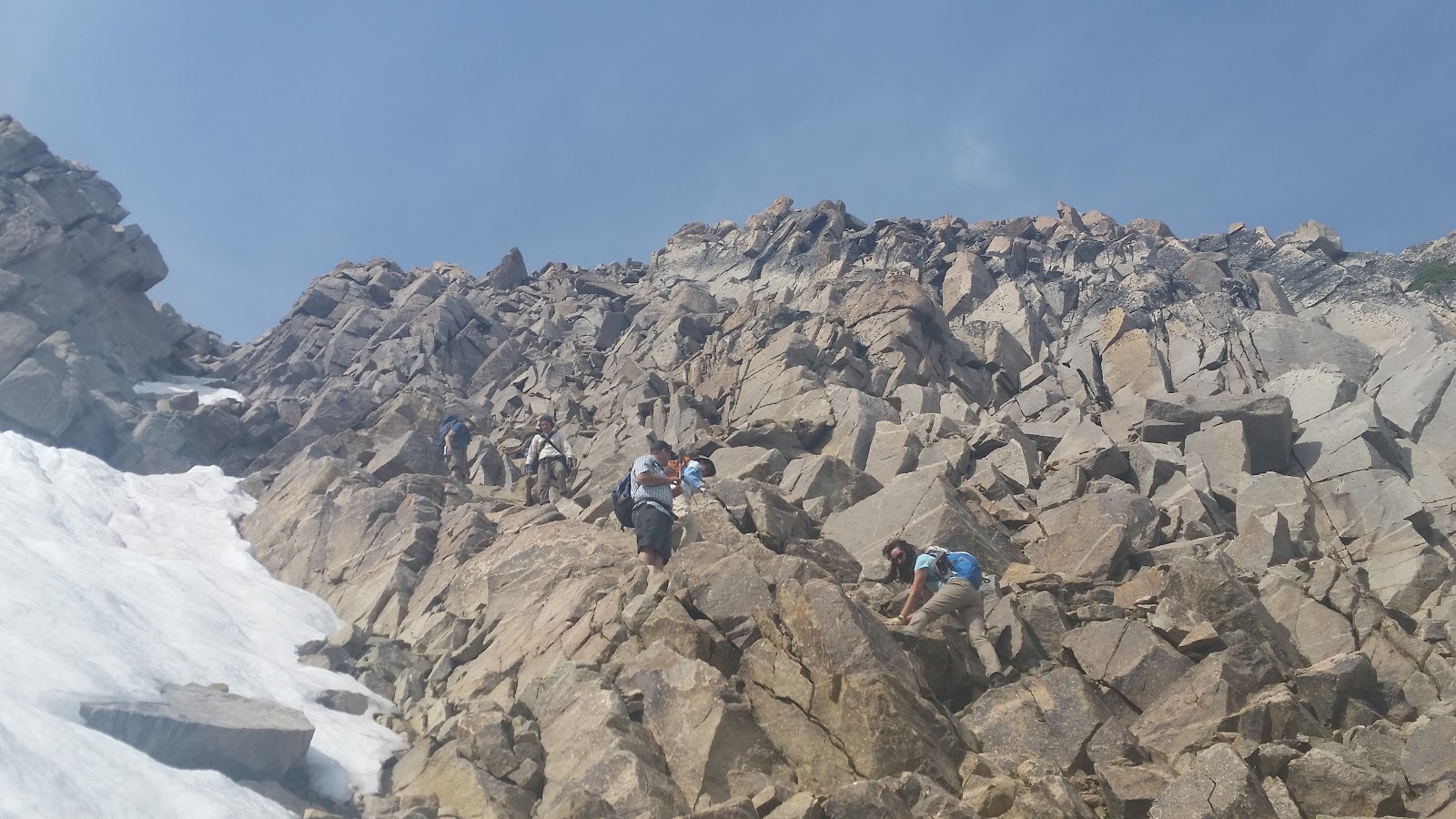
Heading south on the Boise Trail.
Trailhead.
Start of the Trail
The Ogre.
Huckleberries along the trail
Chilling the whiskey and vodka.
Dog Creek camp site.
 

Day 2. Horse Heaven Hill to Baldy Lake.


We expected it to be tough, but dang...

I figured day 2 might be the most challenging. I had estimated 11 miles and 1,300 feet of gain. This is where the nature of the trail reared its ugly head. We woke up early to frost on our backpacks and a cold nip in the air. The trail meanders in and out of nearly every canyon which added mileage; at the same time, it goes down one side and up the other adding more gain. The Forest Service Topo doesn't detail this and the guide book we used underestimated the distance and gain, even without the recommended side trips. It was a hard push just to get to Horse Heaven Pass but the hike to Horse Heaven Hill was worth the extra effort. From here, the map showed a well graded but long and descending traverse down to about 6900, then up to Baldy Lake at 7200.

The trail went downhill, into every canyon, then back up the other side. Once past Potato hill, I hoped our troubles would be over and we would have an easy one mile hike into Baldy, but this turned out to be the hardest part of the day. Per the norm, all of the gain is right before the lake. Unfortunately, this is where all of the downfall was too. After a ten hour effort, we finally got to the lake and snagged up a fine spot. We were a bit behind schedule, but we were all set up before dark. There wasn't much energy left in the tanks after dinner to enjoy the rather warm night as the stars came out.

Looking south.
Trail past Dog Creek.
Heading up to the pass.

Seven Devils.

Cabin on Horse Heaven Hill.

Hells Canyon.


Baldy Lake.


Day 3. Hike to Dry Diggins lookout and Bernard Lake (proposed).

How much worse can it get?

Given the events of day two, I was weary of sleeping too late no matter how bad I wanted to. Despite the early wake up call, we were late getting out of camp. We were delaying having to deal with the horrific downfall leaving the lake. Dealing with the hard part first was both a blessing and a curse. Deez found the unsigned junction and we were heading toward our next destination. The plan was to hike to the junction to Dry Diggins Lookout, drop the packs, dig the views at the lookout and book it down to Bernard Lake to camp. We planned this leg of the trip based on the information in the guide book. We knew it would be high mileage but that would be offset by relatively little gain.

As we hiked toward Hibbs Cow Camp and approached the next junction in the trail that leads to He Devil Lake, we found the worst of the worst of the downfall. Walking the ups and downs with a few areas of overgrown trail, we entered a large meadow with tall burned snags. We tried to move quickly here, but the downfall was, well, to put it mildly, soul crushing. Basically, it straight up sucked. As we gained elevation up the hillside past the burn area, we heard a rather loud crack as the snags swayed in the wind. We were glad to be out of the danger zone.

We had done hardly 5 miles in almost as many hours and changed the plan to stop at Hibbs Cow Camp. Just as we decided this, we came across a large shaded camp site next to a creek. Not wanting to risk getting to Hibbs and not getting a site, and not really knowing what it was supposed to be like, we plopped down in our lavish score of a site. After getting the camp set up, we were both pretty beat. I really wanted to see Dry Diggins, so I peeled off and went for it on an out-and-back hike from camp. I estimated 5 miles round trip; it ended up more like 7.5 with a lot more gain/loss than I expected. The views are very impressive into Hells Canyon, so if you venture into this neck of woods don't miss it, just plan accordingly.

I was back in camp a bit later than I expected and got right to the Pringles and Seven Devils Rye Whiskey. After dinner, we had a symposium. The days had been longer and tougher than we expected. Either way we sliced it, it was still a long way back to the car. Option one: Continue to Sheep Lake and pray that there would be less downfall and that the trail would do what the guidebook and map indicated. Option 2: Cut off the last scheduled night and push to the car.

We felt pretty beat up at this point. After a good nights rest, we could start early and get the heck out of there. After all, we were on vacation!

Sunrise at Baldy Lake.

More downfall.

Hells Canyon from the trail.
Downfall.
More Downfall.

Dry Diggins Lookout.


Hells Canyon from Dry Diggins.
    

Seven Devils.
Duck, bird, thingy.


Seven Devils.
Deez next to a big tree.


Day 4. Hike to the trailhead.

Its just right there.

A cold start to the day warmed quickly as we started out on the shaded trail. When we got to the junction for Windy Saddle, the shade was gone and the sun was high. Walking to the next junction, we cursed every log, every up and down on trail. We did enjoy the Prairie Dogs that scurried about. We chatted with another couple that had cut their trip short and were having the same experiences. The next long descent into a wide canyon meant another long uphill on the other side. The only plus side to this section was a large Huckleberry bush at our break site. The views of Devils Tooth and across the canyon were nice, but not enough to distract us from the long uphill slog, only to drop down the other side, then back up to the car.

The consensus was that for the amount of energy required to do this loop, even with skipping the good stuff at Sheep Lake, was more than enough to second guess our plans. With all the miles and gain, we could have done something really cool like Glacier Peak, Sisters or something (anything). Basically anything else sounded better at that time. We hit borderline Type III fun.  Back at the car, a hand full of Pringles and a shot of whiskey helped us laugh it off and ease the fun factor back to Type II.

Dinner at McCall Brewing Co. was a fine end to an otherwise not real fine day. Our advise on the loop is to skip straight to the good stuff. Take the climbers trail into Sheep Lake, stay a night or two, fish and climb the peaks.  I'm looking forward to that trip.

Peaks from the trail.

Gazing into the canyon.

Downhill but no downfall.
Heading out.


Starting a big descent.
Top of the canyon.


Waterfall.
Devils Tooth.
Main Group.


View from Windy Saddle.


There is always next time!

Happy trails!