Tuesday, August 24, 2021

Kings Peak

Date: August 24, 2021.

Objective: Kings Peak 13,528ft.

Stats: 26 miles and 4,800ft gain round trip in 11:47.  Strava.


I had a trip to the Teton's scheduled for this week that ended up getting canceled.  So now I was without a partner and without an objective.  King's Peak had been on my list for a bit so I figured now was the time.  Even though I'd read that it is ridiculously crowded, I chose to take the north side approach since I would be there early in the week.  I actually had zero trouble finding a camp site.  One really nice thing was that the official camp ground is right at the trailhead, so I was able to walk right out of camp and jump on the trail.  While the elevation gain is fairly gradual, the trail was fairly rough and not super runnable for me.  I'd also read that there are sections that could be quite muddy, but I think I dodged that bullet due to the low snow year.  There were some marshy/ muddy sections, but nothing as near as bad as I'd read in other reports.  Also, no mosquitoes.  Three thumbs up there!

There was a full moon and a sky full of stars as I set out at 0600.  The trail to Gunsight Pass was pretty easy to follow and I ran what I could.  At Gunsight Pass, I decided to try and take the "shortcut" to Anderson Pass, instead of dropping down into Painter Basin.  There was a decent climbers trail and cairns to follow up a cliff band and across the talus to regain the trail to Anderson Pass.  

There was a bit of snow up high that had lingered from a recent storm, but not so much that it required anything special other than a little grit.  From Anderson Pass to the summit the rock was pretty solid.  I could see a few placed where someone had stepped in the snow and punched though in between rocks, so pretty much tried to avoid the snow as best as I could.  This required a bit more scrambling than is probably normal, but it was fun and not too exposed. There was one steep section below the summit block that had become icy from all the recent traffic.  I was pretty much able to climb over/ past it on exposed rock.  It looked worse than it was.  

The summit was pretty broad with an amazing view.  I topped out at 1215 and only hung out for about 15 minutes due to the chilly wind.  There were more people headed up now than I had seen up to this point.  I took a couple breaks in the relative warmth down lower on the way back to Gunsight Pass.  With a straight forward route down, there was nothing to do but grin and bear it and daydream of coming back.

Pictures

Early morning on the trail.

Signage.

Near Elkhorn Crossing.

Elkhorn Crossing.

Gunsight Pass.

Looking west from Gunsight pass.

Painter Basin.

Looking across the plateau and the shortcut. 

Kings Peak from the east.

King's Peak north ridge from Anderson Pass.

Henry's Fork Peak.

Garfield Basin to the west.

False summit.

Gunsight Peak to the east.

Nearing the summit.

Summit block.

Summit pic.

Painter Basin.

North-south trending ridgeline containing several 13ers.

Looking north from Gunsight Pass.

Looking back up/ south to Gunsight Pass.

Henry's Fork Peak from the north.

Kings Peak in the middle.


Saturday, August 14, 2021

Resort to Rock 50k

Date: August 14, 2021.

Objective: Resort to Rock 50k

Stats: 32 miles with 4,500ft gain in 7:27.  Strava.

Quick breakdown

I had been training and getting ready for a trip to the Teton's, but that ended up getting canceled.  I signed up for this at the last minute as I switch gears and objectives.  I figured that my base training was pretty solid, but my ultramarathon specific training had been lacking.  I wanted to see how I'd handle this going into it a little under trained as I prepared for a big objective that wasn't technical climbing.  It ended up being a pretty solid race for me, especially since the deck was not stacked in my favor.  It was pretty dang hot and with some of the smokiest and worse air quality in the area so far.  If anything, I paid for water and extra calories on a long training run.  Mad props to all of the volunteers!  The cutoff was 10hrs and figured I'd be out for around 8.  I'm no fastie, but I was pleased with my finish time.


Wednesday, July 28, 2021

Saddle Mountain

Date: July 28, 2021.

Objective: Saddle Mountain 3,283ft.

Stats: 6 miles with 1,900ft gain in 4hrs round trip.  Strava.


On vacation at the Oregon Coast and found this cool peak to hike.  The trailhead is accessed by taking a paved but steep road.  No fee's (or ferry's) required.  It's a nice hike but kind of steep in places and the footing can be tricky in spots where the trail has been anchored with a chain-link-fence type material that has come loose.  Unfortunately it was too smoky to see any big volcanoes, but we could see the Astoria area and the Pacific no problem.  


Pictures

At the trailhead.

Trail in the forest.

View from the trail.

Stream crossing.

View from higher up.

Looking back down the trail from near the base of the summit.

Higher up, near the summit.

Summit.

Summit views.

Summit views.

Summit views.


Saturday, July 10, 2021

Mount Frank

Date: July 10. 2021.

Objective: Mount Frank 10,957ft.

Stats: From Fourth of July Lake; 8 miles and 3,000ft gain in 5hrs round trip. Class 3.  Strava.

We walked up to Fourth of July Lake to camp for a night or two and do some fishing and this was the closest peak that I hadn't tagged.  From the lake, or trailhead for that matter, follow the trail to Born Lakes.  From the upper lake, I made my way up the talus field to the base of the gully; a very loose and grungy gully indeed.  It was straight forward but no place to throw caution to the wind as rockfall was a problem.  I stuck to climbers left.  From the top of the gully, it was a short and fun section of stable rock to the summit.  It was quite hazy but the view of Castle Peak to the south was still obviously impressive.  I descended the same route, which was as tedious as going up due to the loose rock.

Pictures

Heading towards Born Lakes.

Mount Frank is the point to the left of the prominent diagonal gully.

Grungy gully.

Upper part of the gully.

North side of Castle Peak from the top of the gully.

Class 2+ near the summit.

Ridge to Lonesome Peak.

Summit.  Mouth closed to avoid inhaling flies.


Friday, June 25, 2021

McGown Peak

Date: June 25, 2021.

Objective: McGown Peak 9,860'.

Stats: 14 miles with 3,400 feet of ascent in 6:48 round trip.  Strava.

Links:  Previous attempt via the North Face Snow Climb.

Gear notes: Very light pack and trail running shoes.  Didn't even consider bringing an ice ax or crampons.

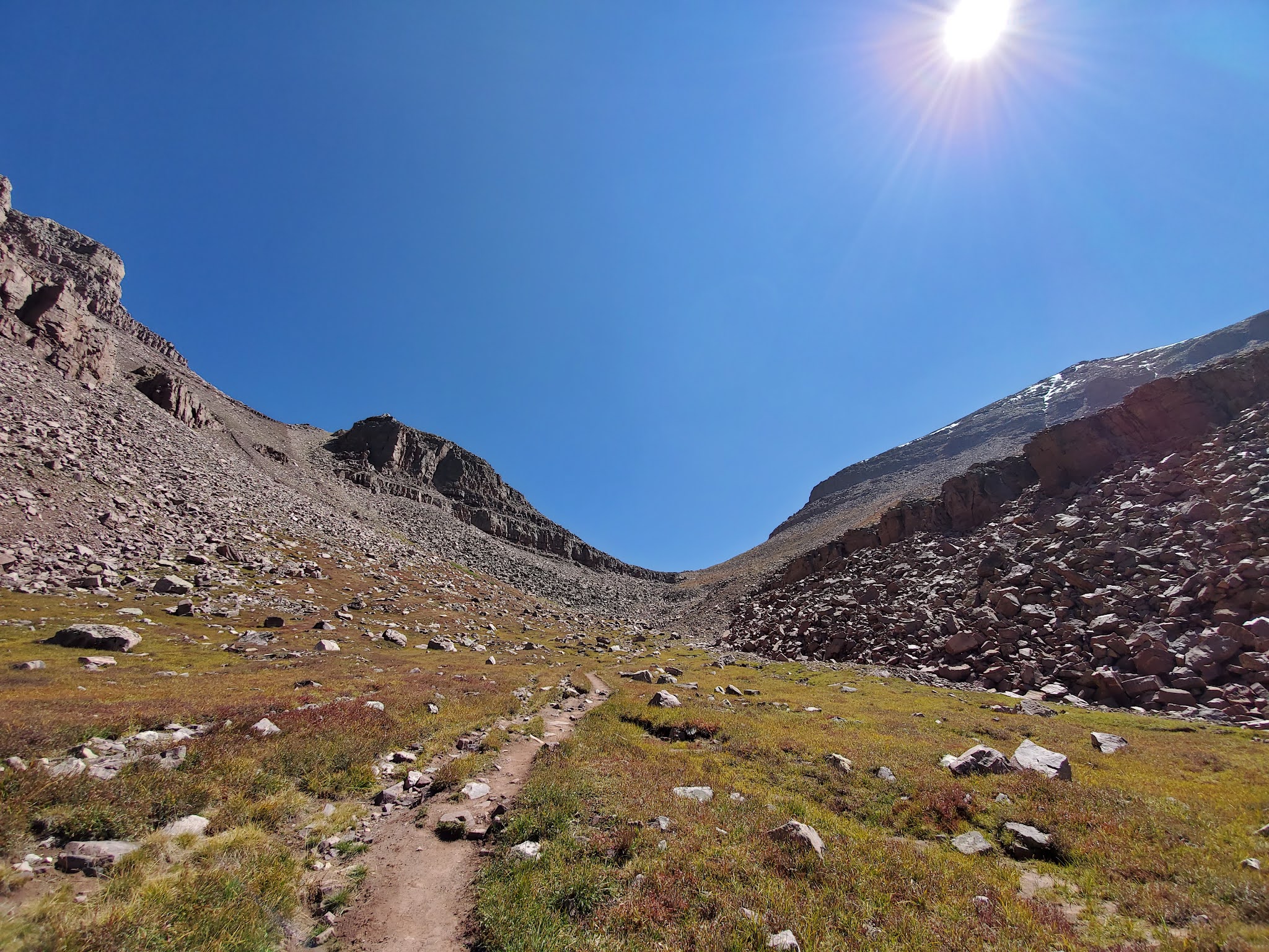
McGown Peak from the trailhead.


It's been a pretty dry spring and thus, a low snow level in the spring.  Time to hit the Sawtooths!  There are many other options and ideas that I have, but I needed to take care of some unfinished business.  I left Boise at 0700 and was moving 2.5 hours later.  The first couple of miles (and last) are flat so the going was easy.  Stanley Creek was the lowest I think I have ever seen.  

Stanley Creek was crossed with little difficulty.


I followed the trail to Point 7899.  I took the south side of the ridge to the west and quickly found a path that led me to the end of that ridge and to the lower cirque and the first real obstacle which is the headwall.  I bypassed it on hikers right, working up the ledges and aiming for the creek at the top.

Headwall of the lower cirque.


From there, I made my way to lake 8609 with little difficulty.  This area is truly magnificent with no discernible trace of man.  I went around the lake on the south side and continued up and to the north, planning to stick to the ridge as much as possible.  

Soaking in those Sawtooth views in the upper cirque.

North face of 9820.

East face and south ridge of McGown from lake 8609.


The rock itself is solid, but the ground is steep, loose and very sandy.  For the most part, I stuck to the east side of the ridge and didn't find any significant route finding problems.  I took an occasional detour over to the west side, but the terrain is pretty vertical and best avoided.  

Classic Sawtooth ridgeline.

Looking back on some of the route.

Looking north from the summit.

Looking south from the summit.

Observation Peak.

Castle Peak.

Mouth closed for bug swallowing avoidance.


At the base of the summit block on the south, I traversed northeast (right) on easy class 3 terrain until I came to an obvious route to the top.  Fun, easy scrambling and nothing too exposed.  On the summit I found a small cairn and a tin box with a register inside.  

McGown Peak is at the extreme northern edge of the Sawtooths, so the view to the south is magnificent.  I could see North Raker with no problem.  Just as I sat down on the summit, a single A-10 flew directly overhead.  A proverbial cherry on top.

To descend I simply retraced my route along the east side of the ridge and as I got lower, I veered more to my left to shoe-ski/ slide with the occasional slip in the sandy areas.  Since it was such a low water and snow year, there wasn't much in the way of route finding problems heading up or down.  Once back on the trail, it was pretty cruiser just jogging back to the trailhead.  

Just do it.

This is the ledge that connects the North Couloir to the summit.

Lake 8609.

Peak 9820 from the cirque.