There had been a lot of recent discussion about climbing over the weekend I had already planed to be out, however, people, dates and objectives were unclear. It seemed that I would be doing a "choose your own adventure" trip since there were no solid plans that had been formed yet. One peak that kept being mentioned was 11,508 foot Smiley Mountain in the southeastern Pioneers. During my own reconnaissance of the area on Google Earth, I found two peaks in a nearby basin that were connected to Smiley by a long ridge. In Tom Lopez's book Idaho: A Climbing Guide I found them listed as Peak 10,995 and Peak 11,151. Dan had indicated that he had already done Smiley and rarely repeats his peaks. When Deb asked "what peaks would you like to do, Dan?" he came up with these same two peaks but by a different route with a very cool ridge walk. Done and done! I had also found what appeared to be a shortcut through the mountains via Fish Creek Reservoir Road to Iron Bog camp ground, the proposed camp and meeting site. No one really knew the condition of the road, not even the BLM and Forest Service. Go figure.
It was planed that Dan would leave later with John and Dylan, and Deb would ride with me leaving at noon. Since I was leaving sooner, I would scout the road and was to text Dan if we couldn't make it over. No problem. Now, I tend to think there is no such thing as coincidence and things happen for a reason, despite the chances taken. We turned off highway 26 on to Fish Creek and drove on good dirt past some nice ranches. As the road meandered into the hills it became rough with deep muddy ruts, standing and running water. It went from "Its a Small World" to "Mr. Toads Wild Ride" in no time! As it climbed toward a high pass, it also got very steep. Like, my Subaru Outback barely made it up the hill steep! After the white knuckle climb, we crested the pass and parked, attempting to pinpoint our position. We had noticed that the road numbers did not jive with the directions I had. Where else could we be? This has to be it...
While we tried to figure out our position, I walked down the road just a tad to find what waited for us on the other side; a deep snow drift that the Suby was not going to make it through. Dang it! We got back in the car and prepared to about-face when a big red truck came over the pass from the direction of the snow drift. We had confirmed with the guys inside that we were in fact on route to Iron Bog. When I mentioned the drift and that we were turning around, the driver says "We just busted it down, I'd bet you make it. If you don't, I got a chain, we'll hang out in case you need pulled out." Awesome, thanks!
 |
| Deb Rose Photo
I rolled down the "road" to face the drift that still looked like the Suby was not going to clear it So I tell Deb to hang on and gun it. Hey, we made it! I gave the red truck dudes a thumbs up and a few honks of the horn, they honked back and we continued on the bumpy drive to camp. Whew...
|

After that madness, we were glad to hit camp. Tents went up, we admired the caves in the limestone cliffs and ate dinner. I was getting pretty tired and having trouble holding my eyes open since I had been up most of the night at work without a nap prior to the long drive. We figured the rest of the group would roll in about 9 and I believe it was 8:58 when their truck pulled up. John had mentioned a slight amendment to tomorrows route to include Smiley Mountain. That got my attention! Since Dan had already done Smiley, he had no intention of doing it again and since he would be heading down to the truck after the first two peaks, he agreed to drive to the south base of Smiley where he would pick us up. Game on!
I called it a night and was lucky to be so tired because I actually fell asleep rather quickly, instead of lying in my tent anticipating the next days climb. Since a big day just got bigger, I would need my rest...

We were up at 5am the next morning and caught the sunrise while we made coffee and sorted gear. Then we jumped in Johns truck and were off to Antelope pass, the proposed start of the climb.

Alpenglow on Smiley Mountain (left) and Peak 11,151 (right).

Close up of Smiley Mountain 11,508 feet.

We got to about 8,800 feet on the road and parked. We had boots on the ground at 7am sharp with the temperature being just cool enough for a quick start up the steep hill without breaking much of a sweat.

Looking up the first hill.

Looking down to the road and Antelope pass.

John and Dylan started just a bit after Deb and I, but they quickly overtook us. I've heard these two were fast, but dang!

We catch our breath at a micro-break and enjoy the views beginning to open up. Dan and John name practically every peak in view.

We work our way up the ridge and watch the valley floor fall away.

Peak 11,151 on the left and 10,995 on the right.

Peak 11,151

Peak 10,995

We got a couple of super fun scrambles along the ridge.

Deb, Dylan and Dan take the final steps up to peak 11,151.

Hey, that looks really close, lets hit it! Peak 10,995 from the summit of 11,151.

We get a short break after hitting the first summit in about 3 hours. From here, Dan headed down to the truck, Deb and John hung out on top a while longer while Dylan and I broke off to tag 10,995.

We began to discuss all things geology and speculate on the inhabitants of Big Foot in this beautiful basin. Dylan also mentioned moving in here.

After dropping our packs we ran up Peak 10,995. By ran, I mean trail running at over 10,000 feet, in boots, though talus and scree.

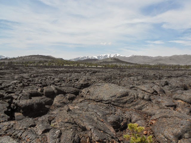
A peek into the Lost River Mountains looking at Leatherman pass with White Cap on the left and Leatherman peak, the second highest in Idaho on the right.

Dylan is an 18 year old machine and it took all I had just to barely keep up with him.

Hey, there's the top!

30 minutes after leaving the summit of 11,151 and dropping our packs, we hit Peak 10,995. Dylan counted our "break" at six minutes before shoving off.

The always impressive Lost River Mountains. Mount Borah is on the left.

After we got back to our packs we took a short break. We also noticed that John and Deb were nowhere in sight. We had expected to see them on the ridge headed for Smiley, but we didn't. After a few whistle blows, we figured they couldn't still be on top of 11,151 and probably wouldn't have headed down with Dan. We decided we had best stick to our plan of going up and over Smiley. As it turns out they were waiting just on the other side of the hill above Dylan's head. They could see us; we couldn't see them. We set off on the ridge at full speed, again...

Here Dylan continues to lead in the days post-hole count as we cross this snow field. We had all carried ice axes and crampons but never used them. This is as much snow as we had to cross all day.

Man, what a view!

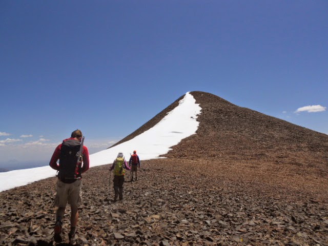
At Dylan's pace, it didn't take long to find and catch up with John and Deb. We regroup and push on up the north ridge of Smiley Mountain.

It was here at about 1pm that the wind really picked up.

Smiley's summit is in the middle and certainly felt further than it looked.

I was hungry so I tried to eat and walk at the same time, but it was hard to breathe at over 11,000 feet with a Cliff Bar in my mouth.
We slid into jackets and pushed up the ridge. One foot in front of the other... My brain was sending instructions to my legs but my legs were having trouble processing that information. I just focused on moving my knees and letting my feet follow.

My lead filled legs and I were happy to top out just behind John and catch this shot of Dylan and Deb taking their last few steps up to the summit.

Summit view.

Looking at the main Pioneer Crest.

Lost River Mountains.

So that made 2 peaks for Deb and John and 3 for Dylan and I. We hit the summit of Smiley Mountain just before 2pm. What a day! Woohooooo!!!

These antlers were next to the summit register. As we signed in, Deb noticed we were the first since August 2013. Cool!

It was still windy and we were in need of a real break so we headed to the south end of the ridge seeking shelter. We sat down, took our boots off and ate. We also had the last part of our route staring us in the face; still over 4 miles down the southeast ridge to go.

I won't speak for the rest of the group, but I was tired and the talus on the south ridge was loose and miserable in comparison to the pleasant north ridge.

After dealing with the talus, we made it to the beautiful and gentle grassy slopes of the mid to lower ridge. If you notice there are only two people in this photo, that's because Dylan was long gone. Now, I'm a fan of B.O.D's (breaks off descent) but he hit the afterburners and we didn't see him until we all rejoined at the truck! Then we came to the final challenge of the day; a steep 300 foot hill filled with 3 foot high sage and ankle rolling boulders. Fun times! Earlier in the day, I had zipped the legs off my pants and I very well could have put them back on, or my gaiters, but that would have involved stopping, taking my pack off, putting them on, putting my pack baa... blah blah blah... I was ready to be done. I went into full on suffer mode and took the leg scraping, masochistic, its going to suck no matter what I do and probably going to take a couple ticks home with me too part of the day in stride with my only motivation being the flat, green grassy field where the truck was parked. We were all back down by just a few minutes after 4.
Why would anyone want to climb up and down that step sage brush, loose talus suffer fest!? Oh yeah, this is Idaho, that's what we climb. I must be losing my mind...

Thanks to Dan for picking a great area and two really cool peaks! Thanks to John for upping the game with the addition of Smiley Mountain and thanks to Deb for agreeing to this madness. Some things probably do happen as chance, but I tend to think that there is no such thing as coincidence and this trip was certainly not that. Had I not been consistently trail running 20 miles a week , there would have been no way I could have kept up with Dylan as poorly as I did. Had Dan not suggested the same two peaks that I had spied in the same area as Smiley and had he not already done Smiley and elected to run the shuttle, this route would probably not have been possible. Had the big red truck dudes not have come over the hill at the same time we were there, we probably wouldn't have made it down the road. A long string of coincidences? I think not.
- Granola out.
Google Earth Overview of the Route