Friday, January 12, 2018

Invisible Mountain Attempt

Low snow and a touch of cabin fever motivated me to try something big in the Lost Rivers.

Date: January 5, 2018.

Objective: Invisible Moutain 11,330ft.

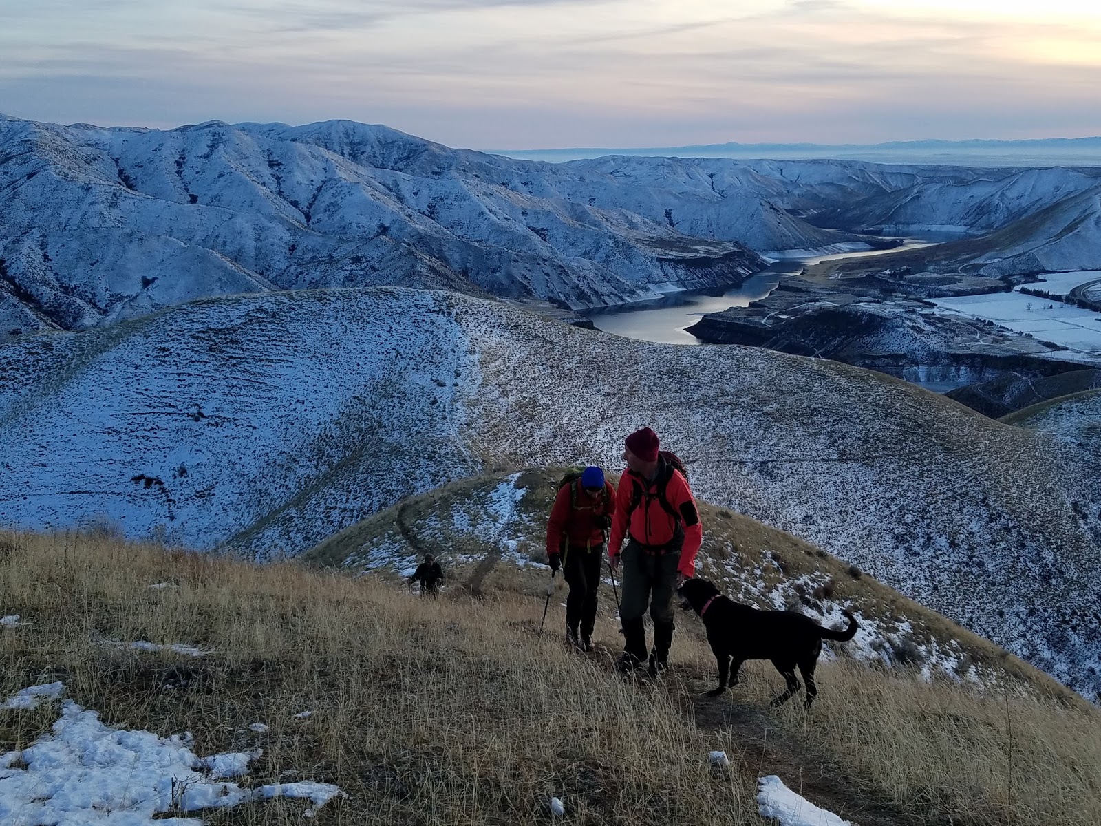
Partners: Took the dog, it was a bit much for him (sad face).

Stats: 6.5 miles and 4,500ft gain in 6:15 round trip. Strava track (note: the track accidentally ended before the hike was done).

Gear notes: Carried ice ax and crampons - probably wouldn't have needed them.

Links: Summit stoke via SplattskiSummitpost info.

With a solid weather window, low snow conditions and a long list of ideas, I wasn't sure what to try. Something chill and close to home? Maybe something a little more adventurous? The bottom line is that I could have chosen several other options that were more viable, but I settled on the bigger questions mark. Why? Just because I could.

Leaving Boise at 4:30am is never fun, especially when faced with a 4 hour drive. After that, my body and mind were 'less than ready to hike'. But its not like you're going to back out at that point. The show must go on. My point? This was my first Lost River one day round trip and likely my last.

The road approach was not difficult. It would have been much better if I could have driven to the end, but that's reserved for HCV 4WD. That will get you about a mile further and save you about 500 feet of gain.

Arial view of Invisible Mountain. Photo: Mike H - Facebook.  


Invisible Mountain from Hwy 93.

White Knob Mountains.

Mount McCaleb in the distance.
Invisible Mountain is relentlessly steep. The nature of the terrain is also no joke. The lower slopes were a mix of soft dirt, which was loose; loose rocks, which were also loose; and some solid ground here and there. There is sage brush to pick your way though, then there are the trees which are also a bit of a challenge to get though. Oh, and there is no trail.

Up higher the trees thin out a bit but the angle remains steep and the rocks are a bit more solid. I hit shallow snow patches around 8,800 feet, which turned to almost knee deep drifts at about 9,500. There was enough dry ground that I was able to weave my way around the drifts for the most part. What significant snow that was present was sugary and loose. Maybe not a good sign if traveling across any covered slopes up high.

Low on the mountain. This might give some idea of the steepness.

King Mountain.

At the snow line.
I wasn't trying to get up this thing in any acute hurry since that would have likely resulted in burnout low on the peak. The clock stuck 1. My go, no-go point. If I was within striking distance, I would go for the top. NO MATTER WHAT, I was going to be on my way down by 2.

By this time, the summit was still about a 2 mile round trip with about 800 feet of vertical, plus the short class 3 section was just ahead and I had no idea what that would be like with the snow drifts on it. Not to mention that the dog was obviously pretty worked at this point. If he was in better shape and I had two more hours of daylight, I would have went for it.

Upper ridge.

High point of the day at 10,500ft.

The true summit waits for another day.
This was not a mountain I wanted to try to descend in the dark. That was just asking for trouble. At least I could turn back now, take it easy on the way down and give the dog plenty of rest. His feet got pretty scraped up to the point that I considered bandaging them. As steep as the terrain was though, I figured it was better for him to have as much traction as he could.

Dog icing his paws.

Lemhi Range.

Looking north toward the Mackay reservoir. 

We got down and out of the wind for a nice long break. I poked around a bit, seeing what else the mountain had to offer. The area close to the ridge line proper was quite rocky with a few tall cliffs. That area is best avoided. I stuck to the trees below the ridge and tried to stay off the rocks as best as I could, which didn't make a difference.

Dog getting his nap on.

Smiley Mountain is visible.
The terrain was so steep that going down was just as though as going up. Gravity is not your friend when the slopes are so steep, loose and rocky. Care must be taken. Back at the car, I took in the irony of the day. Those 2 miles and 800 feet that I missed the summit by? Those were about the exact same stats from where I parked to the 'end of the road' and back! It was too funny to not laugh out loud.

Philosophical takeaway:

I was slightly bummed that I didn't get to the summit, but that is not a measure of success in my book. You have to climb the mountain on its terms. They are much more bigger and much more powerful than you are, and they do not care if you live or die. I feel that a non-summit with good style is better than any summit with poor style.

Don't get me wrong though, I had a fantastic day and still had plenty to smile about.

I believe it was Bob Marley who said "It's all good 'mon."

Happy trails!

Tuesday, January 2, 2018

NYE on Cervidae

This years edition of Moonlight to Cervidae was on point.

Date: December 31, 2017.

Objective: Cervidae Peak 4,987ft.

Partners: Steve W, aka Delta Operator, aka In The Wild Chef, aka Wild Child (the curator of this non-organized event). Brett, John F, Dr. Michael and Lisa.

Stats: 5 miles and 1,900ft round trip. Class 2.

Gear notes: Snowshoes not required; not even carried!.

Links: Last years trip in super cold conditions.

Low sun, high spirits.

I decided to start out at 4pm, instead of the "normal" 6pm and was happy to see others show up for the "early" start. The conditions this year were warm and tame compared to the single digit-maybe colder temps and stiff wind of last year.

Gearing up.

After a few minutes we figured we had all the early peeps we were going to get, so we saddled up and hit the trail.

And they're off!

Start of the trail.

It was nice to have the conditions mild enough that we could stop and take in the amazing views without the risk of getting too cold too quick.

Last light on Lucky Peak.

We were treated to a beautiful sunset as well as a 97% full moon rise at the same time.

Steve crushing trail.

It didn't take long for Brett to overtake us all as he charged up to the summit. I hoped he was running ahead to get the fire going and heat up the chili.

Moon rise and shadow rise. Beautiful. 

Only a few more false summits to go!

It was calm, clear, getting chilly and mostly fun. Its always nice when you can carry on a conversation without the hindrance of puffy jacket hoods pulled up and zipped up collars covering faces, turning words into muffled tones that resemble the Peanut's parents.

Last sunset of 2017.

Steve nearing the top.

Brett was patiently waiting at the top, but there was no warming fire or pot of chili to be had...
We could see some occasional fireworks over the Wilderness Ranch area from the top.

Hey, how about a nip of Fireball!


Summit group selfie. Photo: Steve W.


Starting down.

After enjoying some air time and taking the appropriate amount of selfie's, we strapped on our headlamps and started down.

Wolf Moon rising.


The almost full super moon was bright enough that I never lit my torch on the way down. The moonlit landscape was out of this world. After all, that's why its called Moonlight to Cervidae.


Moon light stroll.

We met Zack on his way up at about six or so. He was a one man wolf pack but I think Steve may have headed back up with him. If so, hats off to you sir. We were all back at the parking lot (except Steve) and wished each other well as we headed off to put 2017 in the rear view mirror. May 2018 be the year of maximum stoke!

Happy trails!