Sunday, December 28, 2014

Kuna Butte 12-28-2014

Partners: Deez and Ketchum.

Stats: 2.5 miles.  Time to summit 1hr (3,236ft).  Total time 1:38.  Elevation gain 371ft.  Class 1.

Gear Notes:  N/A.

After a fresh dusting of snow the night before, we headed out to hit yet another peak on the Lists of John Ada county peaks with over 300ft of prominence.  Kuna Butte appears to be an old and short lived Shield Volcano that likely displayed effusive eruptions that probably ended a little more than 200,000 years ago.  The Mafic nature of this flavor of lava is thin and runny which helped to mold the landscape south of Kuna that is very, very flat. 


Temperature was 34F with light winds and partly cloudy.  There was about 2-3 inches of fresh dry snow on the ground.


There are a few 4x4 roads, one of which leads to the top that we did our best to avoid after parking just off Kuna Mora Rd.


We wandered around on the north slopes heading up while trying to avoid the holes in the ground which could very easily ruin ones day.


We topped out just east of the high point to traverse the ridge.

Looking west to the actual high point.

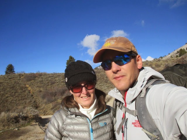
Dees looks on to the high point.


After arriving at the top we chose to push on to the western most part of the peak that, when viewed from the top, appears to be slightly higher.  I think this is a reoccurring issue as it relates to peak bagging; you have to hit all the high points to make sure you get it right the first time, otherwise, you get to go back. 

Looking at the western most high point.

Looking back at the central and true high point.


After a glory shot, a few guzzles of water and a dozen pictures later, we headed back to the car.


There was quite a population of mudders to the south, down in this ravine that are apparently allowed to shoot in the no shooting area.

Ketchum loves snowballs!


With a short and easy walk up Kuna Butte, the days outdoor work was behind us.  The new boots that Deez got me for Christmas felt great and I'm sure they will receive the same high mileage beat down as the last ones!  Thanks babe!

This was nothing more than a walk up, but it puts me one peak closer to completing the list.

Only two left to go!  Hey babe, we don't have plans for next weekend, do we?

Happy Trails!

-Granola, Out.

Sunday, December 14, 2014

Aldape Peak 12-14-2014

Partners: Deez and Ketchum (aka Honey Badger)

Stats: 2.88 miles.  Time to summit 1:15.  Total time 2:30.  Elevation gain >800ft.  Class 1.

Gear Notes:  Miscellaneous stuff to total approx 20lbs.

With the Ada County list of peaks that have 300+ feet of prominence list still on my mind, we head out to hike Aldape Peak.  Its a short hike close to home that requires little effort.  Its an insignificant peak with nothing special about it, other than its on the list.


With a sunny day on the menu, we set off for the drive up Rocky Canyon Road to Aldape summit, where we parked.


The nice thing about these short hikes is that we don't have to get up early.  We got to the trail head at 12pm sharp.  What a great day to wander along the Boise Ridge! 


With sunny skies, cool temps and no wind, we head up.
We followed the road most of the way up the ridge.

Looking east from the route.

A quick stop along the trail. 


We got a great view of downtown Boise along the way.  Hey, look at the pretty little clouds!


More walking.  We just went up from the road.


The Honey Badger doing Honey Badger stuff.  He just doesn't care.

Hoar Frost!

Hoar Frost!


Aldape Peak itself is so insignificant that we walked right past it.  Since we don't pre-load GPS or anything like that, we just walked.  We noticed that we were way off route and actually were heading up the north side of Lucky Peak.  We turned around and figured that we were just below where we wanted to be.


We also saw that the pretty little clouds became a big wall of clouds, so we hit our peak, ate and prepared to wait out the clouds and cold for a bit.

Summit shot!

Clouds rolling in. 


The view was still clear to the east, so we admired the Trinity Mountains for a short while.


Then it was a total white out.  Temps dropped and we literally chilled for a minute.
After about 20 minutes, the clouds began to lift so we started down.


We caught some swell views of the sun through the clouds on the way down.  It was a fun hike for being so short.  While we were never lost, we did wounder where we should have been from time to time.  No planning, no forethought and no idea where things are can be fun!

Sorry kids, my Google tracks didn't come out well... 

Its all good!

Happy Trails!

-Granola, Out. 


Sunday, November 23, 2014

Peaks 4460 and 3793 In The Boise Front. 11-21-2014

Partners: Ketchum.

Stats: Distance 5.85 miles. Total Time: 2hrs 51min.  Elevation Gain: > 1,000ft.

Gear notes: Miscellaneous stuff to total approx 20lbs.

Peak 4460 in the center

These hikes came about after my friends Mark and Tory invited me on a hike of Peak 5180 in the Danskin Rage a couple of weeks ago.  When I asked Mark how he picked that hike, he mentioned Lists of John.  Since I was unfamiliar with that site, I had since looked it up.  I ended up looking at peaks within Ada county that have 300+ft prominence.  I noticed that I had already attained a few, however there are a few that were missing.  The mission was set in motion.

I've never been big on lists, since my list consists of everything...

I began the journey with the furthest peak, 4460.  I probably did not park in the most advantageous spot to start because there were "no trespassing" signs where I had planned to park, so I parked a bit further up on Bogus Basin Rd.  Temperature 34F, Winds light and variable.

Hat pulled back to facilitate ventilation and not to simulate hipster

From the road, I followed the ridge in to Daniel's creek.  A quick pace kept me warm as I gnawed my way down the trail.  I actually dropped quite a bit of elevation, but not to worry, it was all made up at the end.

Ketchum on the trail
  
There was about 4-6 inches of sloppy snow covering the ground so that made for some interesting footing in places, but following the trail was easy ground.  Up and around and up again until there is no more up to do.

Boise Peak
 Its nothing to exciting, but its still hiking and there are still peaks involved.


I had worked up a bit of a sweat which is about the last that thing one would want to do when hiking in cold weather.  There are a few good views to be had, but I would guess that normal people would not hike this.


After double timing it back to the car, it was on to another insignificant, yet relevant peak and number 2 for the day.

Peak 3793 


Since this was on the list and met the 300+ foot prominence rule, I went out swinging on round duce.


Leaving everything behind but the camera and trekking poles, it didn't take long to hit the top of this beast.

But first, let me take a selfie
After a short walk on the summit ridge, we dropped back down to the car.


It was a good attempt at getting above the inversion.


While not anything glamours or extravagant, its always good to be out.  I guess I'll check some things off one list.  Some lists have yet to be made.  Some lists are already done.  It doesn't take much to find adventure and I'm glad I found it once again in the Boise Front, were I essentially developed this ferocious appetite.  I guess I'll just keep chasing squirrels.  

Peak 4460 GPS

Peak 3793 GPS

Welcome to the jungle, essay.     

Happy trails!

-Granola, out

Monday, November 10, 2014

Peak 5180 In The Danskin Mountains. 11-08-2014

Partners: Mark, Tory, Vuyo, Hailey and Ketchum.

Stats:  Distance 5.07 miles.  Total Time 3:34.  Elevation Gain 1600 feet.

Gear notes:  Carried extra miscellaneous stuff to add pack weight of approx 16lbs including 4 liters of water and dog snacks. 

Peak 5180

The Danskin Range is a sub-range of the Boise Mountains.  While not even nearly the biggest or most appealing objectives, they do provide some steep, fun and short hikes close to town.  I've been in the range a hand full of times.  Once for Danskin Peak itself, the ranges highest point, and three other times to hike Three Point Mountain combined with Kepros Mountain.  I have recently been spying the area on Google Earth, looking for some new hikes to do out that way over the winter. With a fine weekend of fall weather on tap, I had really wanted to get up high, however upon remembering that I had plans for the BSU game on Saturday, I decided to stay closer to home.  Mark and Tory had suggested Peak 5180 and extended an invite my way.

I got rolling at 8am Saturday morning to meet Mark and Tory at Black's Creek Summit at 9.  The temperature registered a mere 31*F at the trail head.  With some light frost on the ground, we hit the trail up Deadman Creek.

Vuyo, Hailey and Ketchum run in and out of Deadman Creek

Looking north up Deadman Creek

The day warmed quickly as we walked up the creek.  It warmed up even more as we started up the steep slopes to initiate the ridge walk/loop to and from the high point.


We ascended to the high point on the left side and descended on the far right.

The Danskin Mountains with Three Point visible in the distance


As we neared our peak, we saw two hunters on the lower right ridge.  I shouted "three hikers and three dogs"!  They ether didn't hear me, or didn't care, they didn't bother to wave back.


With all three dogs in sight, Mark and Tory and I push for the top.


Tory, Mark, Ketchum and I on top.  Not pictured but present: Vuyo and Hailey.

Hailey explores the summit area.


Views from the top include the usual suspects; Shaffer Butte, Lucky Peak, Danskin Peak, the Trinity Mountains, Heinen and Kepros.

Trinity Mountains and the Middle Fork of the Boise River Canyon

Danskin Peak in the distance
 We cruised down the other ridge to make a loop, wondering in and out of the brush.


Connecting a couple of slopes and ridges, we regained the trail in Deadman Creek.  The day was now pleasantly warm for November!


Looking up the descent, with Peak 5180 on the left.  This was a fun, short hike and a good workout on a fine fall day.  It was also good reconnaissance for another, longer hike I have planned in this area.

Anyone wanna go!?

If you've hiked everything near by in the Boise Mountains, give the Danskins a try if you haven't been yet.  Fall, winter and spring are the optimal times to visit!

Happy trails!

Granola, out.