Monday, February 9, 2015

Cinder Cone Butte and Big Foot Butte. 2-8-15

Partners:  Deez, Landen (AKA Lego Master) and Ketchum (AKA Honey Badger).

Stats:  Total distance approx 3 miles.  Total hiking time 3 hours.  Lists Of John

Gear Notes:  N/A. 
Cinder Cone Butte from Simco Road

When I had set out to complete the list of Ada County peaks with over 300 feet of prominence almost three weeks ago, we were stopped cold by a broken down car.  Knowing that Mercury is in retorograde, we should have foreseen, or at least expected something like that to occur.  However, I tend to be optimistic.

Hey, at least the car broke down at the exit for Blacks Creek Road and not in the middle of BFE!

The car is now repaired and with a fine dose of Spring like weather over the weekend, we had little in the way of reconsidering our plans of curing a case of cabin fever, despite the potential for another disaster.

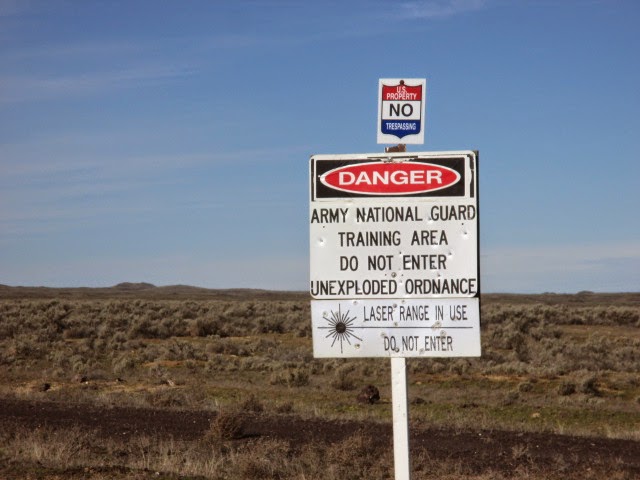
After a smooth departure from town, we were soon heading south on Simco Road, toward the first peak of the day, Cinder Cone Butte.  This trip involved driving thought the IANG Maneuver area which is rather interesting in itself.  Temperature 55F, winds ESE15 G30, mostly sunny.


Cinder Cone Butte tops out at 3,090 feet with 336 feet of prominence and was just shy of 1 mile round trip from where we parked.

Trinity Mountains


The wind was raging but we were just happy to be out in the sunshine.  Since this was such a short hike, no packs were required.  Hiking with me usually turns into a geology field trip, so I did have to stop a few times for mini-lectures about about cinder cones, lava types and how magma composition changes over time.  

Heading up the east side of Cinder Cone Butte

A large radio tower sits atop Cinder Cone Butte and the view is quite nice.

Looking to the north from the top of Cinder Cone Butte

After the short hike to the top, we snapped the obligatory glory shots.  We also found a rather nice chunk of quarts on top.

Another one of those majestic glory shots
We then headed down to the car and set course for Big Foot Butte on Range Road.  This road is heavily traveled by the IANG and is in decent shape.  Although a little rough in places, a passenger car will suffice.

Whoaaa...


I planned to stop and hit Little Joe Butte which sits just off of Range Road.  It only has a little more than 100 feet of prominence, so it was not required to complete the list and would have only been for the LOL's.   However, there is a barbwire fence and a sign indicating a heavy sniper shooting range there, hence we did not attempt it.

Big Foot Butte
After driving about 22 miles along Range Road, we actually passed Big Foot Butte.  We attempted to approach from the north only to be stopped by a barbwire fence and some serious mudding though deep ruts on a side road.  The poor Suby had a rough first day back in action.

Big Foot Butte sits at 3,535 feet and has 390 feet of prominence.  It was a 2 mile round trip from where we parked.


We parked on the side of Range Road and hiked from the east with our lunch in the pack.  Big Foot Butte is probably an old and short lived shield volcano with broken pieces of Pahoehoe lava everywhere.

Cinder Cone Butte from Big Foot Butte


We avoided the numerous cow pies and holes in the ground as we walked, while attempting to communicate with the Whistle Pigs.


It didn't take long to hit the top and we were a little bummed that we could't find a USGS marker.


As one could probably imagine, completing an insignificant project such as this is lack luster, but peaks are peaks and it is always a blast to be on them.

Well, now that I have that out of the way!


Looking south from Big Foot Butte

We dropped onto the leeward side of the pile of rocks that is the summit and enjoyed our lunch with the sun our shoulders.

Walking back to the car was interesting.  Apparently, it was shoot-em-up Sunday and the Whistle Pigs were the targets.  We could hear gunshots from a group about a half mile south of our position and really hoped they were shooting in the other direction.

They drove past our car, so they must know that other people are out here...

We got back to the car without incident and continued north on Range Road.  I had also planned to hit Christmas Mountain which is also not required for the list, but was on the way.  The top looked fortified and there were signs that mentioned something about off limits and the Commanding General so we decided against that peak as well.

Christmas Mountain from Range Road

We finished up our big horseshoe loop though the desert by driving back into Boise, ending up on the south side of the airport on Gowen Road.  There are a few more additional peaks in Ada County that have less than 300 feet of prominence, but I think I'm good with completing the list that involves over 300.   I had finished a project that actually began years ago, before I had even known what I had started, and we had gotten the first peaks of 2015 in a fun, short and easy day.  Just how easy was it, you ask?  It was so easy, that we hadn't even mentioned ice cream to the Lego Master, nor did he even ask about it.  

That easy!

Happy Trails!

- Granola, Out.


Tuesday, December 30, 2014

Last Peak Of 2014! Cervidae Peak 12-30-14.

Partners: N/A.

Stats: Distance 4.58 Miles.  Total Time 4:00.  Summit 4,987.  Elevation Gain 1,900 Feet.

Gear Notes: Cold weather layering and pacing for Mount Rainier with a 25 pound pack.


The Idaho Summits gang is preparing for the annual Moonlight To Cervidae Hike.  We would have been on board but a sweet Christmas gift left us with tickets for Reckless Kelly on New Years Eve.
Not to mention that The Bronco's are playing in the Fiesta Bowl, which would likely mean that I wouldn't be able to walk very straight, let alone up a 1,900ft hike in the dark and cold.


Cervidae Peak is a great training hike.  It's like an outdoor stair master.  For some comparison, it's way better than an indoor stair master.  I've been wanting to try out my possible cold weather layering options that I plan on using for a Mount Rainier attempt in 2015.  I also wanted to get one last peak in for 2014.  Cervidae Peak seemed like the logical choice.  Plus factors:  1. It was really cold and kind of windy.  2.  I would likely need snow shoes and get to break trail.  Temp 19F.  Winds south approx 10mph.  Mostly cloudy. 


Upon seeing the peak, I almost left my snow shoes in the car, but I figured that I would haul them for the added weight and I was also hoping I would need them.


Low on the route the snow was fairly thin.  Just before the route bends to the north, the snow was deep, dry and loose.  There were also plenty of deep drifts to post-hole though.  As I gained elevation, the wind also picked up.  I tend to run way hot when hiking, so cold weather is a bit of a challenge. You want to move, but not too fast because you don't want to sweat.  My lower body layers are dialed in, right down to my boots, I think.  Upper body, there are three temps.  Hot, cold and colder.

Adjust that, hood on, hood off, hat on hat off, gloves on, hands too cold, gloves back on, remove mid weight base layer, keep light soft shell on, add shell jacket...

This was the toughest hike I've ever had of Cervidae.  Deep loose snow , heavy drifts and no one to share the work with.  I've been up here about 20+ times now and in dry conditions, usually hit it in about two hours car-to-car.  Not this time.  With snow shoes on, I kept at it.  After an 8.5 mile run the previous day, my legs were a bit sluggish and my right knee was very sore.  I almost turned back.


The clouds descended on the summit and I had a near white out on top.  It was cold.  Like hands numb after 2 minutes out of my gloves cold.

View off the top.
This summit was well worth the effort!

Looking south from the top.


Charging back down the hill helped warm me up and I gave special attention to pack down the trail for the Idaho Summits gang planning to head up on the following night.


What a great last peak of 2014!

I left a message for ya'll!

Looking up form low on the route. 

Overall, I think my layering system should work for Rainier.  I think the biggest issue might be my right knee.  I should probably have someone take a look at that.  My routes tend to meander a bit, but it should save you some effort in getting up this hill.

It's been a fun year.  Cheers!

Have a great Moonlight to Cervidae friends!  

Happy Trails!

-Granola,  Out


Sunday, December 28, 2014

Kuna Butte 12-28-2014

Partners: Deez and Ketchum.

Stats: 2.5 miles.  Time to summit 1hr (3,236ft).  Total time 1:38.  Elevation gain 371ft.  Class 1.

Gear Notes:  N/A.

After a fresh dusting of snow the night before, we headed out to hit yet another peak on the Lists of John Ada county peaks with over 300ft of prominence.  Kuna Butte appears to be an old and short lived Shield Volcano that likely displayed effusive eruptions that probably ended a little more than 200,000 years ago.  The Mafic nature of this flavor of lava is thin and runny which helped to mold the landscape south of Kuna that is very, very flat. 


Temperature was 34F with light winds and partly cloudy.  There was about 2-3 inches of fresh dry snow on the ground.


There are a few 4x4 roads, one of which leads to the top that we did our best to avoid after parking just off Kuna Mora Rd.


We wandered around on the north slopes heading up while trying to avoid the holes in the ground which could very easily ruin ones day.


We topped out just east of the high point to traverse the ridge.

Looking west to the actual high point.

Dees looks on to the high point.


After arriving at the top we chose to push on to the western most part of the peak that, when viewed from the top, appears to be slightly higher.  I think this is a reoccurring issue as it relates to peak bagging; you have to hit all the high points to make sure you get it right the first time, otherwise, you get to go back. 

Looking at the western most high point.

Looking back at the central and true high point.


After a glory shot, a few guzzles of water and a dozen pictures later, we headed back to the car.


There was quite a population of mudders to the south, down in this ravine that are apparently allowed to shoot in the no shooting area.

Ketchum loves snowballs!


With a short and easy walk up Kuna Butte, the days outdoor work was behind us.  The new boots that Deez got me for Christmas felt great and I'm sure they will receive the same high mileage beat down as the last ones!  Thanks babe!

This was nothing more than a walk up, but it puts me one peak closer to completing the list.

Only two left to go!  Hey babe, we don't have plans for next weekend, do we?

Happy Trails!

-Granola, Out.

Sunday, December 14, 2014

Aldape Peak 12-14-2014

Partners: Deez and Ketchum (aka Honey Badger)

Stats: 2.88 miles.  Time to summit 1:15.  Total time 2:30.  Elevation gain >800ft.  Class 1.

Gear Notes:  Miscellaneous stuff to total approx 20lbs.

With the Ada County list of peaks that have 300+ feet of prominence list still on my mind, we head out to hike Aldape Peak.  Its a short hike close to home that requires little effort.  Its an insignificant peak with nothing special about it, other than its on the list.


With a sunny day on the menu, we set off for the drive up Rocky Canyon Road to Aldape summit, where we parked.


The nice thing about these short hikes is that we don't have to get up early.  We got to the trail head at 12pm sharp.  What a great day to wander along the Boise Ridge! 


With sunny skies, cool temps and no wind, we head up.
We followed the road most of the way up the ridge.

Looking east from the route.

A quick stop along the trail. 


We got a great view of downtown Boise along the way.  Hey, look at the pretty little clouds!


More walking.  We just went up from the road.


The Honey Badger doing Honey Badger stuff.  He just doesn't care.

Hoar Frost!

Hoar Frost!


Aldape Peak itself is so insignificant that we walked right past it.  Since we don't pre-load GPS or anything like that, we just walked.  We noticed that we were way off route and actually were heading up the north side of Lucky Peak.  We turned around and figured that we were just below where we wanted to be.


We also saw that the pretty little clouds became a big wall of clouds, so we hit our peak, ate and prepared to wait out the clouds and cold for a bit.

Summit shot!

Clouds rolling in. 


The view was still clear to the east, so we admired the Trinity Mountains for a short while.


Then it was a total white out.  Temps dropped and we literally chilled for a minute.
After about 20 minutes, the clouds began to lift so we started down.


We caught some swell views of the sun through the clouds on the way down.  It was a fun hike for being so short.  While we were never lost, we did wounder where we should have been from time to time.  No planning, no forethought and no idea where things are can be fun!

Sorry kids, my Google tracks didn't come out well... 

Its all good!

Happy Trails!

-Granola, Out.