Monday, March 23, 2015

Freezeout Hill 3-22-2015

Partners: Deez, Lego Master and Ketchum.

Stats: Distance 1.97 miles. Total time 1:48. Time to summit 1hr.  Summit elevation 3,209.  Elevation gain >300ft.  Freezeout Hill Peaks within 1hr drive of Boise

Gear notes: N/A

Freezeout Hill
Deez and I were slightly hungover so a short walk up Freezeout Hill seemed like a logical idea.  Last weekend we did some reconnaissance on a couple peaks near Emmett that are deep in private property and we had planed to hit Freezeout on the way home.  Heavy rain stopped that plan cold and we returned today to make our short hike to the top.  This small peak sits to the west of Hwy 16.
We parked in a dirt area just off Old Freezeout Road at about noon.  Temp 51F, light east wind and mostly cloudy.

Negotiating the Sage and Barbwire fence proved to be the biggest challenge.
We were a little discouraged by all the barbwire fences, but I remembered Big Dan's  recent report so we followed his advice and stayed on the north side of the fence.

Approaching one of the highpoint's along the way. 
Working our way along the fence we quickly hypothesized a route; we were on it, and en route to our peak.

View toward Squaw Butte over Emmett, Idaho. 
It was not long until we found our way to the top.  The views were plenty, as were the snacks.

Radio tower on the peak.
The Lego Master helped out with the route finding to the top.  He was more than happy to lead the way.  He may be small, but at least he's eager and ready to hurdle himself beyond the confines of the house. 

Cough, cough...


We finished up the snacks, took a glory shot and headed back to the car. 

Looking west from the top.
We soaked up the sunshine and views while Deez and I discussed our annual early-season overnight trip at Grandjean we do in April.  Not that we are super stoked or anything.

Looking east toward Hwy 16.  Crown Point and Prospect Peak are in the background. 
Time to head down. 
Lego Master kicked off the descent and we followed the same fence line back to the car.  


The clouds broke, we enjoyed the sunshine and the Lego Master and I swapped leads on the the way back the car. The hungover and overcast day had changed to a feeling good, walking on sunshine type of day.  Not that we weren't feeling good to begin with; we were just feeling better now that we had added a short adventure to the day.

What a great day to be outside!

With spring break on tap for the children, they will be venturing beyond their bedrooms.  That proclamation was met with some resistance.  At least two out of three children approve.  As for me, I just keep counting down the moments until the next adventure.

The rebellion is brewing.  I will report back when I'm able. 

Happy trails!

- Granola, out. 

Tuesday, March 17, 2015

Macks Peak 3-16-2015

Partners: Ketchum.

Stats: Distance 3.07 miles.  Total time 2:30, time to summit 1:30.  Summit elevation 4,960, elevation gain approx 1,800ft.  Macks Peak on Lists of John.

Gear notes: Random stuff to total approx 14lbs.

Macks Peak.
Well, its that time of year again.  Spring fever is in full effect for me.  Trail runs and local peaks have been a tried and true way of getting into and, more importantly, staying in shape.  After I started putting my new best friend, a foam roller, to good use, I've been able to run and hike with almost no pain at all in my right knee.  Two months ago I thought my days of trail running and climbing big mountains might be coming to an end; now its game on and once again time to plan out those big peaks and salvage what ever chance I may have left to attempt Mt. Rainier or another Cascade Stratovalcano.

Local-lame peaks have been the flavor of choice lately, mostly because they are close to home. Mark Jones has made a custom list on Lists of John; Peaks within a 1 hour drive from Boise, so that's what I've been working from, instead of just doing Cervidae Peak every time I want to train or take a hike. Macks Peak is close to Cervidae, only about 1.5 miles from it as the crow fly's.  I drove about 3.5 miles down the Middle Fork road and parked in a large dirt turn-out.  Temperature 49 degrees, overcast and light wind from the east.

Ascent ridge.

I took the south ridge that sits between to small ponds and stayed on that route all the way to the summit.  This bad boy kicks back pretty good right from the start and there is no warm-up section. The slope angle is about 50 degrees near the top of the lower section, so tripping is really not an option.

Looking down the south ridge.
It is steep enough that it was hard to fall into a good pace so I just kept grinding straight up this sucker.  This was a mental workout as well as physical.

Macks Peak is in the center.
After cresting a point at about 4,200ft, the actual peak came into view.  I took note of my pace at this spot and noticed I had done about 1,200 in 45 minutes.  Hey, not bad!

From this spot, the route is obvious and easy to follow and the neighboring peaks come in to view.

View down the long south ridge.

Shaffer Butte.
Poor Bogus, its had a lean snow year.  I'm thinking that I might move up the time frame a bit for the peaks that I want to do with snow on the route.

Rock Roll Peak comes to mind; I need to get on that.

Looking toward Arrow Rock Dam. 

Summit shot.
There are three different piles of rock that sit atop the peak, all are about equal height so take your pick.  None have a register or any other type of marker, just some trash that I had to pick up.


After a few pictures, Ketchum and I divvied up the lunch.  Cold pizza for me, dog treats for him.
I had eyed another cool looking ridge to the south that I had wanted to descend, but upon inspection, it would have taken significant effort to attain it.  We simply reversed the ridge of ascent, which was steep, quick and uneventful.  Just the way I like 'em!


Macks Creek.
Macks Creek seemed a little out of place since there was actually running water in it.  Macks Peak was a great workout despite it being so short, and it also got me one more peak on Mark's list.

There are 99 of them so get at it people!  

This is the current top ten: Zack V, Dan R, Mark J, Tom C, Dave P, Tom L, Sean D, ???, John P, and ???.  I will add, I feel that this is not a competitive thing, its more like a chill and friendly "see you next weekend/can't wait to see your pictures" type of thing.  Many of these peaks are deep in private property and may never be done. We did a bit of reconnaissance on a couple of peaks near Emmett on Saturday; the struggle is real.

zdvickery40 
idahosummits35 
jonesdcu34 
DrGranola23 
DavePahlas19 
Tom Lopez16 
SawtoothSean14 
ingelosi13 
splattski13 
eWarg12 

Haha, how am I in 4th place among all of these heavy hitters!?


I'm in no rush to complete this list of peaks, but it does give me inspiration to attempt new local peaks.  Heck, I'm still working on the Idaho 12'ers.  It does feel really good to be a trail runner again; and even better, I get to go climb high mountains again.  These last few local-lames were only a small step in the large scheme of thing, but I love it just the same.  It's like studying before the test.

It's all uncharted.

Happy trails!

-Granola, out.


Tuesday, February 17, 2015

Peak 5,069 AKA "Station Peak"

Date: Feb 15, 2017.

Partners: Mark, Dan and Ketchum.

Stats: Station Peak:  4.17 miles, >500 feet of gain, class 1.

Gear Notes: N/A.

IdahoSummits Trip Report


Mark, Dan and I had planned to hit a small peak in the Danskin Mountains.   Its a fairly easy task, but I was feeling slow and a little sore after hauling my old butt up the cliffs the day before.  None the less, I picked Mark up at Starbucks and we met Dan at Blacks Creek Summit at 10am.  We had set our sites on peak 5096.


The weather was perfect; slightly cool, clear skies and almost no wind.


Our route took us up a hillside and onto an old road.  The peak has over 300 feet of prominence so, yet, even though it is small, it counts as an actual peak.


A beautiful day in the Danskin Mountains.
Shaffer Butte.

Peak 5096, "Station Peak".
 As we cruised down the road toward our peak, we caught up with each other about our recent adventures and discussed future plans.

Mark and Dan surveying the area. 

Three Point Mountain.
Both Dan and Mark are fairly competitive peak baggers with a long list of peaks accredited to their names.  They are also quite aware of what constitutes an actual peak.  For conversation sake, it must have over 300 feet of prominence.  Interestingly enough, this means that Three Point Mountain is actually not a peak and just a point.

Trinity Mountains.

It was about an hour of walking until we reached our objective for the day.  All the usual suspects were in view and I'll spare you the list.

House Mountain.

Danskin Peak, the ranges high point.
Other than looking at the map and Google Earth, I hadn't done much research on this peak.  It wasn't until we hit the top that Dan informed us that no one had claimed an ascent on LOJ, so we would claim the first.  Aside from the barbwire fence that sits a ways back from the peak, there was no cairn, trash or anything else to suggest that someone had actually been there.


Fortunately for me, I don't have T-Rex arms and I haven't completely given up on life, so I have not bought a selfie stick.  Here is a handy-dandy flow chart to aid you in deciding if you should get one.


After hanging out on the peak for a while, we decided we needed more miles added to the day.  Mark had noticed these odd structures from the top, so we went down to check it out.

Peak 5096, "Station Peak".

There is an overgrown road that leads between the two old foundations.  These structures were obviously inhabited at some point, but the purpose is not clear.  My best guess is that since they sit at the top of Station Creek and on the edge of the National Forest Boundary , it was a Forest Service station of some sort.


The concrete foundations had been stripped of whatever had composed the buildings.  We found some miscellaneous debris and an obvious rock-lined walkway.


After a short time investigating Marks cool find, we headed down Station Creek.  Now we had a first world problem to deal with.  We had just done a peak, now the peak needed a name.  Dan appropriately suggested Station Peak.

Looking up Station Creek.
On the way out there was some light to moderate bushwacking through Station Creek, but nothing too bad if we don't count the barbwire that Mark found, and we eventually found a trail that lead us back down to Black's Creek Road.

Hiking down Station Creek.

The road walk back to the car was uneventful and we passed the time with more witty conversation than you can shake a selfie stick at.  It was a great weekend to be out enjoying what will probably be a teaser dose of spring.  The weather, company and hike were all equally awesome.  The only complaint, if you could call it that, is it had gone by so dang fast.

You know what they say; Time flies like an arrow, fruit flies like a banana!

Happy trails!

- Granola, out.
  

Monday, February 9, 2015

Cinder Cone Butte and Big Foot Butte. 2-8-15

Partners:  Deez, Landen (AKA Lego Master) and Ketchum (AKA Honey Badger).

Stats:  Total distance approx 3 miles.  Total hiking time 3 hours.  Lists Of John

Gear Notes:  N/A. 
Cinder Cone Butte from Simco Road

When I had set out to complete the list of Ada County peaks with over 300 feet of prominence almost three weeks ago, we were stopped cold by a broken down car.  Knowing that Mercury is in retorograde, we should have foreseen, or at least expected something like that to occur.  However, I tend to be optimistic.

Hey, at least the car broke down at the exit for Blacks Creek Road and not in the middle of BFE!

The car is now repaired and with a fine dose of Spring like weather over the weekend, we had little in the way of reconsidering our plans of curing a case of cabin fever, despite the potential for another disaster.

After a smooth departure from town, we were soon heading south on Simco Road, toward the first peak of the day, Cinder Cone Butte.  This trip involved driving thought the IANG Maneuver area which is rather interesting in itself.  Temperature 55F, winds ESE15 G30, mostly sunny.


Cinder Cone Butte tops out at 3,090 feet with 336 feet of prominence and was just shy of 1 mile round trip from where we parked.

Trinity Mountains


The wind was raging but we were just happy to be out in the sunshine.  Since this was such a short hike, no packs were required.  Hiking with me usually turns into a geology field trip, so I did have to stop a few times for mini-lectures about about cinder cones, lava types and how magma composition changes over time.  

Heading up the east side of Cinder Cone Butte

A large radio tower sits atop Cinder Cone Butte and the view is quite nice.

Looking to the north from the top of Cinder Cone Butte

After the short hike to the top, we snapped the obligatory glory shots.  We also found a rather nice chunk of quarts on top.

Another one of those majestic glory shots
We then headed down to the car and set course for Big Foot Butte on Range Road.  This road is heavily traveled by the IANG and is in decent shape.  Although a little rough in places, a passenger car will suffice.

Whoaaa...


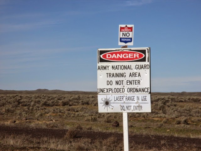
I planned to stop and hit Little Joe Butte which sits just off of Range Road.  It only has a little more than 100 feet of prominence, so it was not required to complete the list and would have only been for the LOL's.   However, there is a barbwire fence and a sign indicating a heavy sniper shooting range there, hence we did not attempt it.

Big Foot Butte
After driving about 22 miles along Range Road, we actually passed Big Foot Butte.  We attempted to approach from the north only to be stopped by a barbwire fence and some serious mudding though deep ruts on a side road.  The poor Suby had a rough first day back in action.

Big Foot Butte sits at 3,535 feet and has 390 feet of prominence.  It was a 2 mile round trip from where we parked.


We parked on the side of Range Road and hiked from the east with our lunch in the pack.  Big Foot Butte is probably an old and short lived shield volcano with broken pieces of Pahoehoe lava everywhere.

Cinder Cone Butte from Big Foot Butte


We avoided the numerous cow pies and holes in the ground as we walked, while attempting to communicate with the Whistle Pigs.


It didn't take long to hit the top and we were a little bummed that we could't find a USGS marker.


As one could probably imagine, completing an insignificant project such as this is lack luster, but peaks are peaks and it is always a blast to be on them.

Well, now that I have that out of the way!


Looking south from Big Foot Butte

We dropped onto the leeward side of the pile of rocks that is the summit and enjoyed our lunch with the sun our shoulders.

Walking back to the car was interesting.  Apparently, it was shoot-em-up Sunday and the Whistle Pigs were the targets.  We could hear gunshots from a group about a half mile south of our position and really hoped they were shooting in the other direction.

They drove past our car, so they must know that other people are out here...

We got back to the car without incident and continued north on Range Road.  I had also planned to hit Christmas Mountain which is also not required for the list, but was on the way.  The top looked fortified and there were signs that mentioned something about off limits and the Commanding General so we decided against that peak as well.

Christmas Mountain from Range Road

We finished up our big horseshoe loop though the desert by driving back into Boise, ending up on the south side of the airport on Gowen Road.  There are a few more additional peaks in Ada County that have less than 300 feet of prominence, but I think I'm good with completing the list that involves over 300.   I had finished a project that actually began years ago, before I had even known what I had started, and we had gotten the first peaks of 2015 in a fun, short and easy day.  Just how easy was it, you ask?  It was so easy, that we hadn't even mentioned ice cream to the Lego Master, nor did he even ask about it.  

That easy!

Happy Trails!

- Granola, Out.