The White Cloud Mountains need no introduction. This range is famous for its jagged white-colored limestone peaks that give the area its name. There are several lakes that are easily accessed, and several more that require more effort. For this trip, we chose to camp at the very easy to access Fourth of July lake. The easy access makes it quite popular so we weren't too surprised when we found the trailhead full of cars. We began our walk to the lake under mostly sunny skies with warm temps and a welcome occasional breeze.
We saw a few groups heading up and passed a few more on their way out. All in all, the traffic really wasn't bad. We didn't have the pleasure of sharing this section of trail with any dirt bikes which was a bonus in itself. Upon arrival at the lake, we found it oddly vacant. We had first choice of camp sites and quickly snagged up a primo spot for the night. Not long after, a couple more groups showed up. We quickly realized that there was an over abundance of these annoying little blood sucking vampire bugs that fly, more commonly known as mosquitos. In Idaho, July means bugs, just as November means cold. After getting the tent up, I took off for Fourth of July Peak and naturally, the dog followed. We went light and fast for the 1,300ft climb up the northeast ridge.
Looking up the northeast ridge of Fourth of July Peak.
Upper ridge.
Ketchum apparently enjoying the view.
The route was straight forward class 2 with one short section of borderline class 3. In one hard push from camp, we hit the top in about an hour where there was a stiff and cold wind out of the west waiting for us.
Summit of Fourth of July Peak.
Patterson Peak above Fourth of July Lake.
Castle Peak standing tall over Washington Lake.
Ivory Peak and Ebony Peak.
Summit selfie with Dog.
Summit register.
After all the summit duties like signing the register and taking pictures, Dog and I zipped back down the ridge and were back in camp after about a 3 mile round trip in just over 2 hours. It was kind of like a speed lap of Cervidae Peak, only way cooler.
Fourth of July Peak hovering in Alpenglow.
The blood suckers tried to get the best of us and did manage to score a few direct hits while we got the fire going to smoke them out. After dinner and our chosen liquid libations, we got to enjoy one of the finest things the mountains have to offer: Alpenglow.
The next morning warmed up quick as we ate first breakfast. The days objective; Patterson Peak with a possible side trip to Blackman peak. Deez was looking to set her PR for altitude so we were going to head to Patterson first.
Patterson over the unnamed lake along the trail.
Following the trail to the pass that leads to Born Lake was easy enough, stopping once for second breakfast and some pictures. Once atop the pass, we had a clear view of Blackman peak to the north. Patterson Peak sits higher and further from the saddle so we kept to the plan and headed south along the ridge to tag it first.
Blackman Peak from the pass.
Sawtooth Mountains.
Patterson Peak from the pass.
We skirted below the crest of the ridge and aimed for the base of the main ridge to the summit. There were a few rock towers to move around and the ridge stays fairly flat so we made good time.
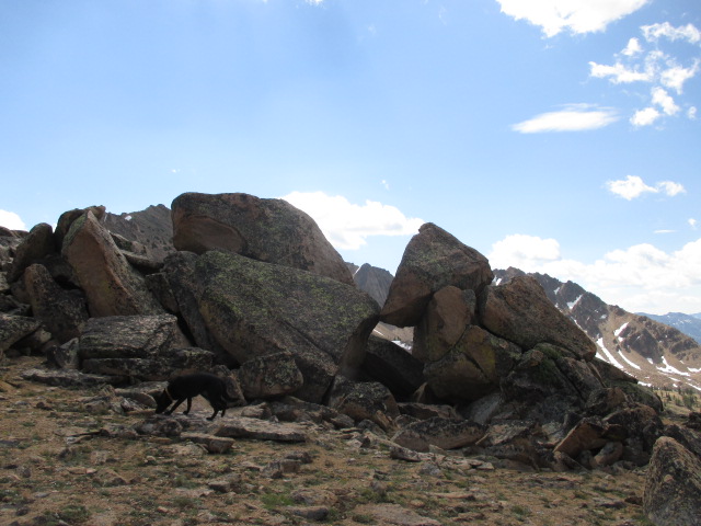
Boulders along the ridge.
We had a nice break and first lunch before the summit push and I offered up a pep talk to Deez who was having a mental struggle and doubting her ability to make the top.
This is 60% mental toughness and 40% physical ability. We'll go slow, one small section at a time. Your mind needs to be stronger than your legs and you have to be prepared to suffer a bit. The pain is an illusion; the summit glory is reality and only comes after putting one foot in front of the other.
Deez heading up the ridge.
We pushed on and the wind was increasing as we gained elevation up the ridge. I was keeping a watchful eye on the large cumulus clouds building to the west, and noted the lifting condensation level was getting lower as the clouds pushed our way. To the east, I could make out Borah Peak in the Lost Rivers. The sky was dark there and I could see streaks of precipitation falling. This meant the clock was ticking and the race was on to get to the top and down before thunderstorms started. I'm a little vulgar and pretty harsh when I go Drill Sergeant and yell at myself in my head. Deez got the nice Drill Sergeant motivation.
Ah, you can do it. Keep going, one foot in front of the other. There you go...
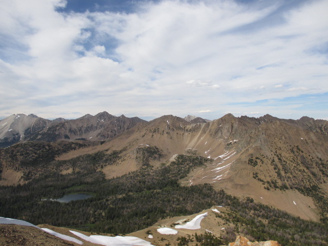
Looking north northeast at the White Clouds.
The remainder of the ridge was mostly class 2 with a fun and short scramble up to the true summit. I don't think Deez realized how close we actually were and it wasn't long until we were standing on top.
Summit ridge.
Looking east.
Deez on the summit of Patterson Peak.
By the time we got to the summit, the wind was probably a steady 30-40mph and gusting higher than that. Those occasional strong gusts threatened to knock us off our feet so we tried to stay low.
Looking west at Fourth of July Peak.
We had just enough time to get some pictures and not much more. Kind of a bummer after the effort to get there, but sometimes that's part of the deal. Sometimes you get a couple of hours, and sometimes only a couple of minutes. With conditions not getting any better and not wanting to test the chance of thunderstorms, it wasn't long until the nice Drill Sergeant initiated the PUHA descent. In case you don't know, PUHA stands for pack up, haul ass.
White Cloud Peaks.
Summit of Patterson Peak.
Looking north towards Blackman Peak.
Four Lake Basin.
We zig-zagged down through the rocks and made it back to the last good sheltered area for a break and second lunch. Now, the pep talk turned in to the I told you so talk. Even if she didn't think so, I knew she could make it. Deez tested and pushed beyond what she thought was the limit of her mental strength and I'm pretty darn proud of her. Our thoughts shifted to Blackman Peak as we made our way back to where the trail crosses over the saddle.
Deez descending the summit block.
Dog in full sprint a little close to the edge.
When we got back to the saddle, Denise said she was done and didn't want to go for it. Time wise, it wasn't too late, but those pesky clouds were still getting bigger and I didn't want to be up there if the thunder storms started. Not wanting to physically overexert myself going for it so close to a major objective, I called it off and we headed down, stopping at the unnamed pond along the trail for a short break.
Ketchum at the lake with Patterson Peak in the background.
After a 3.5 mile round trip with 1,400 feet of gain, we had a few rain drops on the way back to camp, and by the time we were breaking down the tent we had strong wind gusts and a rather loud, although solitary clap of thunder. We turned over our camp site to a couple from Portland with the blood sucking vampire bugs included at no charge.
Ketchum displaying the "bait and switch" look.
Deez got her highest peak yet so she was stoked as we packed up and headed out. For some reason she still felt a little intimidated by Patterson and didn't want to look back on the peak. Hey, look! You just climbed that!
Ketchum the crazy birthday dog (July 4, age 5) got a backpacking/peak bag trip and also got to set his altitude PR. Dog was actually worn out when we got back to the car. A tired dog is a quite dog, and we like it when he's quite.
Back at the trailhead.
The success of trips like these comes down to doing things right. Starting at the right time; bringing the right equipment; taking the right amount of steps. If you do enough things right, you may find yourself at the top of a peak, and more importantly, back in the parking lot where the real celebration can begin. I feel that strength exists on four levels: Physical, mental, emotional and spiritual. I have had all of those levels of strength tested at some point on every trip I've ever done, and in life in general. When we test our strengths, we found out where our limit is. When we know where our limit is, we can learn when to push beyond it, or pull back when we need to.
The Cottonwood Peaks are accessed off the middle fork road, about 20 miles from the turn off at the high bridge. I was looking for something local that I hadn't done yet and these peaks came to mind. Super Dave's trip report was my original inspiration and this caught my attention when I noticed there would be lots and miles and gain. There are two ridges that can be used to get to West Cottonwood and I decided on the eastern most ridge as it looked to be a shorter and more direct approach to try and nab both peaks.
Lambing Creek drainage. I used the hill on the right.
Looking down the ridge.
I hopped on the steep hillside and started up, gaining 1,000 feet in the first mile. It was at about that point that I hit the first obstacle; a thick grove of young trees. My instincts told me to stay on the ridge but the trees were thick enough that I would have had to basically claw my way through. Luckily I found a game trail to the west that got me past it.
The grove.
Past the grove, the slopes opened up again and the route looked obvious; just stay on the ridge.
There was a small section of brush that I waded through, just to get though it. After that there was more brush. Lots and lots of brush with no apparent way though. The worst of it started about 4,800 feet and it took me a while to find a way past it. There was a secret passage of game trails on the west side of the ridge that did eventually get me past it, but it required loosing elevation, steep side hilling and hopping over several downed trees.
At about 5,200 I was able to regain the ridge and actually enjoy the views and hiking.
Looking back on the main ridge after hiking the secret passage.
Cool rock formation.
Upper slopes.
The day was heating up and it had taken longer than I anticipated to cover what little ground I had up until this point. I reached the top of West Cottonwood about 1:15pm.
Mount Heinen.
Looking south.
Looking north to East Cottonwood.
The ridge to East Cottonwood didn't look promising. It would have been about a 7 mile round trip and there looked to be plenty more brush. Even if I had time for it, I probably wouldn't have done it.
Dog and I on top.
After a short break on top I figured I might as well start down.
Looking down the ridge.
Lots of brush.
I was able to navigate down the ridge and around the brush for the most part. There was still that one last section of dense brush that I shimmied though because it looked to be way shorter then going around. Then it was back down the steep slopes in the heat of the day. It was a good training session, but a forgettable hike.
Cody, Jim and I put together a climb up the north face of Idaho's third highest mountain. 12.200ft tall Mount Church is normally climbed from the west side and approached from highway 93. Cody and Jim wanted a ski descent so the north face was the logical choice for them and I've been eyeing this route for a long time myself. The drive to the Pashimori side is longer and significanly more rough than the highway making this route very remote. We saw a few people on the drive in and out, but had the mountain all to ourselves.
Lerch. Note: Cody is getting in the front-left passenger seat. Jim is in the drivers seat on the right.
Cody and I met Jim and his rig Lerch in Banks and set off on the long drive. Lerch is a trailhead finding beast of a machine with quite the back story. He was the superhero of the trip as Jim piloted us into the very rugged but amazingly beautiful Pashimori Valley. We ran into a guy from Virginia who reported he had attempted Mt. Corruption, only to be stopped short of the summit due to soft snow at about 11am.
Pashimori Valley.
Pashimori Valley.
Pashimori Valley,
We arrived at the trailhead and were packed up and rolling just after 5pm. We had a moderatley difficult cross-country approach to lake 9682 where we planned to bivy for a few short hours.
Heading out.
We hopped across the east fork and followed the trail for a short time before heading off-trail into the canyon.
Approaching the trail.
Jim and Cody carried skis so they did a majority of the route finding down low as we wandered and bushwhacked through the canyon.
Mt. Church.
Seeing the north face with my own eyes for the first time struck me pretty hard. Its very big and imposing to say the least.
Creek crossing.
First thing was next, find the bivy spot. We were able to find our landmarks and picked our way up the canyon without too much trouble. Then we saw this tall and beautiful waterfall that we were on the wrong side of. We hiked the scree and snow fields to the right and crossed above it where the river originates as a spring from the hillside.
Water fall.
Upper valley.
Once we got across the water hazard and above the treeline, the going was pretty smooth, but the hour was growing late. We needed a bivy site and preferably before dark.
Note the crack in the upper snow field.
This side of the Lost River Range has a wonderful alpine feel to it. The upper valley here is just spectacular.
Approaching camp.
Jim was below Cody and I when we came across a meadow with running water and was the first into our unplanned Shangri-La bivy site. We decided to hold up here and climb the rest in the morning
Bivy.
Sunrise.
The overnight temps never felt too low as I laid in my bivy sack while drifting in and out of consciousness. We were up at 04:30, fueled up, loaded our packs and were going an hour later.
Hmm, it's kinda warm for snow climbing...
Mt. Church.
We were less than impressed with the snow as we started out. The quantity was there, just not the quality. I was on snow shoes moving up the unsuportive snow with some difficulty while Jim and Cody skinned up with what appeared to be relative ease.
Route up the north face.
We passed the lake that we had originally planned to bivy at. It was open and there was enough flat ground to camp. We all had to shed a layer pretty quick in the warm morning temps. The name of the game became top out by ten, done by one. We got a move on. The ledge's on the face lay cattywampus and with the soft and lousy snow, we chose the main snowfield to the left to avoid exposure to the cliffs that cross the fall line, in case of a slip and being unable to self arrest.
Jim and Cody skinning up the headwall.
Skinning up looked to be going well for Cody and Jim. I was sinking in to the boot top level with snow shoes on. Fun times. We could see a lot of recent wet slide activity as we worked up the headwall.
Old avy track.
We regrouped and applied crampons to climb up some old avy debris hoping it would be firm. It was not. The lack of supportive snow made for tough going and a suspision that we might not get too high before needing to bail.
Low on the north face.
We soldiered on taking only short maintenance breaks and taking turns breaking trail. We did see old ski and boot tracks in the snow.
Jim starting his lead.
The higher you go on the route, the more the angle increases.
Break time.
It was 8am and already t-shirt weather with a slight breeze.
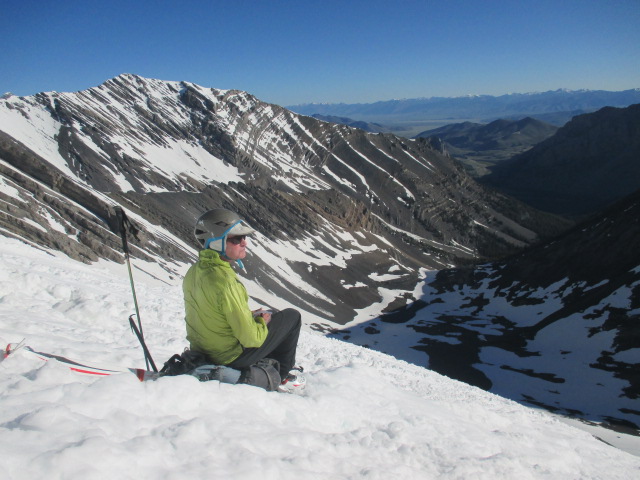
Jim at a rest break.
After Jim's lead, he and I had a short break while Cody pushed on.
Cody finishing his lead.
We caught up to Cody while he rested and then I took the lead for the last 1,400ft or so to the top of the north face. It was a difficult lead in the ever softening snow. I fought for every step.
We estimated the upper slopes to be 50-plus degrees as we four pointed our way up. Once on top we saw the knife edge summit ridge was corniced and we couldn't go any farther. Perspective of the ridge was hard to tell but our summit was very airy with bearly enough room for the three of us. We did the typical well that point might be higher, yada-yada for about thirty seconds of the two minutes we spent on top.
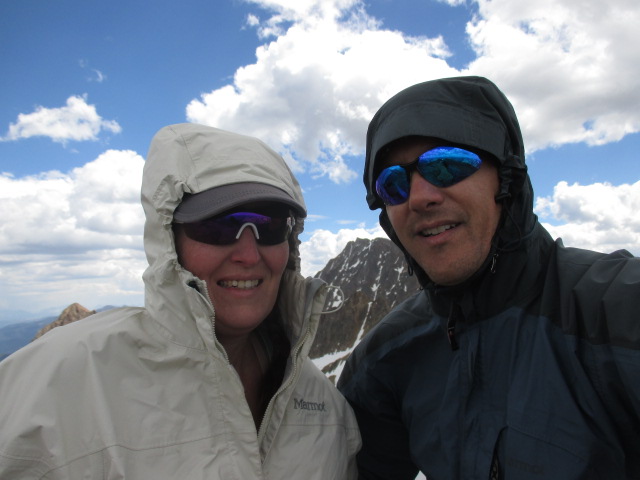
All smiles on the top of the north face.
A few pictures and few sips of water was about all we had time for. It was 9:30 and we needed to get down ASAP.
High point.
Looks like we missed the actual highpoint by just a bit. My altimeter logged 12,180 which was probably off a bit one way or the other. I think Codys GPS said 12,155...? I suppose it was a near miss but we were elated that we climbed the north face. Jim and Cody felt it was close enough and I would agree, the high point was a technicality. I guess I'd say that we summited but did not hit the high point. The peak bagger in me still feels only 99.9% satsified. Oh well, sometimes that's all you get!
Looking north towards Borah Peak.
I was more concerned with being stable on our small perch in the sky than I was with photos or high points. In hindsight, I'm a little disappointed I didn't get more photos of the gnarly ridge.
12k mildly hypoixic grin.
Jim enjoying the views.
We had the Idaho Summits Spring Outing group in our thoughts and hoped they were doing well as we gazed at the Pioneer Mountains. I started down while Cody and Jim clicked into their skis. They were well past me in no time and I struggled my way down. Normally, plunge stepping isn't that bad, but it's hard to do when you sink in up to your knees with every step.
Arch at the base of Mt. Church.
We regrouped at the bottom of the face and refueled once more before heading back to camp.
Lake 9682.
Cody and Jim heading down.
We broke camp and were heading down about a quarter past noon. Not bad, but we still had the off trail descent to do with full packs. It was slow going at times but we found a good route down the canyon and back to Lerch.
Mt. Church from the trail.
I will say that this trip had it all: It was remote with a moderately difficult cross-country approach, a cool bivy site, alpine start, crappy snow, difficult steep face to an airy summit with no time to spare on the route and with great partners who had PMA all the way. Per Cody and Jim, this was Type II fun; hard and kinda hate it while you're doing it, but remebered as fun in retrospect.
Adventure level was 10/10 and we were all smiles as we headed back to civilization with Jim at the helm of Lerch for the long and bumpy drive out of the Pashimori Valley. This trip is easily on my favorite list.