Friday, April 23, 2021

Mount Shasta

Date: April 23, 2021.

Partners: Roy and Todd.

Stats: 12.5 miles with 6,000 feet of vertical gain.  No summit.

Links: Mountain weather.  Climbing advisory.  Strava


Mount Shasta from the north, heading south on I-5.  Shastina is on the right.

Mount Shasta and the Avalanche Gulch from the Bunny Flat trail head.

We had originally planed to try Shasta as part of an epic tour of the Cascades in late May/ early June and were planning to climb something in the 10-12k range in Idaho this weekend. However, due to the very low snowpack we decided it was now or next year to try Shasta. We had a narrow window of time, but at least that lined up with our narrow weather window. We would try a one day ascent involving 7,000 feet of climbing to 14, 162 feet in elevation. The plan/ desire was to ski this bad boy, but the low to non-existent snowpack said otherwise.

After the road trip down there, we ended up tossing our tents up at the end of the parking lot for a few hours of sleep. Alarms set for 0200, departing at 0300. It was a clear, cold and windy night. The forecast for the next day was clear, cold and windy with a storm coming in somewhere between 1600 and 2000 with potential for some serious wind and heavy snow.

At least we were at the trail head and this would save us some time in the morning.  We actually registered the night before since the summit pass is good for 3 days.  After wrestling the tents up in the wind, a Mountain House for dinner and chasing some Pringles with a beer, we called it a night.


Dirt bagging it in a parking lot.

The next morning came in clear and cold.  We set off on the snow not being super sure of the route. We ended up more or less following the trail on the GPS/ map up to Horse Camp and tree line.  It was here that we had had enough of the shenanigan's with the snow.  We'd been playing the off again/ on again game and we lost.  The snow was not going to get better and skiing was out of the question.  What little snow that was present was a gnarly mix of sun cup/ sastrugi, with some of it being waist deep.  We ditched the planks and soldiered on.  With a decent snow pack, this would be a straight forward just head up route, but we were dealing with the ups and downs of moraines and trying to keep on the most efficient line.

Getting started.  Photo by Todd.

Looking up from just above tree line.

We had decided to take the "Left of Heart" variation on the Avalanche Gulch Route, instead of taking the "normal" line toward Thumb Rock.  This would be a steeper line, but more straight forward and hopefully avoid an epic scree-fest.  However this did expose us to more rock fall from the Red Banks.  We kept our heads up and our eyes open, but noted that it was fairly quiet.  There had been recent reports of rock Vs human encounters though, so this was no place for a picnic.

Roy and I climbing.  Photo by Todd.

Upper route showing the continuous line of snow, the "left of heart" variation.

Todd and Roy and the base of Casaval Ridge.

Break time, probably near Lake Helen.

We started gaining altitude, although progress was hard to gauge given the huge scale of this route.  Our plan called for summiting or turning around by 1200.  Even though we were finally getting up high, our progress was slow due to the altitude.  By "our" I mean Roy and I's. Todd had just finished the Idaho 12'ers two weeks ago, so while not only being super fit and the youngest guy in the squad, he was also riding a bit of previous acclimatization that Roy and I didn't have.  

Roy climbing.

Looking down what could be an epic ski descent.

Funky snow.

Roy and Todd gutting it out.

Roy enjoying the climb.

At 1130, conversation ensued.  We were at approx 12,600 feet, but the storm was on its way and we were still too far off from the summit to continue.  There was no reason to force a bad situation just for the sake of maybe reaching a summit.  We decided that we would have a nice rest, enjoy the view and not thrash ourselves on the descent.

High point.

Heading down.

Clouds rolling in.

Having a little fun.

Todd boot skiing.

The Mountain was no longer happy.

The snow had softened up a bit, so going down wasn't as bad as we thought it could be.  As we got lower, we could see that there was a lenticular cloud over the summit now.  I for one was glad I wasn't up there.  After a lot of walking in ski boots, one short glissade and one half-assed attempt to ski just above tree line under our belts, we got back to the parking lot none the worse for wear.  We made tracks for the town of Mount Shasta to camp down lower and avoid the brunt of the storm.

Hopefully it will be a different story when I make it back, when conditions are better.

Friday, April 9, 2021

Mount Constitution

Date: April 9, 2021. 

Partners: Deez. 

Stats: 3.39 miles with 715ft vertical gain in 1:46 round trip. 


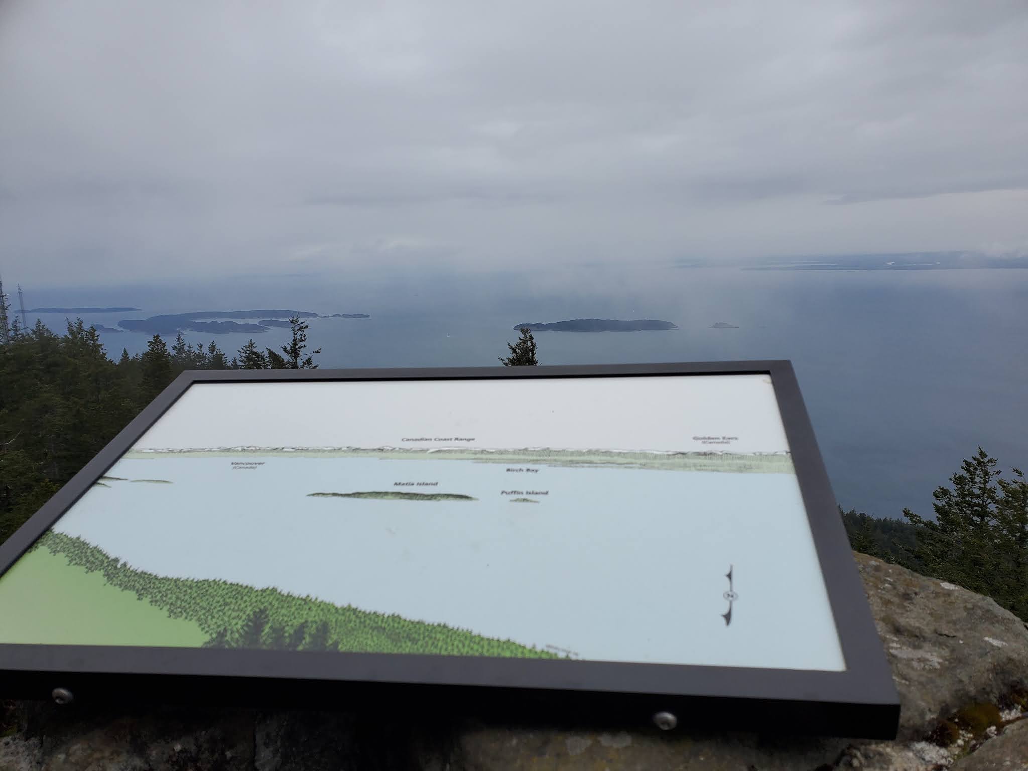
We hit this up while chilling on the San Juan Islands, so the first thing one would have to do is make your way to Orca's Island. Not exactly a day trip from The 'Ho. Once we were on the island, getting to the State Park and our desired trailhead was pretty straight forward. There are options to make this a longer day, but we were at the mercy of typical PNW weather. Our route was short and straight forward with lots of giant trees and wonderful views of the sound. There was heavy cloud cover though, so no view of Mount Baker. Take time to walk to the top of the lookout tower and take in the history of it all. If you make your way out here and the weather totally sucks, don't fret. You can drive to the top.

Interesting facts: Mount Constitution is the Moran State Park highpoint, Orcas Island highpoint, San Juan Islands and San Juan County highpoint. Also the second highest mountain on an ocean island in the contiguous 48 states. Only Devils Peak in the Channel Islands of California is higher.

Pictures


Saturday, October 24, 2020

Gallagher Peak

Date: October 23, 2020.

Objective: Gallagher Peak 6,100ft.

Stats: 6.8 miles w/ 3,100ft ascent. 4:40 round trip.  Strava.

Link: Gallagher Peak on Idaho: A Climbing Guide.

Gallagher Peak sits just off the Banks to Lowman Highway.  While access is pretty good, there is not much shade on the route so it would be best done in the spring or fall.  Due to the low elevation, it is also quite warm.  A spring ascent with a couple feet of snow might be the best option, as that would get you above some of the brush.

I parked at the wildlife viewing area on the south side of the highway, but there is a dirt pullout parking area on the north where the route begins.  I say route and not trail because the "trail" is not signed, but is pretty obvious.  I started up the valley that holds Little Gallagher Creek and walked past an old building, following the path up the valley.


Road at the beginning of the route.

Looking down the valley at the old building.

Looking up the valley.


There was some brush to contend with, as well as some ups and downs.  I was aiming for the saddle and following some game trails and shooting for the "less brushy" areas seemed to work just fine.  Just stick to the north side (hikers left) of the valley.


Looking up the valley with some of the better parts of the trail shown.

Looking down the valley.

Once I got the the saddle, I turned left/north to follow the ridge.  I worked along the ridge, moving in and around the brush.  There were a few steep hills/false summits and overall the terrain was fairly straight forward and pretty fun.

Looking south from just above the saddle.

Looking north up the ridge.

Gallagher Peak in the distance.

From the time that the peak is visible on the ridge, there is still some ground to cover.  I came expecting some brush and I was not disappointed.  There were also some fun rocky sections but nothing even close to class 3.  Just stick to the ridge and keep an eye on the map.

Peak 7,460 from the summit of Gallagher.

Shafer Butte and Mores Mountain.

Looking south from the summit.

Benchmark.

The summit is approached from the south.  Time to hunt for the benchmark!  I skirted the large patch of brush on hikers right to the northern end of the highest contour line in search of the highest highpoint.  It was there that I found the benchmark.

I retraced my route along the ridge to point 5578.  There I turned hikers right and followed the ridge past points 5089 and 4836, instead of going down the valley.  The terrain was pretty much more of the same, but better views.

Looking down the ridge from just south of the summit.

Point 5089 is just past the trees.

Looking over the saddle and south ridge from point 5089.

Looking up to point 5089.

Note the dirt area just in front of the highway to park.  My car is in the pullout on the highway.

Looking down the ridge at point 4836.

There was actually a fairly defined path heading down.  Most of this ridge is not too steep, but a lot of elevation change is right at the end, or start, depending on which way you're going.

Looking down the ridge.

Looking back up the ridge.

Steep, brushy slope right at the end.

Looking up from the base of the southwest ridge.

I would say that it is worth doing to full loop on this peak.  However, I would recommend going up the southwest ridge (the way I went down) and go down the valley (the way I went up).


Monday, September 21, 2020

IMTUF 100 DNF

Date: September 12, 2020.

Objective: Go 100 miles with 22,000 feet of elevation gain in 36 hours with intermittent cutoff's along the way.  

Links: Strava2020 Super CourseIMTUF 100.

The big week had come and I felt confident and ready.  Confident that I was going to be in for a long and TUF journey, and ready to suffer my way though it.  My training had been the best I could do, all things considered.  Between the summer heat and busy shifts at work leaving me with little sleep at least two days a week, I had to constantly readjust my training plans.  If I've learned one thing, its that adjusting a training plan is necessary and "powering though" just to forge ahead to stick to the "plan" can be foolish and lead to overtraining or burnout.  At least I felt like I nailed my taper.  One notable change to the race itself was that it had been moved from the normal location of Burgdorf, to Jug Mountain Ranch.  The normal even-year clockwise course had been changed to the "Super Course".  A mashup of the McCall Trail Running Classic 40 mile course and a good portion of the normal IMTUF course.  The general consensus of this change was that an already extremely difficult course got even harder.  

We were early (which means barely on time) to the start line and check in.  I navigated the typical early morning chaos of restrooms, drop bags and "yes, I'm actually starting" and was back at the car getting final preparations in order when I caught a strong whiff of some chronic smoke that almost made me gag.  Whoa... brah... I appreciate the enthusiasm, but daaaannnng brah...  It was 5:45 in the AM.  

Deez would be crewing with Landen in tow and I had three drop bags out on the course.  My mental game was set and I knew that trying to "crush" the first climb up, over and down Jughandle Mountain was not going to do me any favors.  The forecast was for warm temps and smoky skies, but Saturday morning was about 34F waiting for the starting nod.  I wanted to run in those first few miles to warm up, but stuck to a fast walk for the most part.  The first climb of the course had about 4,000 feet of gain, so I forced myself to chill.  On the climb up Jug, I could feel the air getting warmer as the sun rose.  I told myself "go slow, go smooth."  At the top of Jughandle, I noticed that I was about 30 minutes behind my projected pace.  I told myself that it made no sense to "make up time" now and kept my effort chill, but I did run when the opportunity presented itself.  

After the first aid station at Louie Lake, there was some fairly easy ground and it felt good to be moving at a quicker pace than the crawl up and down Jug.  On the south facing trail up to Boulder Summit (not the summit of Boulder Mountain) I could feel the heat kicking up a notch.  Once over the pass and headed down the north side, it was fairly shaded and there were a few streams to cross.  I knew I was behind my "target pace" but hey, things change.

I pulled into the second aid station which was the first crew access point and Deez and Landen were waiting.  I had planned to be able to take a few minutes here, but I got myself in a panic when the aid station guys reminded us that there was a hard cutoff coming up in a about three and a half hours at the next aid station which was 9.5 miles away.  Eek.  I was 5/10 worried. 

I felt it was a better option to keep moving and make the cutoff than it was to "take a few minutes".  Jogging the road past Slick Rock was pretty nifty since I've never actually seen it before.  But down in that canyon I could really feel the heat coming on.  This next big climb of the course goes up Fall Creek with 2,700 feet of elevation gain and about the same vertical descent in about 9.5 miles.  No easy task, but it felt manageable.  At the start of the climb, I could feel my legs getting a little heavy.  I started taking salt caps to help help cramping, but I always, always cramp up in the heat.  Eventually the heat and steep terrain began to take its toll and pretty soon I was stopping every five minutes or so to shake out a calf cramp here and a hammy cramp there.  I was already running low on fluid despite topping off at the last aid station and I did not want to be in a position of rationing water on a hot climb.  I was looking for any stream nearby that might be drinkable, or at least be good enough for a quick dip, but I never found one.  By the top of the climb I was getting cramps in my sides and had a constant twinge/cramp on the inside of the my left leg.

I figured that even at a walking pace, I could still probably make the cutoff.  I popped one more salt cap, took a gel, drained the last mouth full of fluid and prepared for battle.  There was little shade and in my humble opinion, it was pretty dang hot and miserable.  This part of the course is on a dusty ATV trail which wasn't too bad, but the downhill section I was looking forward to did not do my legs any favors.  

I saw a course marker that indicated 2 miles to go until the aid station.  I think deep down, I knew my day was over at this point.  "Just make the cutoff" was all I could think about.  Denise and I were in cell service so I knew at least the crew was there.  My pace was reduced to a hobble and my legs were starting to seize.  I was having flashbacks to the worst muscle cramps I have ever had at the McCall Trail Running Classic in 2018.  On a very hot and shadeless climb up Boulder Mountain, my legs totally seized up and I was actually laying under a tree for a bit with my legs totally locked.  Somehow I managed to work though that, but today was different.  

I stumbled into South Crestline with about 5 minutes to spare, but the damage was done.  From that point, I would have to cover at least another 25 miles with at least 4,000 feet of elevation gain to the next crew access point.  There were two other aid stations on the next section known as The Crestline, which was presumed to be some of the toughest terrain on the course, but no crew access.  That basically means there is nowhere to drop out when, not if, but body totally shut down.  Even though the crew rallied to get me what I needed, there was no point in going on.  I would only be putting myself and possibly others at risk.

Just because this is a supported mountain run, it does not mean that there are other people to riley on if you get into trouble.  If it had been 25 miles to the finish, "they" couldn't have stopped me from going on, but that was not the case.  Taking my first DNF was a hard, but honest.  Today was just not my day.  It looked like there were several others that either didn't make the cutoff or dropped at South Crestline.  By the time the race was over, the DNF rate was over 50%.  Out of 207, 90 finished.  I was merely a statistic and casualty of war.  I tip my hat to those who made it past the 50k mark and especially to those who finished.  Extremely difficult?  Damn skippy!  Will I try again?  Lets just say, never say never.  After all, I vividly remember when I said I'd never try a 100 miler.  And yet, there I was...

Big thanks to Team Turtle for the love and support.  Thanks to all the race volunteers and the race directors Jeremy and Brandi.  In 2020 aka the COVID year, it was amazing this happened at all.  No whining, no excuses, no regrets!     

My pictures
Team Turtle pre race.

Between Ladybug and Jug.

The summit of Jug through the trees.

Looking north towards Boulder Mountain.

On Jug.

Pictures of me coming of the top of Jug by photographer Cary Johnson