Sunday, November 23, 2014

Peaks 4460 and 3793 In The Boise Front. 11-21-2014

Partners: Ketchum.

Stats: Distance 5.85 miles. Total Time: 2hrs 51min.  Elevation Gain: > 1,000ft.

Gear notes: Miscellaneous stuff to total approx 20lbs.

Peak 4460 in the center

These hikes came about after my friends Mark and Tory invited me on a hike of Peak 5180 in the Danskin Rage a couple of weeks ago.  When I asked Mark how he picked that hike, he mentioned Lists of John.  Since I was unfamiliar with that site, I had since looked it up.  I ended up looking at peaks within Ada county that have 300+ft prominence.  I noticed that I had already attained a few, however there are a few that were missing.  The mission was set in motion.

I've never been big on lists, since my list consists of everything...

I began the journey with the furthest peak, 4460.  I probably did not park in the most advantageous spot to start because there were "no trespassing" signs where I had planned to park, so I parked a bit further up on Bogus Basin Rd.  Temperature 34F, Winds light and variable.

Hat pulled back to facilitate ventilation and not to simulate hipster

From the road, I followed the ridge in to Daniel's creek.  A quick pace kept me warm as I gnawed my way down the trail.  I actually dropped quite a bit of elevation, but not to worry, it was all made up at the end.

Ketchum on the trail
  
There was about 4-6 inches of sloppy snow covering the ground so that made for some interesting footing in places, but following the trail was easy ground.  Up and around and up again until there is no more up to do.

Boise Peak
 Its nothing to exciting, but its still hiking and there are still peaks involved.


I had worked up a bit of a sweat which is about the last that thing one would want to do when hiking in cold weather.  There are a few good views to be had, but I would guess that normal people would not hike this.


After double timing it back to the car, it was on to another insignificant, yet relevant peak and number 2 for the day.

Peak 3793 


Since this was on the list and met the 300+ foot prominence rule, I went out swinging on round duce.


Leaving everything behind but the camera and trekking poles, it didn't take long to hit the top of this beast.

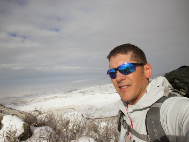
But first, let me take a selfie
After a short walk on the summit ridge, we dropped back down to the car.


It was a good attempt at getting above the inversion.


While not anything glamours or extravagant, its always good to be out.  I guess I'll check some things off one list.  Some lists have yet to be made.  Some lists are already done.  It doesn't take much to find adventure and I'm glad I found it once again in the Boise Front, were I essentially developed this ferocious appetite.  I guess I'll just keep chasing squirrels.  

Peak 4460 GPS

Peak 3793 GPS

Welcome to the jungle, essay.     

Happy trails!

-Granola, out

Monday, November 10, 2014

Peak 5180 In The Danskin Mountains. 11-08-2014

Partners: Mark, Tory, Vuyo, Hailey and Ketchum.

Stats:  Distance 5.07 miles.  Total Time 3:34.  Elevation Gain 1600 feet.

Gear notes:  Carried extra miscellaneous stuff to add pack weight of approx 16lbs including 4 liters of water and dog snacks. 

Peak 5180

The Danskin Range is a sub-range of the Boise Mountains.  While not even nearly the biggest or most appealing objectives, they do provide some steep, fun and short hikes close to town.  I've been in the range a hand full of times.  Once for Danskin Peak itself, the ranges highest point, and three other times to hike Three Point Mountain combined with Kepros Mountain.  I have recently been spying the area on Google Earth, looking for some new hikes to do out that way over the winter. With a fine weekend of fall weather on tap, I had really wanted to get up high, however upon remembering that I had plans for the BSU game on Saturday, I decided to stay closer to home.  Mark and Tory had suggested Peak 5180 and extended an invite my way.

I got rolling at 8am Saturday morning to meet Mark and Tory at Black's Creek Summit at 9.  The temperature registered a mere 31*F at the trail head.  With some light frost on the ground, we hit the trail up Deadman Creek.

Vuyo, Hailey and Ketchum run in and out of Deadman Creek

Looking north up Deadman Creek

The day warmed quickly as we walked up the creek.  It warmed up even more as we started up the steep slopes to initiate the ridge walk/loop to and from the high point.


We ascended to the high point on the left side and descended on the far right.

The Danskin Mountains with Three Point visible in the distance


As we neared our peak, we saw two hunters on the lower right ridge.  I shouted "three hikers and three dogs"!  They ether didn't hear me, or didn't care, they didn't bother to wave back.


With all three dogs in sight, Mark and Tory and I push for the top.


Tory, Mark, Ketchum and I on top.  Not pictured but present: Vuyo and Hailey.

Hailey explores the summit area.


Views from the top include the usual suspects; Shaffer Butte, Lucky Peak, Danskin Peak, the Trinity Mountains, Heinen and Kepros.

Trinity Mountains and the Middle Fork of the Boise River Canyon

Danskin Peak in the distance
 We cruised down the other ridge to make a loop, wondering in and out of the brush.


Connecting a couple of slopes and ridges, we regained the trail in Deadman Creek.  The day was now pleasantly warm for November!


Looking up the descent, with Peak 5180 on the left.  This was a fun, short hike and a good workout on a fine fall day.  It was also good reconnaissance for another, longer hike I have planned in this area.

Anyone wanna go!?

If you've hiked everything near by in the Boise Mountains, give the Danskins a try if you haven't been yet.  Fall, winter and spring are the optimal times to visit!

Happy trails!

Granola, out.

Monday, October 20, 2014

Primus Omnilte Ti Review

The Omnilite Ti is a great and versatile stove.  If you need to boil a quick pot of water for melting snow, or making coffee, it will do that.  If you need a fine simmer for your Chicken Pesto Pasta, it will do that too.  The size of the stove itself is just right for a 2 liter pot for 2-4 energy conscious hikers and 485g's of fuel should last you several days.  The base is stable and the provided windscreen is an added bonus.    

  The Omnilite Ti warming up breakfast at the base of Mt. Adams, Washington.

The interesting thing about it is that it will burn just about any fuel you can get in to it.  Aviation fuel, diesel fuel, kerosene, you name it, this stove can likely burn it.  

Bottom line; it has been functional and reliable in every situation I have used it in and the sound of the jet is music to my ears.  Thanks to In The Wild Chef for giving me the opportunity to use such a fine product made by Primus Stoves!

 Whipping up another great dinner at Jennie Lake, Idaho.

Happy Trails!

- Granola, out.


Saturday, October 11, 2014

Sinker Butte 10-11-2014

Date: October 11, 2014.

Objective: Sinker Butte. Idaho: A Climbing Guide.

Partners: Deez and Ketchum.

Stats: Not too hard. We did 5.22 miles in about 3 hours.

We were short on time, big on energy and really itching to get out.  I've had Sinker Butte saved for just such an occasion, so off we went.  While not big or really significant in any way, if you're looking for a short hike close to town, you can do a lot worse.  Fall is a great time to visit this area because even when the temperature is not too hot, it still feels really warm.  This day was 70* and partly cloudy with a light cool breeze.  However, there is no shade to be had other than on the the south canyon wall.

Sinker Butte from the road.

Swan Falls Dam.

Guffey Butte and Sinker Butte are both what is known as a Maar.

The hike begins at Swan Falls Dam, that has dam restrooms, open to the dam public.

Swan Falls Dam.


The only map we had showed land use so we could tell Sinker Butte was on BLM land, although the Butte itself was not indicated on the map despite it also showing  the roads in the area.

Snake River.


After a quick walk on the dam to cross the Snake River, we were walking up the open slopes and then on the road that leads to the south canyon rim.  There are some really neat pyroclastic and tuff formations here.

Boulder. Deez for scale.

Welded tuff.

Looking northwest on the gravel road that will lead you to the canyon rim.

Road.


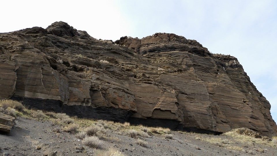
There are some cool tephra horizons in the canyon wall.

Cliffs.


Looking west across the canyon as the road turns south.  It was about here that we left the road and took a short cut to the top which left my legs scratched up from the brush.  Deez was the smart one and wore pants.

Cliffs.


On the final push.  It's about here that the views open up.

Looking northwest.

Deez heading up.

Deez heading up.
Clouds.
You can see the Owyhee Mountains to the south.  The high point is the pile of rocks that has a summit register and a very tattered flag.

Looking south.


While this was nothing more than a fun short hike, standard procedure still applies; Sign the register, eat a sandwich, take in the views and snap lots of pictures.

Dog on top.


On top.

BSU had the day off so I was sporting the Gator's!

Register.


Deez at the highpoint.

Leaving the highpoint.

Snake River Canyon.

We dropped off and regained the road to avoid the brush.  This takes you through the rest of the canyon which is actually quite impressive and worth the extra mileage.

Canyon.

Looking west.


Taking in the view of the canyon.

Looking back on what we descended.

In the canyon.

In the canyon.

From here we stayed on the road for most of the hike back above the dam to keep in the shade.

North canyon wall.


Checked another item off the ever expanding to-do list.
Not a bad way to spend a Saturday afternoon!


Swan Falls Dam.

Another Dam view.


Google Earth view.


Adventure is where you find it!

Happy trails!

-Granola, out.