Monday, May 18, 2020

White Cap Peak

Date: May 16, 2020.

Objective: White Cap Peak - 11,899ft.

Partners: Malachai and Todd.

Stats: 8 miles and 4,500ft gain.  Class 2/3.  Strava track.

Gear notes: Ice ax and crampons carried but not needed.


White Cap Peak from Hwy 93.

This was supposed to be the week that we did our main group training climb for Mt. Rainier in June, but with the National Park that the mountain is located in being closed, we had no choice but to call it off (for now).  I was still planning on getting out and Todd said he was in and Malachai jumped on at the last minute.  I figured White Cap Peak would be fairly straight forward, although I was a bit worried that it was going to be tough on Malachai for a first time peak.

I had taken a good look at the peak earlier and could see an overhanging cornice above one of the major gullies that our potential route would follow.  It was big enough that I could see it unaided from the road and it looked pretty monster through the binoculars.  I figured the gully was wide enough that we could avoid the overhead danger, and if all else failed we would find another way.

We met up in Mackay and found some not great but free camping.  After some dinner, a couple beers and a lovely rain/hail mix we were off to bed hoping that our apparent party animal neighbors weren't going to pull an all nighter.  It was a cold night but I managed to sleep fairly well.  We woke up at 5 to cold temps, clear skies and a bit of frost.  I hopped in Todd's rig and he was able to muscle it up Sawmill Gulch Road and cut a big chunk of leg work out of the day.

We set off at 6:45, following the road to it's end, then following what we could of the unofficial trail.  There was a decent amount of pretty hard snow in the canyon and we could hear running water underneath.  At one point we were no longer able to follow the trail and we were short of the gully we wanted.  After some brief conversation, we decided that instead of bushwhacking to get to where we wanted to be, we would just start up the the slopes to the left and get out of the canyon.

Early morning view of the White Knob Mountains.

Getting ready to hike.

View across the Lost River Valley.

Walking up the road.

Leatherman Peak a the head of Sawmill Gulch.


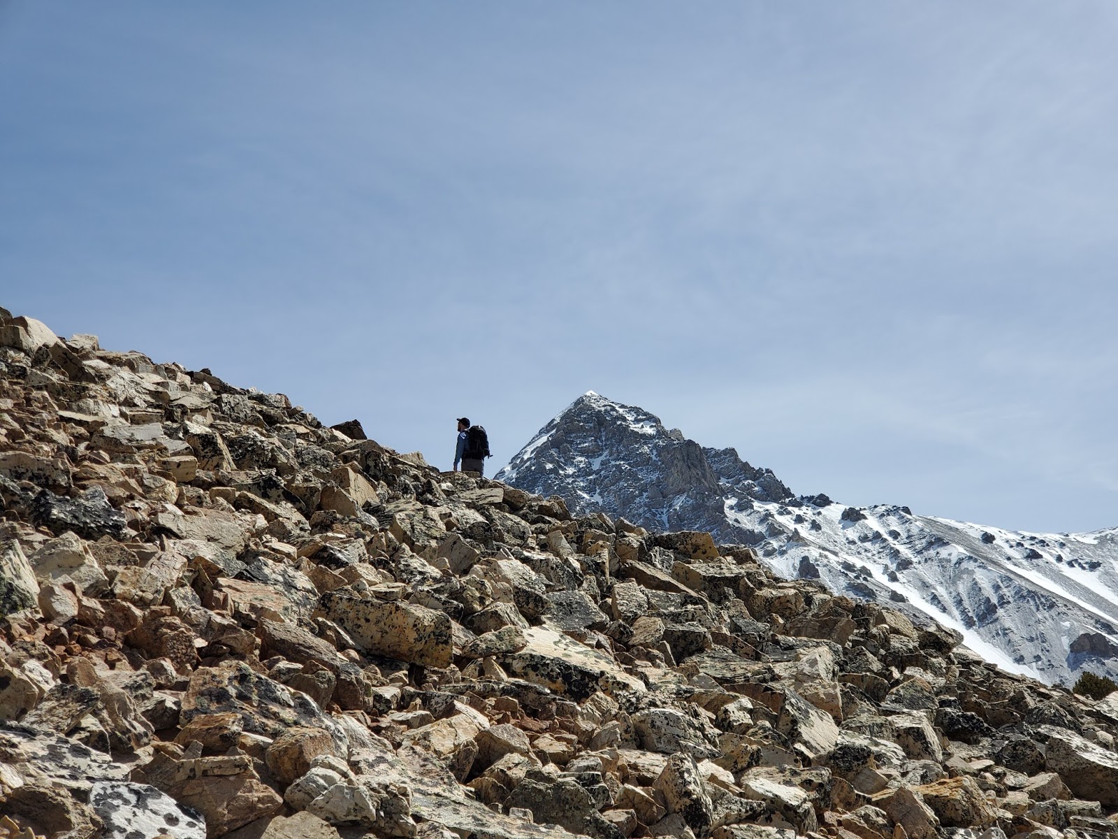
That worked quite well and we soon arrived at a nice bench, had a short rest and then began another push to the tree line.  At this point we were at 10k and after more brief conversation Malachai had decided he was at his high point for the day.  We made sure Chai was good-to-go and decided that we would split up (slight wince) and would regroup in about 2 hours.  From there I could see that the ridge we wanted was not far and decided to keep the line we were on, aiming for the Col just northeast of point 11,045.  Todd worked the snow and I stuck to the rocks.  That overhanging cornice turned out to be a decent size and I was glad we were never under it.  We arrived at the Col, had a short break then set off for the summit, skirting the rise in the ridge to the north to about 11,400.

Todd at a rest break.

Chai coming up the hill and probably thinking we're nuts for calling this fun.

Crossing an old avalanche track.

Bad Rock Peak.

Chai crossing some snow.

Bad Rock and Church.


From there it was a typical, albeit very scenic and kind of steep walk up.  Conditions were cold and breezy on top and some pretty hefty cornices adorned the summit ridge.  We summited at noon-thirty and only stayed long enough to snap our glory shots and gawk at the view.  After maybe 10 minutes we headed back down to the Col for a nice break where it was relatively warm.


Todd climbing with Leatherman in the background.

View of the top of the gully and a small portion of the cornice.

Todd with the LRR crest in the background.

Summit push.

Close to the top.

Summit.

Me on the highpoint.
Todd on the highpoint.

Looking south-ish along the crest.

Mount Borah.

Looking north-ish.


There were a few decent fingers of snow to glissade and that made us quite pleased.  Malachai was in fine shape and waiting for us as we descended to his position.  Todd really wanted Chai to get some glissading time and the fresh blood jumped at the chance.  After a quick snow climbing and glissading 101 course Chai was ripping glissades and self arresting like a pro.

White Knob's.

Pioneer's.

Glissading.
Chai the mountain climber. Photo: Todd C.


Glissading.  Photo: Todd C.


We followed that finger of snow as low as we could, then bushwhacked in the direction of the mouth of the canyon until we found the trail again.  The snow was very soft and sloppy on the way down and while we did post hole from time to time, I had to remind the guys that if your're not punching in at least knee deep, you're not doing it right.

While we were walking down, Todd graciously suggested that he could jog down, get his truck and drive back up to us.  Malachai was in borrowed boots and developing some blisters.  That allowed him to get his feet dry and save him some misery.  Chai was fresh blood and got served up what I like to call the full mountain buffet.  It's a little bit of everything; rain, snow, hail, wind, cold, hot and sunny, bushwhacking and blisters, all topped off with amazing views.  While we didn't get any bug bites, I hope Chai at least got nibbled on by a big fat climbing bug.  He has rock climbed, hiked, hunted and backpacked before, but this was his first attempt at a big peak and he hung in there like a champ.

Saturday, April 18, 2020

Shafer Butte Ski

Date: April 18, 2020.

Stats: 9.2 miles and 2,700ft of vert.

Strava: https://www.strava.com/activities/3317987385

Yeah, COVID, social distancing, etc... Hey, this is basically my back yard and was about the most I could justify doing during the stay at home order.  With another trip to Mt. Rainier coming up in June (we hope, not likely, idk, maybe, we'll see) its time to get some altitude and training peaks.  I figured I ought I'd take a lap up good ol' Shafer Butte for some "training".

I decided I should sneak in from outside the ski area to avoid whatever potential complications there could be, and also to add in some mileage.  The Ridge Road was pretty crummy.  In the end, I should have just driven to the ski area like everyone else apparently did.  That would have afforded time for more laps on the sweet spring corn.  I won't go into any significant route details but I will say the snow was hanging on and surprisingly pretty good.  It felt really good to be out on a mountain and soak in the view from the top.

A few pictures:


Thursday, October 24, 2019

Mount Aire, Utah

Date: October 19, 2019.

Objective: Mount Aire 8,621'.

Partners: Deez and Landen.

Stats: 4 miles with 2,000' ascent in 3:37 round trip.

Links: Strava.  Trail info.  Trailhead info.

We were in SLC for a concert and managed to sneak up a quick peak just before a storm front came in.  It was quite busy but what else would you expect on a Saturday at a popular trailhead?  The trail was pretty muddy in a few spots but aside from a few slips and slides, it was a straight forward hike with great views from the top.


Sunday, September 29, 2019

Blackmon Peak

Date: September 27, 2019.

Objective: Blackmon Peak 10,300'.

Stats: 3.5 miles with 1,500 feet of ascent in 3:46 round trip.

Difficulty: Class 2.  Moderate, short hike but high altitude.

Links: Lists of John.  Strava.  Idaho: A Climbing Guide.  Summit Post.

The Back Story

Back in 2016, Deez and I hiked into Fourth of July Lake to tag a few 10ers before I left for Mt. Rainier.  Blackmon Peak was on the list for that trip, but I ended up passing on it due to a thunderstorm coming in.  After that trip, we decided that Blackmon would make an excellent first 10k peak for Landen (or anyone really).  We eyed a couple of dates in 2017 but all were canceled; once due to lingering snow in the summer and once due to bad smoke from a wildfire in the late summer/fall.  We set out for it in 2018 only to turn down Fourth of July Creek Road to find the area closed due to the Bible Back fire.  The first attempt of 2019 ended just east of Garden Valley with a disabled vehicle and a few tears.  The next window we had required us to thread the needle due to a forecast weekend storm bringing cold temps and snow.  We excused the youngster from school to bring him along on an already scheduled trip to Sun Valley where Deez had a mid-week work conference.  The original plans for that week had also been scraped to accommodate having the kiddo along, plus needing to get in and out of the mountains quickly due to the approaching cold front.

Trip Report 

With a full day in Sun Valley, I wanted to get up a peak but didn't want to commit to anything too tough because we would be hiking Blackmon the next day.  I selected Dollar Mountain for a warm-up hike.  It left "us" with "lots of energy left" which was good.  Due to the schedule, we had a not early, but not late departure from Sun Valley.  We crossed our fingers, said a prayer to the Car Gods and headed over Galena Summit.  We arrived at the trailhead but had to sort though three bags of gear to condense into one pack.

Side note: we were still prepared to spend a night in the backcountry if the weather improved.  Since we were now doing the peak as a day hike, at least we no longer needed 90% of it.

12:45PM and we were actually putting our boots on the mountain!  I knew we had a bit of time to spare for the short hike, but I also knew the weather was going to be cold and windy up high.

Blackmon from the trailhead.

Actually at the trailhead.

Initial section of the route.

It was nice and warm down low.  The initial section of the route was a bit ambiguous.  I just kept an eye on the map and tried to follow the road-turned-trail that leads to Strawberry Basin and the saddle just west of the peak.  We payed a quick visit to one of the mines and eventually I found the trail; a great trail in fact.  Easy ground!  We came across a group of hunters who were ready to discharge their bows and politely let me know that "there were deer here just a minute ago".  Wink-wink.

Looking west toward the Sawtooths.

Low on the southwest ridge.

Weaving though the trees on the ridge.
From the trail, I picked a prominent gully and hiked up the side to gain the southwest ridge and then stopped for a rest.  The route is short and straight forward but the anticipation was high.  It wasn't long before we set off for the summit.  Probably not going to throttle back at this point.


Deez crushing it up the ridge.

Landen close to the summit and eager to top out.

Fourth of July Peak.

We had to make one more quick stop to don a layer in the cool breeze.  The summit sits just above treeline and the views were amazing.  D.O. Lee Peak sits just to the north and was impressive but the view to the east and Castle Peak was out of this world.  The combination of a skiff of fresh snow and low angle light with the crisp fall air was just fantastic.

Landen waiting for us on the summit.

Castle Peak in the background.

USGS marker.

D.O. Lee Peak.

Landens first 10k summit!

It would all be for naught without plenty of time on the summit, so we layered up with what we had and got our gawk on.  There had been a few twists and turns to get this summit and I was sure to thank the Mountain Gods for allowing us to set foot here.

Mount Frank and Lonesome Peak over Ants Basin.

That summit selfie.

High-fives.

Eventually it was time to head down and it wasn't long until we had to doff our layers.  We took the same route down, which wasn't the most exciting, but it was easy to follow.

Looking down the southwest ridge.

Hiking down.

It didn't happen the way we planned but Landed got his first 10k summit.  We made good time on the descent and soon found ourselves back at the mines.  Watch your step around there!  We gave one more round of thanks to the mountain and made sure to pay respect to the Car Gods as well.  The rest of our quest was smiled upon and soon we were in Stanley for dinner.  The ensuing cold front left a few inches of snow in the high mountains so it will be interesting to see how the rest of the rest of autumn shapes up.